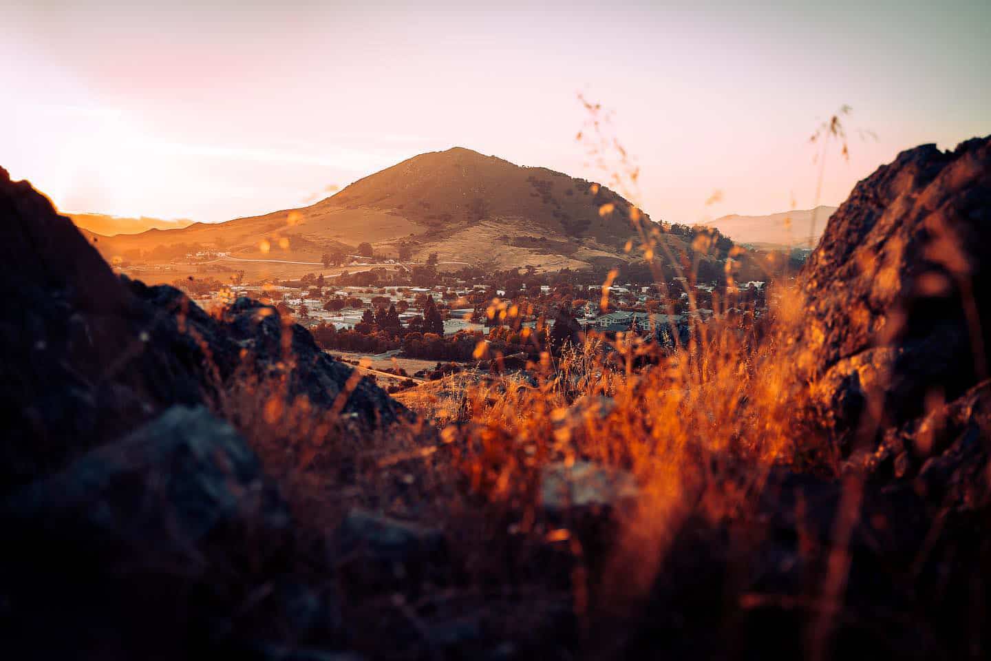
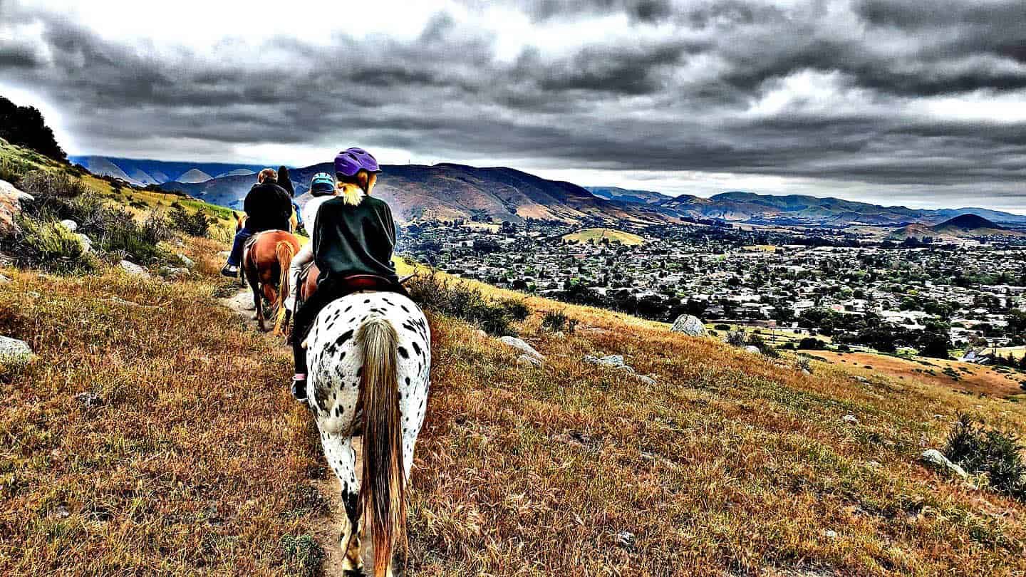
Lush, mountainous, and hiking-friendly, San Luis Obispo has much to offer the visitor looking for a good trek. For starters, the climate is perfect for hiking here, with moderate temperatures that rarely become uncomfortably hot or cold. The city also boasts a wide variety of trails. San Luis Obispo sits along the path of the Nine Sisters, a set of nine peaks that stretch from Morro Rock to Edna Valley. Most of these peaks have trails that are open to the public, with various levels of difficulty and elevation gains. Other trails like Cuesta Ridge, Poly Canyon, Johnson Open Space, and Reservoir Canyon offer sweeping views of the city and beyond. Even more hiking options border the area as well. These include Montana de Oro’s scenic oceanfront trails in Los Osos, and views of coastal wine country on Islay Hill in Edna Valley. (Islay Hill is also one of the Nine Sisters peaks.) Note: Each of these walks is dog-friendly, but be aware that leash laws are enforced on each of them. To preserve the trail ecosystems, and for everyone’s safety, do not let your dog off-leash — you can be ticketed! So please keep Fido safe by clipping on his leash.
Explore Hiking Along Highway 1
Bishop Peak Hike
The tallest of the Nine Sisters peaks, Bishop Peak is one of the most popular hikes on the Central Coast. This towering mountain provides a backdrop behind San Luis Obispo, and is one of the town’s most distinctive silhouettes. Choose from a multitude of trailheads and sub-trails that travel up, down, and around the mountain. The way can often be rocky, narrow, and steep, so definitely come prepared with water and wear good, grippy shoes. To summit Bishop Peak, take one of the two entrances. The trailhead on Highland Drive leads to a 3.5-mile roundtrip hike. To enter at the trailhead on Patricia Drive results in a 4.2-mile hike with a larger elevation change. Scramble to the rocky top of the mountain, and see grand vistas overlooking Cal Poly, downtown SLO, Cerro San Luis, and more. Bonus: Take the Patricia Drive trailhead and follow signs for the Felsman Loop Trail to take in a 2.4-mile moderate hike along the mountain’s northeastern face.
Cerro San Luis Peak
You might hear locals call this peak Madonna Mountain because the Madonna Inn lies at its base. Cerro San Luis sits right at the center of San Luis Obispo, accessible from several trailheads. In fact, it’s possible to grab coffee in downtown SLO, hike up the mountain, and grab lunch downtown afterward — all on foot. Like Bishop Peak, Cerro San Luis is one of the Nine Sisters peaks, and features a four-mile out-and-back hike with 1,100 feet of elevation change. To summit the mountain, take the main trail from the end of Marsh Street, just before the onramp to Highway 101. Find a dirt parking lot there, with a connection to the sidewalk under the freeway that leads to downtown San Luis Obispo. Eager hikers can extend the trail to a 5.7-mile roundtrip by starting the walk at Laguna Lake Park. Additionally, other easier and/or shorter hikes can be found here. Try the Lemon Grove Loop, which circuits the southeast face of the mountain. Or embark on the “M” trail, which travels to the large M painted on the side of Madonna Mountain. (Fun fact: the M actually stands for Mission Preparatory School, not Madonna.)
Reservoir Canyon Hike
This is the hike to take for epic views and a good climb. Visitors can expect a 5.35-mile, 1,350-foot ascent up the mountains southeast of the city of San Luis Obispo. Access the trailhead via Reservoir Canyon Road off Highway 101 North, after the Monterey Street exit. (This can be easily missed! Be sure to keep an eye out as you drive; Reservoir Canyon Road is two miles north of downtown SLO.) The Reservoir Canyon Hike comprises two trails: the Reservoir Canyon Trail, and the Summit Trail. Some locals refer to this as “the waterfall hike” because it features a 15-20-foot waterfall within the first mile. This is the destination for the Reservoir Canyon Trail, which breaks off for a short detour to the waterfall. The Summit Trail, however, takes you to the peak where an old tower housing a bell is located. It’s recommended that visitors combine the two trails for the best, most rewarding hiking experience.
Johnson Ranch Loop
If you’re looking for a pretty countryside walk in the foothills, the Johnson Ranch Loop is a great place to explore. The 242-acre Johnson Ranch Open Space lies a couple miles south of San Luis Obispo, and features two trails. Mountain bikes share the trail, and most visitors choose to travel counterclockwise to keep traffic moving the same direction. The primary trail is the South Loop, a moderately easy hike over 2.6 miles and a 400-foot gain in elevation. At the 1-mile mark, hikers can diverge onto the North Loop Trail, which adds another 2 miles and 340 feet in elevation gain. The North Loop also connects to the Filipponi Ranch Trail, which leads to the Irish Hills Trail. Altogether, these trails can stack together for a significantly long hike, or visitors can simply take the South Loop for a comfortable walk over grasslands and through a low stand of oak trees at the base of the trail. Be aware that the trail leads over a creek bed that is usually dry, and has a small footbridge across it. A small section of trail also includes an easement through a working ranch road. Access the trailhead at the parking lot directly off Highway 101 between San Luis Obispo and Pismo Beach at the Higuera Street exit.

The Poly Canyon Trails
Poly “P”
Look at the mountains behind Cal Poly University’s campus, and you can’t help but notice a large “P” that decorates the hillside. This is the iconic Poly P, one of the oldest hillside initials on the West Coast. The P first appeared in 1919, supposedly as part of a rivalry between the university and San Luis Obispo High School. (SLO High actually has its own hillside initials — SLO — visible from the Poly P on a facing hillside.) Throughout the academic year, Cal Poly students decorate the P for holidays, specific events, clubs, and departments. The out-and-back distance to the P is less than a mile, making this a fun, if steep, hike. Bonus: Want to accept the so-called Tri-Tip Challenge? Do as the Cal Poly students do. Over the course of just one day, hike the Poly P, Cerro San Luis, and Bishop Peak. Then follow it up by getting tri-tip sandwiches at Firestone Grill.
Design Village
Cal Poly is known far and wide as one of the strongest universities for architecture majors. This demanding program has a light side, though, as seen in the Design Village in Poly Canyon, behind the school. Often referred to as the “Architecture Graveyard,” the Design Village features a variety of experimental structures from architecture students over the years. In fact, for many years, architecture students would design their structures, then spend a weekend living in them. Today, the village is still in use as a testing ground for students’ architectural ideas, and new installations pop up over time. (For those interested, the history of the structures can be seen on the Cal Poly University website.) To find Poly Canyon and the Design Village or “Architecture Graveyard,” it’s a 2.5-mile hike with only 300 feet of elevation gain. Make the trek for an easy out-and-back hike — just be aware that, on school days, you’ll need to pay for parking.
Serenity Swing
Want to swing beneath an oak tree with a jaw-dropping view of rolling green hills? The Serenity Swing hike is for you. Walk into Poly Canyon, behind Cal Poly, and walk past the Design Village or Architecture Graveyard. One mile past that, you’ll find a playground swing that someone hung from a stately old oak tree, facing out to rolling hills. In springtime, after the rains, this is a gorgeous sight, as native grasses turn the rippling hills and mountains a vibrant green. This is also a terrific spot to watch large swaths of hillsides turn orange, yellow, purple, and white with the bloom of spring wildflowers. Altogether, the Serenity Swing hike is about 3.5 miles, out and back, with a gain of 725 feet in elevation. Most of the hike is moderately easy, though the final section is very steep — and very slippery after the rain. Bring poles if you have them, and wear grippy hiking shoes to ensure you get a turn on that swing.
Hiking Stenner Springs
The Stenner Springs trail adjoins Poly Canyon via Stenner Creek Road in the hills behind Cal Poly University. Pass the Design Village, pass the Serenity Swing, and Poly Canyon becomes Stenner Creek Road. This is a small dirt road that travels over and alongside Stenner Creek, fed by numerous natural springs in the area. In fact, this creek flows through the Cal Poly campus into the City of San Luis Obispo, eventually traveling to outlets in Avila Beach. The open space behind Cal Poly is also home to some very popular mountain biking trails. These include the Shooters Trail, Elevator Trail, and Morning Glory Trail, as well as a mountain biking course in the Eucalyptus groves there. Bonus: Hikers can combine several trails here for a 9.7-mile loop. Start from the Cal Poly campus at the parking area for the Stenner Creek Trail, about 1.8 miles past the Cal Poly Meats facility. Hike the Stenner Creek Trail to the Eucs, then descend via Red Dog Trail to Poly Canyon Road. This will lead back around to campus, where you started from.
Hiking Cuesta Ridge
Drive over the Cuesta Grade from San Luis Obispo to Santa Margarita, and you’ll pass the turnoffs for hiking Cuesta Ridge. This trail runs laterally along the Santa Lucia Mountains, cutting into the range to the east, and rolling down a saddle to the west. The trail is split by the 101 Freeway at the top of the Cuesta Grade: East Cuesta Ridge, and West Cuesta Ridge. Each starts high in the mountains, with access to tremendous panoramic views.
For the West Cuesta Ridge, park at the top of Cuesta Grade on the southbound side of Highway 101. (There is a turnout on the southbound side, but if you’re driving northbound, look for the split in the center divider to cross over.) The address for the trailhead is Forest Route 29S11, and the hike covers 6 miles, out and back, with a change of 950 feet in elevation. This is an area rich with native plant communities, coast range geology, birds and wildlife. Early in the hike, check out the interpretive sign about the botanicals of the West Cuesta Ridge, then follow through the Los Padres National Forest. In this area, dogs, bikes, and hikers are all welcome.
Find parking for the East Cuesta Ridge trail at the top of Cuesta Grade, on the northbound side of the freeway. This can only be accessed via the northbound side of Highway 101, as the center divider doesn’t allow access from the southbound side. Locate the trailhead via the address Forest Route 30S11. This hike has an altogether different style of terrain, with a long, gradual elevation gain. Depending on how much you want to hike, the trail is between 8.4 and 10.2 miles, out and back, with an elevation gain of 1075 feet. This cuts eastward toward the Santa Lucia Wilderness, and welcomes hikers, dogs, bikes, and equestrian travelers. The views reward anyone who takes either of the Cuesta Ridge trails on. These provide glimpses of San Luis Obispo, the Irish Hills, and all the way to the Pacific coastline.