Preserves, Estuaries and Sanctuaries on Highway 1
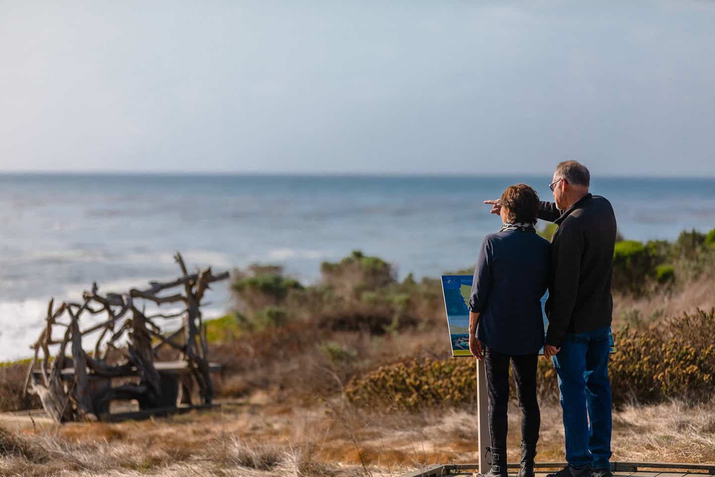
The natural landscape of our stretch of Highway 1 has inspired paintings, poems, literature and song. As such, we take its conservation very seriously so it can inspire generations to come. Here, you’ll find thousands of acres of protected open space, both on land and at sea. These estuaries, fields, mountains, bluffs and beaches are home to sea otters, elephant seals, snowy plovers, Monarch butterflies and many other creatures. Our set-apart spaces also house precious native plants like Los Osos’s ancient oaks and Cambria’s Monterey Pine trees, which are endangered and rare.
But these places aren’t for the flora and fauna only; they’re meant for everyone to enjoy. Visitors and locals alike love to hike across the many miles of coastal trail along Highway 1. We treasure our panoramic mountain views, intimate oak forests, and ocean vistas, and we love to share them. As you explore our quiet, splendor-filled corner of the world, please remember to leave it the way you found it. Observe regulations about dogs, noise, open hours, staying on paths, wildlife, and litter.
Find Your Sanctuary Along Highway 1
Pismo Preserve
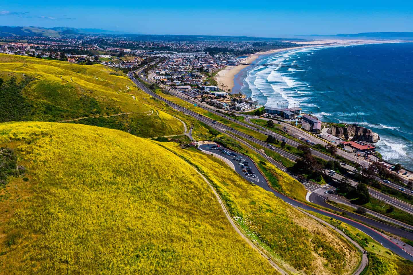
One of the newest parks to open on the Central Coast, the Pismo Preserve spans 880 acres of premium coastal wildlands overlooking Pismo Beach. This ranch might have once been developed, but the Land Conservancy of SLO County raised $12 million to purchase it in 2014. After thousands of volunteer hours building trails for public use, the Pismo Preserve opened in 2020. In keeping with Land Conservancy best practices, two-thirds of the property are off-limits to visitors. The remaining third boasts a wide variety of trails totaling 11 miles, from high ocean vistas to sheltered grassy glens. (In fact, some trails nab amazing views of Edna Valley and Price Canyon, on the eastern side of the hills.) Some trails are very family-friendly, with minimal mileage and easy terrain, while others are longer and more challenging to tackle. The Pismo Preserve is also open to mountain biking and equestrian riding on all trails except the Vamanos Trail. Dogs are welcome on the trails, as well, provided they are on leash.
The Pismo Preserve trailhead includes an ADA-compliant picnic table and restrooms. (The Land Conservancy is at work on a new wheelchair-accessible trail to be opened at a later date.) Equestrian trailer parking is also available, as are water troughs throughout the preserve. Find the Pismo Preserve just uphill from the northbound side of Highway 101 in Pismo Beach. Take exit 191B, then Mattie Road to the trailhead. Reserve horse trailer parking through The Land Conservancy.
Los Osos Oaks State Preserve
The coast live oak trees in this remarkable state preserve have grown over sand dunes here for over 800 years. Walk one or a combination of three trails here beneath their majestic limbs. Some of these branches have grown in unusual ways and create interesting shapes adjacent to the path. Five plant communities grow within 90 acres of woodland: coastal sage scrub, dune oak scrub, coast live oak forest, and streamside riparian plants. In the oak scrub, the oak trees grow only six or eight feet tall, maximum. These are considered dwarf oaks, a result of their unique growing conditions here on the coast. The coast live oak forest oaks, however, can be giants that grow up to 25 feet tall. Rabbits, foxes and bobcats have been known to make their homes under the trees, and can sometimes be seen along the path. Bird species here include great horned owls, barn owls, hummingbirds and western flycatchers. You can also see an ancient Chumash refuse site here, with heaps of clam and abalone shells, called “middens.”
The trail system at the Los Osos Oaks State Preserve comprises about 1.5 miles in length. The easy, flat, unpaved path makes for an easy solo walk or walk with friends or family. Please leave Fido at home, though, as pets are not permitted on the trail. Also be aware that the park doesn’t offer restrooms or facilities of any kind. To reach the preserve, drive south from Los Osos on Los Osos Valley Road. Just past the outskirts of the city, look west for the wooden sign identifying the Los Osos Oaks State Nature Preserve. The trailhead can be found west of the small parking lot.
Sweet Springs Nature Preserve
Managed and owned by the Morro Coast Audubon Society, this Los Osos preserve protects precious open space, plants and animal species. In fact, over 350 species of birds have been sighted on Sweet Springs’ 32 acres since the 1990s. Though the preserve features wide-spanning views of Baywood, Morro Bay and Morro Rock, often the best views here are those of the wildlife. Walk the half-mile trail that loops along the river, watching for Great-horned owls, California quail, black-bellied plovers, long-billed curlews and many others. Follow the path of the Chumash and Salinan people who lived here as far back as 500 A.D., before European explorers arrived. At one time, a hunting and fishing lodge called “The Duck Inn” occupied this space. Moreover, the property has several times gone up for development, but never was. Today, it is protected from hunting, fishing, or building of any kind. The preserve also protects the Morro Shoulderband snail, a federally endangered endemic species whose population has decreased rapidly due to development. The snail’s natural environment is coastal dune scrub, so the Sweet Springs Preserve works hard to remove invasive plant species and reinstate natives.
As a protected bird habitat, Sweet Springs does not allow dogs nor beach access. To reach Sweet Springs, drive 7 miles northwest from San Luis Obispo on Los Osos Valley Road. Turn right onto 9th Street for five blocks, then turn left onto Ramona Avenue. The small parking area for Sweet Springs Nature Preserve is on the corner of Ramona Avenue and 4th Street.
Fiscalini Ranch Preserve
With 437 acres of protected coastal land, Cambria’s Fiscalini Ranch Preserve offers a rare glimpse of untouched California. Here, it’s easy to see the forests, bluffs, and rugged coastline through the eyes of its earliest inhabitants, the Salinan and Chumash people. The land later became a Mexican land grant, and one of the parcels became the Fiscalini Town Ranch, owned by the Fiscalini family. After nearly a century of ranching, the property was sold and slated for development. But in 2000, it was purchased through public and private funds to be accessible by all. The preserve thrives with native coastal sage scrub, Monarch butterflies, and Monterey pine forest. Benches stand along the nearly 8 miles of hiking trails for visitors to rest and enjoy the scenery. Some of these trails travel across broad bluffs while others meander through pine and oak forest, freshwater marshes and wetlands. Spy a red-legged frog, western pond turtle, great blue heron or Cooper’s hawk while walking the trail. You may also encounter the compact cobweb thistle or Cambria morning glory.
The Fiscalini Ranch Preserve is located in Cambria, just off Highway 1 about 34 miles from San Luis Obispo. Turn west at the traffic light onto Windsor Boulevard and take it to its end, about 1.1 miles. Park and find the marked entrance to Fiscalini Ranch Preserve.
Kenneth Norris Rancho Marino Reserve
Named after a founder of the Natural Reserve System, this 500-acre reserve protects some of the most spectacular coastline in all of California. While the Cambria property is privately owned, it is managed by UC Santa Barbara and available for use by UC schools exclusively. The reserve protects 185 plant species, 24 species of mammals and 111 of birds between the coastline and up a 700-foot-elevation ridge. These species populate the shoreline, grasses, ponds, coastal scrub and Monterey Pine forest here, including a remarkably diverse marine ecosystem. The reserve lies adjacent to the White Rock Marine Protected Area, south of Cambria, home to one of California’s largest kelp beds. This makes an ideal habitat for sea otters, but sea lions and gray whales have also been spotted here.
Like so much of coastal California, this land was once home to the Salinan and Chumash people. Their middens can be found here dating back 5,000 years, containing red abalone shells and mammal bones. Following the mission era, ranchers grazed cattle to the wide coastal prairies, and still do today.
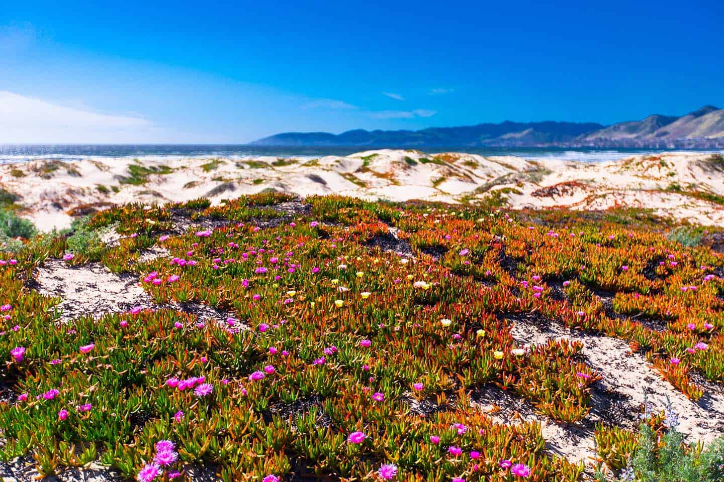
Oceano Dunes Natural Preserve
A place both thrilling and peaceful, the Oceano Dunes Natural Preserve is the most extensive dune complex in California. Members of the Northern Chumash tribe made their homes in settlement camps along the coast here, thousands of years ago. Later, Don Gaspar de Portola’s expedition of 1769 would land here and hunt a skinny bear – un oso flaco. It has since become Oso Flaco Lake and sits at the southern end of the dune system. In the 1930s and 40s, the Oceano Dunes also attracted a band of bohemian artists, musicians, writers, nudists and mystics called the Dunites. They believed the dunes endowed their inhabitants with creative energy, encamping in lean-tos in the sand for many years.
Today, the Oceano Dunes boast the only beach-vehicle recreation in California, the Oceano Dunes State Vehicle Recreation Area (SVRA). Here, freewheelers bring their offroading vehicles to climb the dunes and play on the beach. (Street-legal vehicles are welcome on the beach, too.) But the Oceano Dunes offer plenty of quiet spots too, where the flora and fauna of the natural landscape beg to be explored. On a dune walk, look for birds like the ruby-crowned kinglet and American kestrel, as well as an abundance of wildflowers and native grasses. Especially watch for the snowy plover, a threatened bird species, as well as the California least tern, which is endangered. Both species nest within the Oceano Dunes. And who could forget Pismo clams? This area has been famous for its bivalves for decades, and clamming is still permitted here. Be sure to carry a current fishing license and rigid measuring device. Only 10 clams can be taken from the beach, and all must measure at least 4 1/2” each.
Find the Oceano Dunes State Nature Preserve off Highway 1, just south of Pismo Beach.
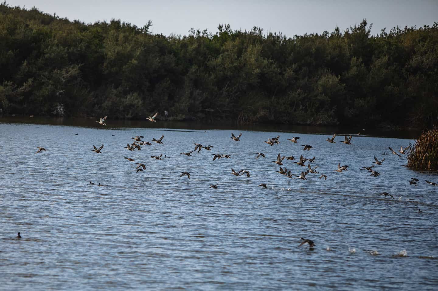
Oso Flaco Lake
This natural playground lies at the south end of the Oceano Dunes, named after the “skinny bear” hunted by Portola’s expedition of 1769. (Apparently the bear was skinny because it was sick, and later made all of the sailors sick as well.) The centerpiece of the Oso Flaco state-preserved natural area is the freshwater Oso Flaco Lake. Here, a wide diversity of life welcomes visitors around the lake, into the dunes and, further on, at the Pacific shoreline. At the start, arroyo willows and wax myrtles canopy over the path, branches think with lacy Spanish moss. Along this riparian corridor of Oso Flaco Creek, find deer, the coast garter snake, and the red-legged frog among the grasses and shrubs. As the path continues, a plank boardwalk travels over Oso Flaco Lake, providing a different perspective of the 75-acre lake. This area provides a refuge for local and migrating birds; in all, the Oso Flaco Preserve is home to 200 bird species. The trail then leads through majestic sand dunes to the wide open beach, where species like the western snowy plover and California least tern nest among the coastal scrub. Roll and jump over the dunes, wade in the Pacific, or comb the beach for shells. A day at the Oso Flaco Lake State Natural Area makes for peaceful and scenic family fun.
Come for the full 2-mile round-trip walk, or to rest on a bench and spy birds and other wildlife through binoculars by the lake. To reach the Oso Flaco Lake State Natural Area, travel south on Highway 1 past Oceano to the southernmost end of San Luis Obispo County. Turn right on Oso Flaco Lake Road and follow to its end, at the Oso Flaco Lake parking area and trailhead. Leave Rover at home, though: dogs are not permitted in the park. Be prepared to pay a small entry fee to enter the preserve.
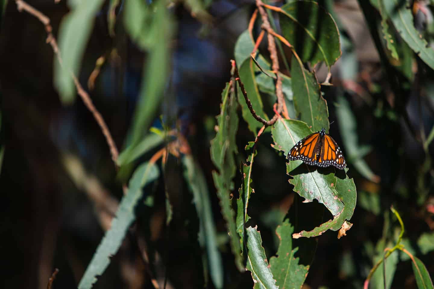
Monarch Butterfly Nature Preserve
Thousands of Monarch butterflies migrate to the northern edge of the Oceano Dunes each year. The small eucalyptus grove, just off Highway 1, serves as a protected overwintering site for the butterflies. Like birds, Monarchs migrate twice per year up and down the West Coast. When cold weather sends them to warmer climates, they stop in Oceano to bask in the winter sunlight that hits the eucalyptus leaves. The butterflies arrive sometime around October each year, mate in February, and are soon gone just after. But while they’re here, their beautiful orange and black wings cluster on the leaves, like something out of a fairy tale. Indeed, at high season, the Monarch Butterfly Nature Preserve is one of the largest populations of Western Monarch Butterflies in the world.
A group of devoted volunteers oversees the Monarch Butterfly Nature Preserve between October and February. Docents give free daily educational talks, and are on-hand throughout the preserve to answer questions. They also provide high-powered telescopes for viewing the Monarchs closely on the leaves, as well as a small gift shop. The Monarch Butterfly Nature Preserve lies just south of Pismo Beach on Highway 1, just past the North Beach Campground on the right.
The grove is free to visit and open to the public daily from sunrise to sunset. Peak butterfly season is late October to February, when the monarchs overwinter in the grove’s eucalyptus trees. The area provides picnic tables, a restroom, and a mercantile trailer selling books, apparel, toys, and butterfly-related items. The Monarch Mercantile Trailer, operated by the Central Coast State Parks Association, is open year-round from 11 am to 4 pm. During butterfly season, the hours are extended.
Irish Hills Natural Reserve
At over 1,000 acres, this natural area extends from the western edge of San Luis Obispo up north toward Los Osos. Find chaparral and oak woodlands along 8 miles of trail that feature towering views of San Luis Obispo and the Los Osos Valley. Also within these 1,000 acres lives a plant species unknown to any other part of the world. In 2019, scientists discovered chorizanthe aphanantha, also known as the Irish Hills spineflower. The green and pink spiked flower has been submitted to the California Botanical Society to be considered one of California’s rarest plants.
The Irish Hills connect to the Los Osos Oaks Reserve to the northwest, and recently extended west with the inclusion of the Waddell Ranch. At 154 acres, this is a sizable addition to a publicly-owned piece of old California. Much of the Irish Hills property was once used by miners; many of the trails follow the path of old mining cars. Today, hikers and mountain bikers take to the trails to enjoy this beautiful, protected open space, perfect for exploring.
Avila Beach Bird Sanctuary
Did you know that Avila Beach lies directly in the path of the Pacific Flyway? This 4,000-mile route between the Arctic and Mexico’s west coast sees at least 1 billion migrating birds each year. But, due to habitat loss and other factors of modern life, this number continues to dwindle. As a hotspot of migratory bird traffic, Avila Beach was designated a bird sanctuary in 2015. The San Luis Obispo Creek corridor connects to a tidal estuary — an ideal spot for birds to feed, nest, and raise their young. Here, volunteers promote the conservation and restoration of ecosystems to improve and maintain bird diversity in Avila Beach.
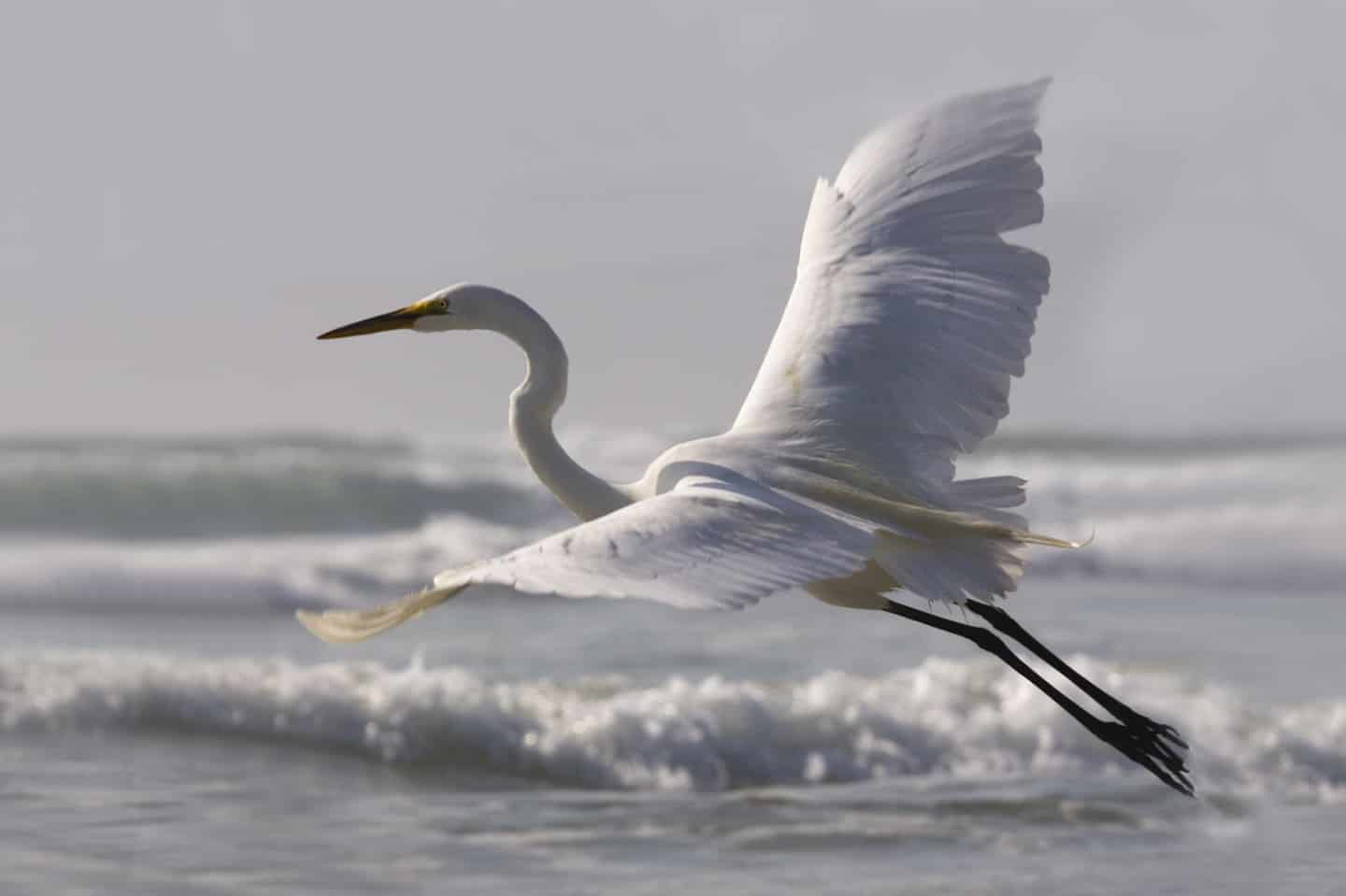
There are many ways to see the huge diversity of birds in and around Avila Beach. One of the simplest ways is to sit on the beach and look for seabirds like the surf scoter or the penguin-like common murre. Or walk the serene Bob Jones Trail to see great blue herons, northern shovelers, grebes, and snowy and common egrets. Other species include Anna’s Hummingbird, the black phoebe, cormorants, thrashers, and many types of geese and ducks.
Monterey Bay National Marine Sanctuary (MBNMS)
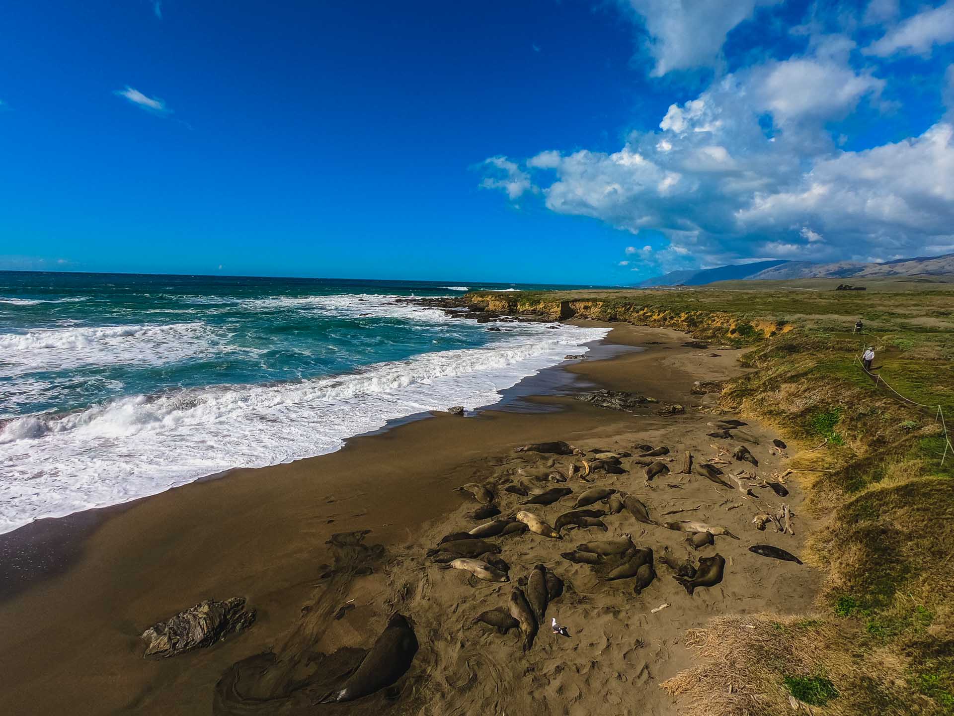
Established in 1992 as a federally-protected marine sanctuary, this world treasure spans from Marin County to Cambria: about 276 miles altogether. The National Oceanic and Atmospheric Administration oversees the Monterey Bay National Marine Sanctuary, covering 6,094 square miles and plunging 12,743 feet. As such, it is the largest US national marine sanctuary — larger than Yellowstone National Park. The sanctuary offers some of the best wildlife viewing in the world, including 36 species of marine mammals alone. Some of these are specially protected, including the Sea Otter Sanctuary and the Piedras Blancas Elephant Seal Rookery near San Simeon. The MBNMS also covers state-protected waters near San Simeon and Cambria, including the Piedras Blancas State Marine Reserve and Cambria State Marine Conservation Area.
To explore more of the MBNMS, make a visit to the Coastal Discovery Center near Hearst Castle in San Simeon. The center is a collaborative project between the MBNMS and California State Parks, located just steps from San Simeon Bay. Here, find educational programs and exhibits focused on the marine area’s cultural and natural history. Admission is free; find the entrance to the center at Hearst Memorial State Beach, just opposite the entrance to Hearst Castle in San Simeon.
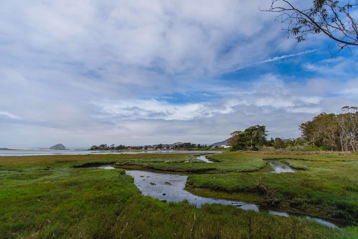
Morro Bay National Estuary and Nature Preserve
The area south of Morro Bay boasts two different state-protected areas and a federally-protected estuary. The Morro Bay National Estuary covers 2,300 acres spanning from Los Osos to Morro Bay, first designated a state estuary in 1994. In 1995, it was named an Estuary of National Significance, thanks to the work of volunteers, agencies, local government, nonprofit organizations, and landowners. To protect this precious local resource, the Morro Bay National Estuary Program is one of just 28 National Estuary Programs in the country.
The Morro Bay State Marine Reserve protects the shallow mud flats on the eastern end of Morro Bay State Park. These flats are mostly drained at low tide, but when the tide is high, this can be an excellent area for kayaking and birding. To the west, the Morro Bay State Marine Recreation Management Area keeps most of Morro Bay protected, including the estuary and back bay. Locals love to kayak between the Morro Bay State Park Marina and Los Osos, crossing the estuary and looking for seabirds. Kayak outfitters also offer tours to the sandspit that extends to Morro Rock — some even offer picnic lunches and dinners on the sand. But a tour operator isn’t required to access this beautiful strip of beach; just paddle out and enjoy.
Chumash Heritage National Marine Sanctuary
San Luis Obispo County is the only California coastal community to boast two National Marine Sanctuaries, including both the Chumash Heritage National Marine Sanctuary, and the Monterey Bay National Marine Sanctuary. Designated in October 2024 as America’s 17th national marine sanctuary, this remarkable protected area spans 4,543 square miles off the coast of Highway 1. As the first Tribally-nominated marine sanctuary, and the third-largest in the nation, it safeguards an extraordinary variety of marine habitats. These include vibrant kelp forests, rocky reefs, unspoiled sandy beaches and underwater mountains. Uniquely, the sanctuary protects both a rich marine ecosystem as well as ancient cultural heritage, like over 200 NOAA-documented shipwrecks and areas of deep significance to Indigenous peoples. Find the Chumash Heritage National Marine Sanctuary’s protected waters stretching from off the coast of Avila Beach all the way past Nipomo and the southern border of San Luis Obispo County to the Gaviota Coast in Santa Barbara County.
Stewardship travel for good
Don’t miss the opportunity to learn more about these precious, protected places. With Stewardship Travel for Good activities, you can dive deeper into the culture, heritage, and landscape of this special stretch of Highway 1. Tour the Piedras Blancas Light Station, built in 1875, with views of the Monterey Bay National Marine Sanctuary. Or volunteer at the Guadalupe-Nipomo Dunes Natural History Center in the native plant garden, native seed collection or on a beach clean-up. For more ideas and information, check the Stewardship Travel For Good Activities page. And check our Wildlife Viewing Tips for ways to ensure the safety of all creatures in their natural habitats here.