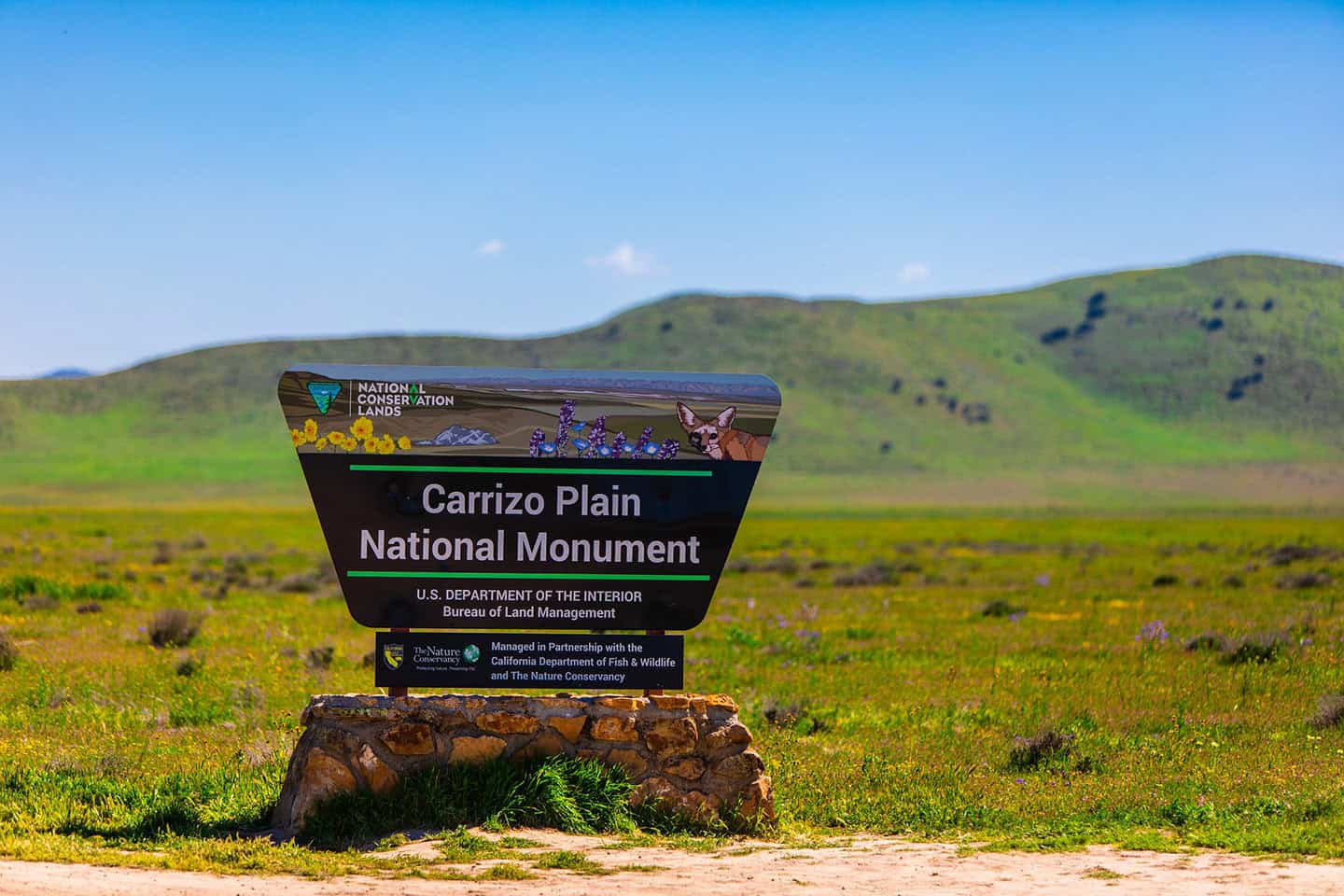
Experience the Carrizo Plain superbloom, a rare and vivid wildflower event that transforms the California Valley into rolling fields of color. In the right year, vast sweeps of purple, orange and yellow carpet the valley floor as far as you can see, the kind of scene that you simply have to witness in person to understand. Not guaranteed every year, a superbloom here is well worth the road trip when conditions come together. Beyond the blooms, you’ll find the calm shores of Soda Lake, sacred Native American rock art at Painted Rock and wide-open views that reward every mile of the drive. Plan your timing, find your favorite viewing spots and let this guide set you up for one of the Central Coast’s most vibrant spring adventures.
Download your free Wildflower Map from Highway 1
Get MapQuick Planner: When to Go and How to Plan the Day
Plan your wildflower road trip carefully. The Carrizo Plain superbloom typically peaks toward the end of March, though bloom timing shifts year to year depending on rainfall and which species are putting on the show. However you build the day, plan for a remote landscape with limited cell service, limited bathrooms and no services for 45 to 60 minutes in any direction. Bring water, snacks, sun protection and a full tank of gas before you head out.
If you have two to three hours, focus on one major viewing area like Shell Creek Meadows and pair it with a stop at the Soda Lake boardwalk for a change of scenery. A half day gives you time to explore two viewing areas plus a short hike at Overlook Hill or Caliente Mountain Ridge Trail. Armed with a full day, you can loop through multiple stops across the plain and add in a visit to Painted Rock if you’ve secured a permit ahead of time.
What Causes the Superbloom
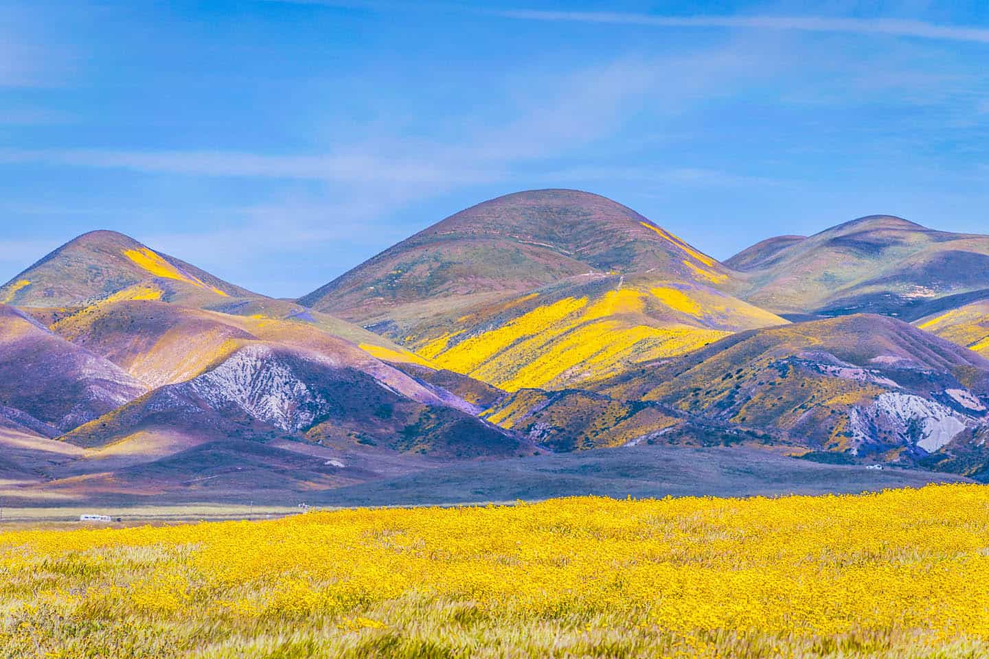
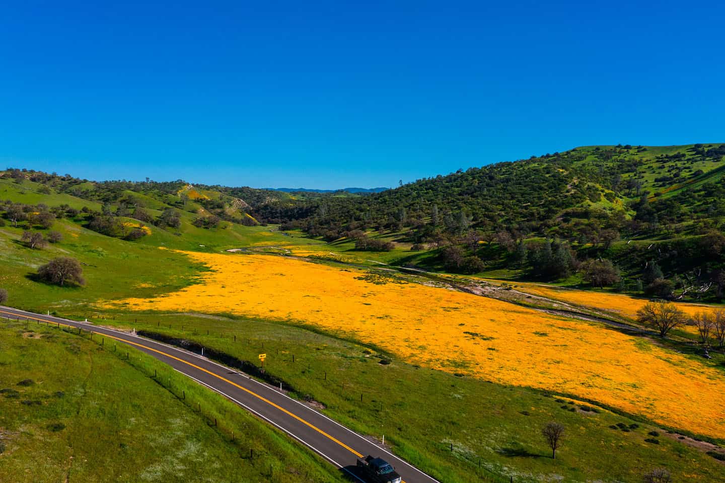
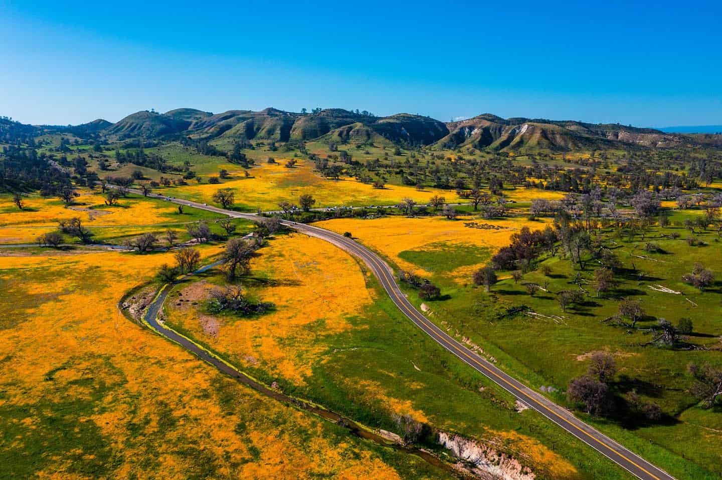
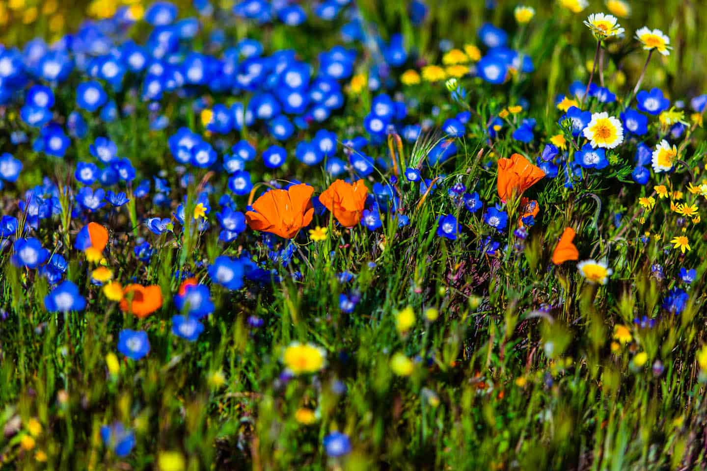
The conditions matter. A superbloom happens when environmental conditions align at just the right time. Droughts followed by steady rainy weather can create the perfect setup in Carrizo Plain, and when an extended rainy season takes hold, dozens of wildflower species bloom simultaneously across the valley floor. The result is a kind of slow-motion wave: color sweeping across the landscape for weeks, shifting as different species hit their peak. Depending on when you arrive, the Carrizo Plain may be saturated in deep purple phacelia, bright orange poppies or golden fields of tidy tips stretching to the base of the Temblor Range.

Best Time to Visit Carrizo Plain for Wildflowers
There is no single perfect time to visit. The Carrizo Plain superbloom generally peaks toward the end of March, but that window shifts every year depending on rainfall and which species are in bloom. For the Carrizo Plain wildflowers 2026 season, the same rule applies: conditions on the ground matter more than the calendar. Some years the bloom starts strong in mid-March and fades by early April. Other years it stretches well into spring with new waves of color replacing the last. The best way to think about it is a season, not a date, with bloom intensity changing week to week across different parts of the plain.
Before you make the drive, check the Theodore Payne Foundation’s Wildflower Hotline for weekly updates that run from March through May. The recordings are short, around five minutes, and available by phone at 818-768-1802 ext. 7 or as a podcast on Spotify and Apple. It’s the easiest way to time your visit and avoid driving out to a valley that hasn’t popped yet.
Superbloom Tips and What to Bring
Know the terrain. You’re heading into a remote area with next to nothing between you and the horizon, so pack smart before you roll. Bring a fully charged phone or camera to capture the scenery, binoculars for a closer look at the landscape and plenty of snacks and water to keep you fueled. Layer your clothing for temperatures that can swing throughout the day, wear sunblock and sunglasses against the bright California sun and lace up sturdy walking shoes for comfortable footing on uneven ground.
Bathrooms are limited across the Carrizo Plain. The nearest option is a portable restroom behind the community center in California Valley, so plan your stops accordingly. Cell service is spotty to nonexistent depending on your provider and location, so download your maps and plan your route before you leave home. Once you’re out on the plain, count on being off the grid.
Road Conditions, Mud, and Where Not to Pull Off
Hope for the best, but prepare for the weather. The superbloom coincides with the tail end of the rainy season, which means mud is a formidable hazard across the Carrizo Plain. Even 4×4 vehicles can get stuck on soft shoulders, and tow services are often hours away. It’s not uncommon to see rows of vehicles stranded together, with well-meaning helpers stuck right alongside the people they stopped to rescue. Stick to designated pull-offs, especially after recent rains, and resist the temptation to drive onto unpaved ground for a closer look at the flowers.
Simmler Road is accessible by rugged vehicles only and can become excessively muddy in wet conditions. If you’re not confident in your vehicle’s capability, skip it and focus on easier access points like Shell Creek Meadows or 7 Mile Road.
Remember: California Valley has minimal services and most of the businesses in town have been closed for years. There’s nothing within a 45 to 60 minute drive, so bring everything you need with you: fuel, food, water and any supplies for the day.
Best Spots to See the Carrizo Plain Superbloom
Shell Creek Meadows
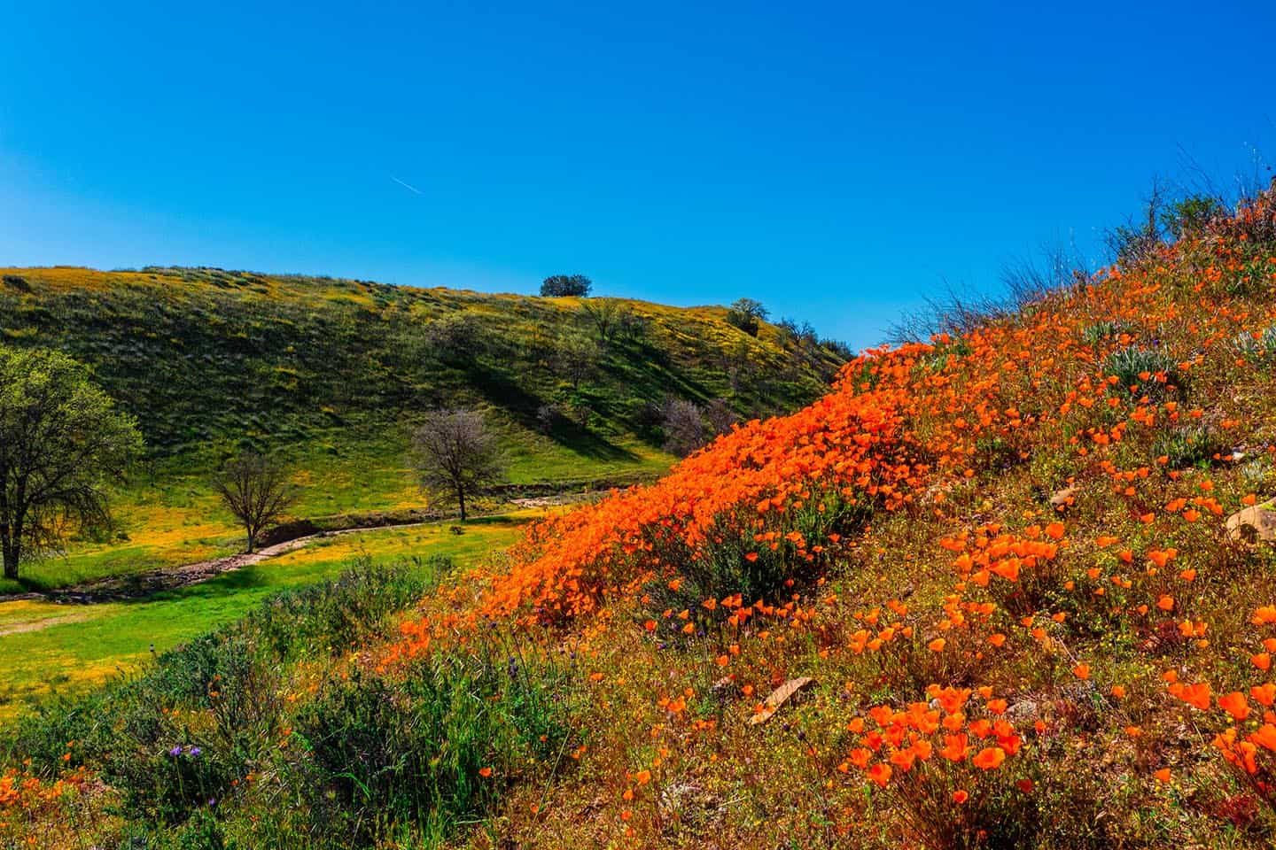
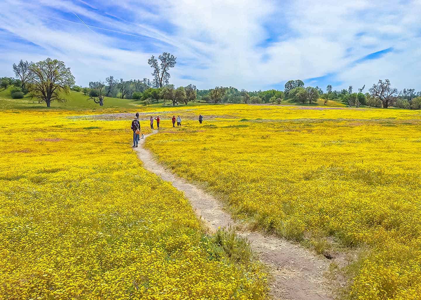
Shell Creek Meadows is the spot most people flock to first, and for good reason. Located at the intersection of Highway 58 and Shell Creek Road, this stretch of the plain puts on one of the most concentrated wildflower displays in the region. Shell Creek Road wildflowers peak alongside the broader Carrizo Plain bloom, typically toward the end of March. In 2026 and beyond, expect goldfields, coastal tidy tips, baby blue eyes and California poppies blanketing the meadows in layers of color visible from multiple pull-offs along the road. If you only have time for one stop, make it this one.
Simmler Road
Simmler Road takes you deeper into the plain with a more diverse mix of wildflowers, but it comes with tricky conditions. This road is accessible by rugged vehicles only and can turn dangerously slick after rain. If your vehicle can handle it and the weather has been dry, the reward is a stretch of blooms with far fewer people around.
Caliente Mountain Ridge Trail
Caliente Mountain Ridge Trail offers a completely different perspective. The terrain shifts from flat valley floor to ridgeline, opening up panoramic views across the plain below. Caliente Mountain Road splits off Selby Road, but keep in mind the gate can be closed during the rainy season when roads get too muddy for safe access. Check conditions before you plan this one into your day.
7 Mile Road
7 Mile Road gives you a look at the eastern side of the Carrizo Plain, where it intersects with Highway 58. This is a solid option if you’re building a loop through the area and want to see how the bloom varies across different parts of the valley.
Wildflower Hotline
The Theodore Payne Foundation’s Wildflower Hotline is the best tool for timing your visit to any of these spots. Weekly updates run from March through May, with short five-minute recordings available by phone at 818-768-1802 ext. 7 or as a podcast on Spotify and Apple. Sign up for their newsletter to get updates straight to your inbox.
For more wildflower viewing along the coast, explore wildflowers on Highway 1. If the trails here spark your interest, check out hiking on Highway 1 for more options back on the corridor.
Carrizo Highlights Beyond Wildflowers
Even if you don’t time the superbloom perfectly, the Carrizo Plain has plenty to reward the drive. From unique geology to one of California’s most unusual lake ecosystems, this landscape tells a story that soars well beyond wildflowers. Bring your camera, because Carrizo Plain National Monument photos tend to be the kind that stop people mid-scroll.
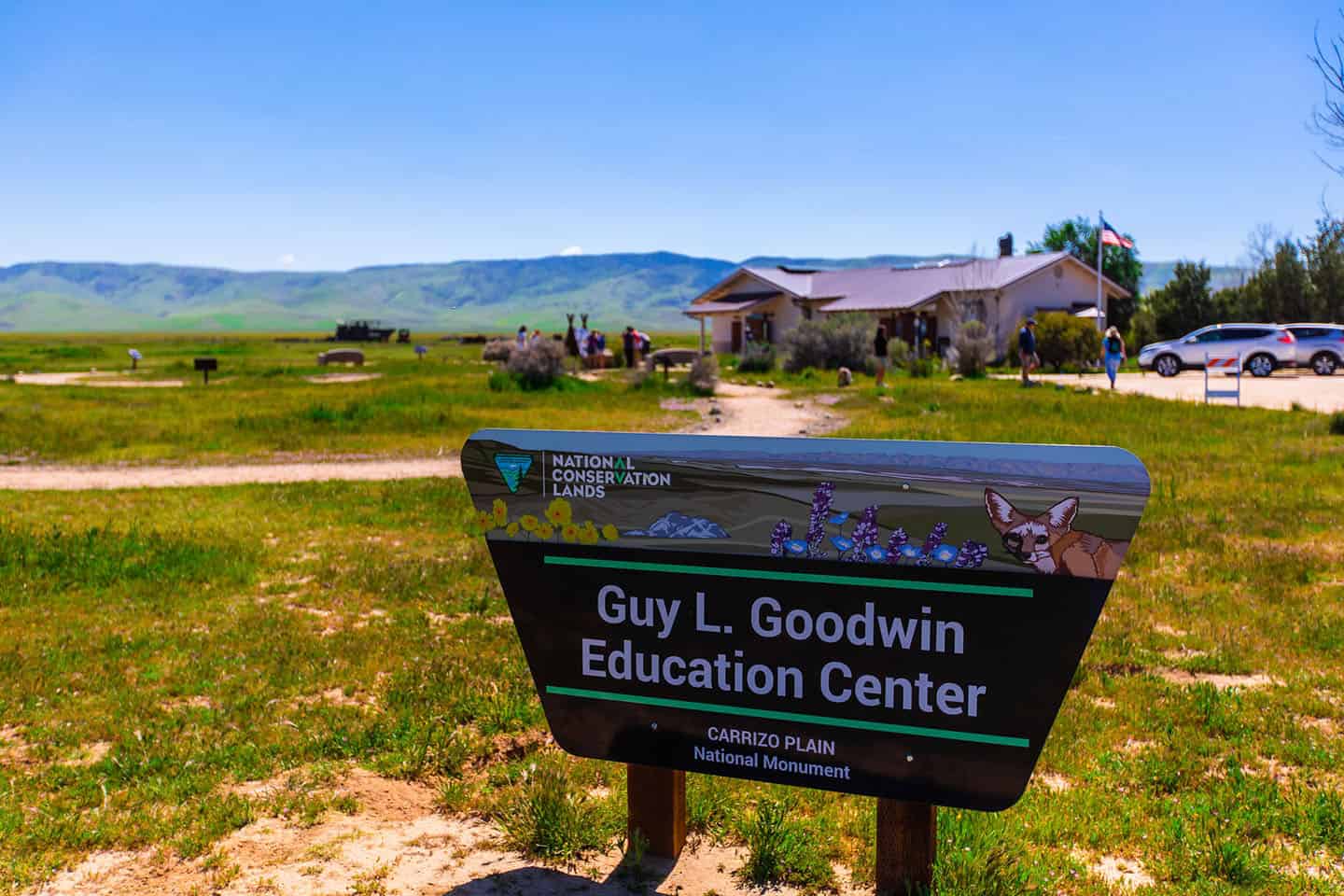
Goodwin Education Center
The Goodwin Education Center is a fitting first stop for getting your bearings. Open seasonally from December through May, Thursday through Sunday, 9 am to 4 pm, the center offers maps, regional info and context that helps the rest of your visit make sense. Find it at 17495 Soda Lake Rd, Santa Margarita, CA 93453.
Soda Lake and Boardwalk Trail
Soda Lake is one of California’s largest alkaline lakes, a shallow body of water with no natural drainage that slowly evaporates through the summer months. An elevated boardwalk trail lets you walk out over the lakeshore and take in the unique ecosystem up close. It’s a calm, scenic break from the wide-open expanse of the surrounding plain.
Overlook Hill Trail
For a quick change in elevation, Overlook Hill Trail is a short tenth-of-a-mile hike near Soda Lake that takes you to a hilltop with 360-degree views of the surrounding plain. Bring binoculars and give yourself a few minutes at the top to take it all in.
San Andreas Fault
The surface fractures of the San Andreas Fault are visible at the foot of the Temblor Range, one of the few places where you can see this kind of geological feature from ground level. Early morning or evening light works best here, when low-angle shadows bring the fracture lines into sharper relief.
Painted Rock Permits and Visiting Rules
Painted Rock is a sacred Native American rock art site, a striking sandstone formation lined with images created by the Chumash and other Indigenous peoples of the region. Access is managed by the Bureau of Land Management and requires either a BLM-guided tour or a self-guided visit with a permit reserved in advance through recreation.gov. Specific seasonal access rules apply, so check availability and requirements before you plan this into your day. This is a culturally significant place, so take your time, stay on designated paths and treat the site with the respect it deserves.
Camping and Staying Overnight
Camping at the Carrizo Plain is about as off-grid as it gets. There are no hotels, no lodges and no services nearby, so staying overnight means bringing everything you need with you: water, food, fuel and gear for self-sufficient camping.
KCL and Selby campgrounds are both managed by the BLM and operate on a first-come, first-served basis. Neither has water, electricity or hookups, so plan accordingly. What you do get is a quiet night under some of the darkest skies on the Central Coast, with the kind of stillness that stays with you long after you leave.

Resources and Preparation
A few things to keep in mind before you head out to the Carrizo Plain:
- Download maps and plan your route ahead of time. Cell service is spotty to nonexistent across much of the plain.
- Bring more water and snacks than you think you’ll need. The nearest town with services is roughly an hour away.
- Plan bathroom breaks before you arrive. Facilities are limited to a portable restroom behind the community center in California Valley.
- Bring layers and sun protection. The Carrizo Plain is bright, exposed and temperatures can shift quickly throughout the day.

Stewardship Travel for Good
Wildflowers are delicate, so treat them that way. The Carrizo Plain superbloom draws crowds, and how those crowds behave directly affects whether the blooms come back. A few simple ground rules go a long way toward being a stewardship traveler for good:
- Don’t trespass. Fenced areas may be private property. Read and respect all posted signs.
- Don’t trample. Stick to established paths and well-worn walking areas. Avoid stepping into untouched terrain, even for a photo.
- Don’t park off-road. Stay on pavement or packed surfaces and park parallel to the road. Pulling into wildflower habitat damages the very thing you came to see.
- Respect wildlife. Keep your distance and minimize disturbance. The plain is home to species that depend on this landscape year-round.
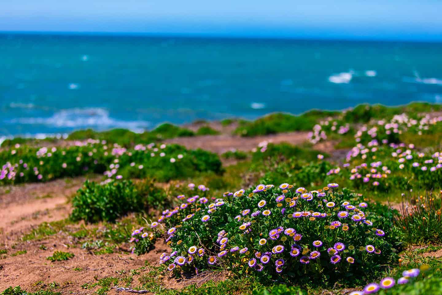
More Wildflowers Nearby on Highway 1
Cruise around the next bend. Once you’ve had your fill of the Carrizo Plain, Highway 1 wildflowers extend all along the coast. This iconic route weaving through San Luis Obispo County lights up in spring with its own wash of color, and a few stops along the corridor are worth building into your drive back.
Cayucos is a quick route from the plain: take Highway 58 west to the 41 and you’ll land in a laid-back coastal town where hillside blooms meet ocean views. Wildflowers spill down the bluffs above the beach, and the slower pace here makes for a perfect wind-down after a day on the open plain.
Los Osos sits a little further south along Highway 1, reached by taking the 58 to the 101 and then cutting over to the coast. The hillsides and trails around Los Osos and Baywood come alive with native wildflowers in spring, and the nearby coastal preserve offers some of the best low-key hiking on the corridor.
FAQ
When is the Carrizo Plain superbloom peak? The Carrizo Plain superbloom typically peaks toward the end of March, but timing varies year to year depending on rainfall and which species are blooming. For the Carrizo Plain superbloom 2026 season and beyond, the best approach is to monitor conditions rather than lock in a date. Check the Theodore Payne Foundation’s Wildflower Hotline for weekly updates before you drive.
How do I get bloom updates before I drive? The Theodore Payne Foundation runs a Wildflower Hotline with weekly recordings from March through May. Call 818-768-1802 ext. 7 or listen on Spotify or Apple Podcasts. You can also sign up for their newsletter to get updates by email.
Where are the best places to see wildflowers in Carrizo Plain? Shell Creek Meadows at the intersection of Highway 58 and Shell Creek Road is the most popular and concentrated viewing area. 7 Mile Road on the eastern side of the plain and Simmler Road (rugged vehicles only) offer additional options with different wildflower mixes.
Are Carrizo Plain roads paved and safe for cars? Highway 58 and the main routes through the plain are paved and accessible to standard vehicles. Simmler Road requires a rugged vehicle and can become dangerously muddy in wet conditions. Muddy shoulders are a hazard across the area, especially after rain, so stick to designated pull-offs and avoid driving onto soft ground. Tow services can be hours away.
Do you need tickets for Carrizo Plain or Painted Rock? No tickets are needed to visit the Carrizo Plain or view the superbloom. Painted Rock is a separate site that requires either a BLM-guided tour or a self-guided permit reserved in advance through recreation.gov. Seasonal access rules apply.
Can you camp at Carrizo Plain? Yes. KCL and Selby campgrounds are both first-come, first-served and managed by the BLM. Neither has water, electricity or hookups, so come fully self-sufficient. Download the Carrizo Plain camping brochure for locations and details.
What should I bring for the Carrizo super bloom? Bring a fully charged phone or camera, binoculars, plenty of water and snacks, layered clothing, sunblock, sunglasses and sturdy walking shoes. There are no services anywhere nearby, so pack everything you need before you head out. Cell service is limited, so download your maps in advance.
Is Carrizo Plain worth visiting if it’s not a superbloom year? Absolutely. Soda Lake and its boardwalk trail offer a look at one of California’s most unique alkaline lake ecosystems. Overlook Hill Trail gives you 360-degree views of the valley from a short tenth-of-a-mile hike. The San Andreas Fault surface fractures are visible at the foot of the Temblor Range, and Painted Rock is a year-round destination with the right permit. The landscape itself is worth the drive.