Hiking in Cayucos
Cayucos captivates hikers with miles of diverse trails along Highway 1, where coastal wonders await at every turn. This laid back beach community beckons road trippers a variety of terrain: pristine beaches for leisurely strolls, dramatic cliffside paths hugging the shoreline, and elevated trails revealing breathtaking Pacific panoramas. From easy seaside ambles to challenging treks, Cayucos caters to all adventure levels. The temperate climate invites year-round exploration, while the only off-leash dog beach on Highway 1 makes it a must-stop for four-legged travelers. Explorers stepping onto Cayucos trails embark on unforgettable journeys through one of California’s most stunning coastal landscapes, transforming a simple break into a memorable hiking adventure.
EXPLORE HIKING IN CAYUCOS
Whale Rock Reservoir Trail
Whale Rock Reservoir Trail invites explorers on an easy 4-mile out-and-back journey along the eastern shores of San Luis Obispo County’s most intimate reservoir. Built in 1961 and named for the historic whalers who once scanned Estero Bay for passing cetaceans, this 1,350-acre aquatic oasis now quenches the thirst of the surrounding county.
From late April through mid-November, the reservoir’s shores become an angler’s paradise. Here, fishing enthusiasts can cast their lines for an impressive array of aquatic residents — steelhead, catfish, bluegill, and Sacramento suckers all call these waters home. That said, the allure extends beyond the water’s edge. Sharp-eyed hikers might spot majestic bald eagles soaring overhead, ospreys diving for their next meal, or a variety of migratory birds resting on their long journeys.
While four-legged companions are welcome on leash, trail-goers should remain vigilant. The path weaves through terrain where rattlesnakes bask and ticks lurk, presenting challenges for both pets and their human counterparts.
To embark on this scenic adventure, road trippers can follow Highway 1 south from Cayucos for one mile, then turn left onto Old Creek Road. After a 1.5-mile drive, the trailhead awaits on the left, just shy of the PG&E substation. Adventurers should note the modest entrance fee, a small price for the natural wonders that await along this serene reservoir trail.
Whale Rock Reservoir Trail Summary
Distance: 4 miles out and back
Elevation gain: 288 ft
Hiking difficulty: easy
Dogs allowed: yes, on leash
Permits and fees: $2 access fee
Hours: 6 A.M. to 5 P.M. Wednesday through Sunday during fishing season for fishing and hiking
Amenities: pit toilets, picnic areas, parking.

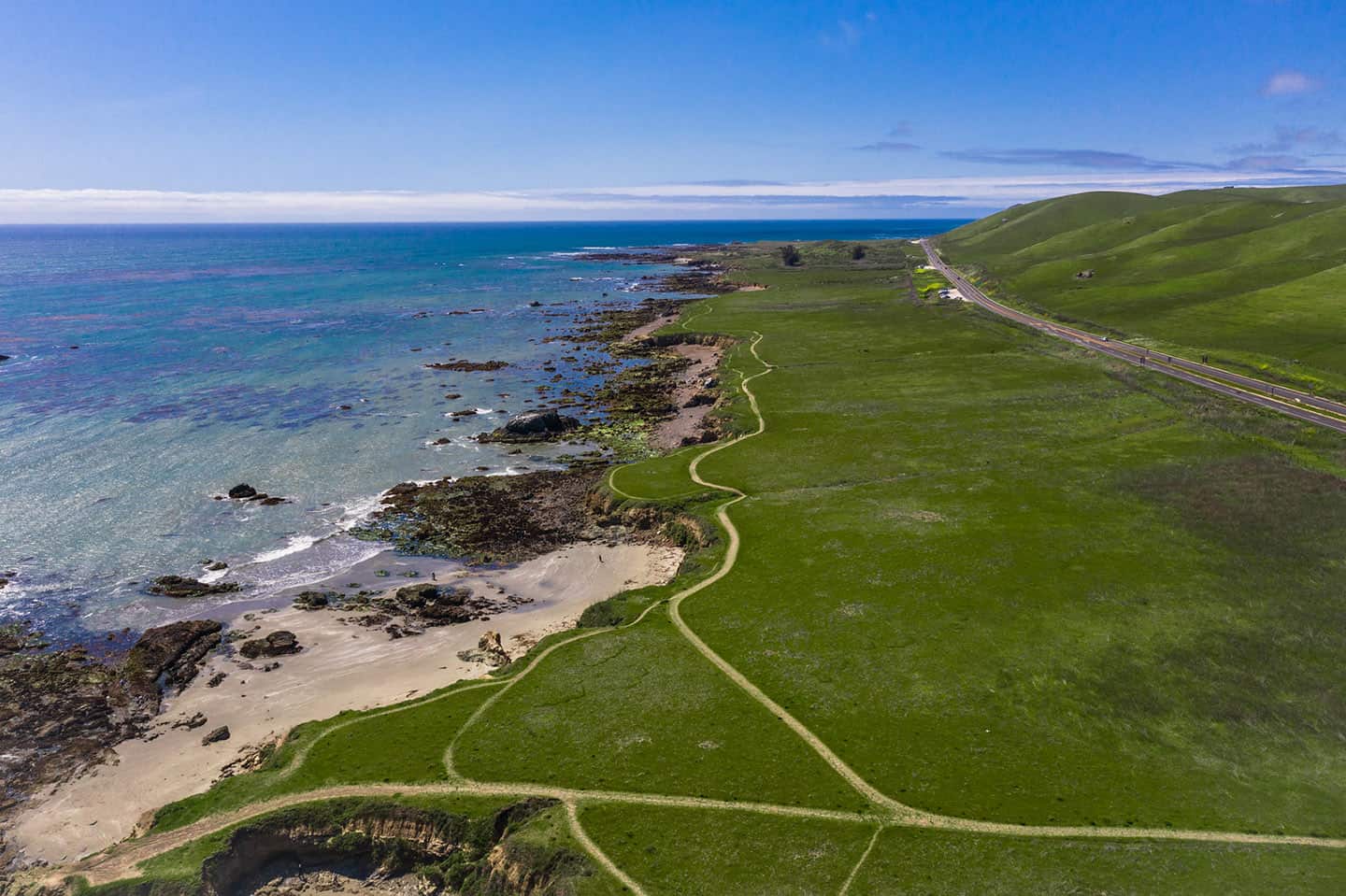
Estero Bluffs State Park Trail
Estero Bluffs State Park unfolds along 353 acres of pristine coastline in scenic Cayucos. Established in 2002, this hiking destination was once home to the Chumash and Salinan peoples, later part of the California Missions. Today, it beckons explorers with panoramic vistas of the bay and iconic Morro Rock.
The park’s rugged shores harbor a vibrant ecosystem: Tide pools teem with marine life, while playful otters and harbor seals frolic offshore. Above, the sky comes alive with the graceful flight of pelicans, cormorants, seagulls, and snowy egrets.
At the heart of the park, the Estero Bluffs Trail stretches for 4 miles, tracing the coastline from north to south. A network of lateral paths connects to this wide, flat main trail, allowing hikers to tailor their adventure – from brief excursions to longer coastal treks. For those seeking to feel sand between their toes, a scramble down near San Geronimo Creek leads to the beach below. Adventurous spirits can explore from cove to cove, navigating tidal rocks along the way.
Road trippers approaching from the south will find the park just north of Cayucos, its expanse unfolding along the ocean side of Highway 1. Multiple pullouts offer ample parking throughout the four-mile stretch. For the ideal starting point, explorers should seek out the trailhead at San Geronimo Road, marked by a restored windmill — a silent greeter guiding the way to coastal adventure.
Estero Bluffs State Park Trail Summary
Distance: 4 miles, one-way along the coastline, though lateral trails can shorten the trip
Elevation gain: 276 ft
Hiking difficulty: easy
Dogs allowed: yes, on leash
Permits and fees: none
Hours: 6 A.M. to sunset, daily, year-round
Amenities: parking
Hang Glider Hill Trail
Soar to new heights on the exhilarating Hang Glider Hill Trail, a local favorite that offers more than just a hike. This popular spot serves as a launching point for hang gliders, adding a thrilling dimension to the hiking experience. Visitors might witness the breathtaking sight of hang gliders taking flight, soaring over Highway 1, and gracefully landing on the beach below.
The trail itself presents a moderate challenge, rewarding hikers with panoramic views of the coastline and the vast Pacific Ocean. As explorers ascend the hill, they’ll feel the invigorating ocean breeze and gain a unique perspective of the coastal Cayucos landscape.
Hang Glider Hill Trail Summary:
Distance: 1.6 mi out and back
Elevation gain: 564 ft
Hiking difficulty: Easy to Moderate
Dogs allowed: yes, on leash
Permits and fees: none
Amenities: None, with very limited parking at the end of Chaney Ave

Cayucos Beach Trail
Embark on a scenic journey along the Cayucos Beach Trail, where the rhythm of the waves accompanies every step. This delightful coastal path stretches from the iconic Cayucos Pier to the southern edge of Cayucos State Beach, where it seamlessly merges with Morro Strand State Beach. For ambitious hikers, the adventure can continue all the way to the majestic Morro Rock, offering an extended beach walk with ever-changing coastal vistas.
A highlight of this trail is the off-leash dog beach at the southern end, providing a paradise for four-legged explorers to frolic in the surf and sand. This unique feature makes the Cayucos Beach Trail a standout destination for pet owners traveling along Highway 1.
As visitors stroll along the shoreline, they’ll be treated to views of surfers catching waves, shorebirds darting along the water’s edge, and perhaps whales in the distance. The trail offers a perfect blend of natural beauty and small-town charm, with the historic Cayucos Pier standing as a picturesque landmark.
Cayucos Beach Trail Summary
Distance: 2.5 mi
Elevation gain: N/A
Hiking difficulty: Easy
Dogs allowed: Yes (off-leash on south side of beach)
Permits and fees: none
Amenities: Pier adjacent with plenty of food and parking options

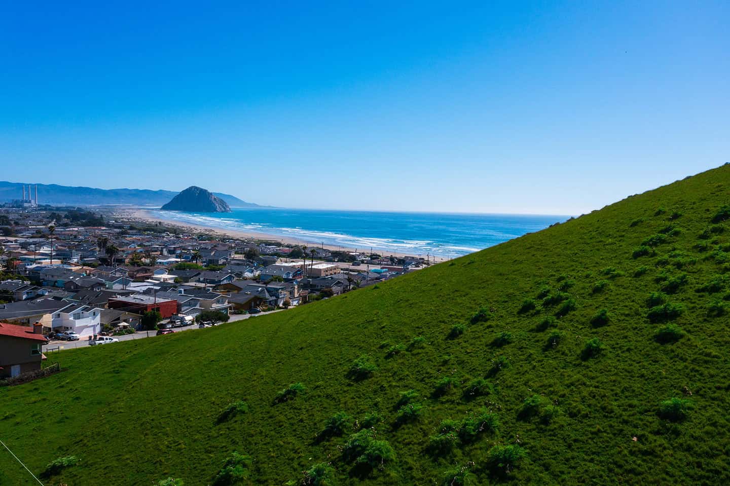
Cass Hill Trail
For those seeking a moderate challenge with rewarding views, the Cass Hill Trail delivers in spades. This hidden trail gives visitors a chance to gain elevation and perspective, unveiling breathtaking panoramas of both land and sea. As trail-goers ascend Cass Hill, they’re treated to an ever-expanding vista. To one side, the sparkling waters of Whale Rock Reservoir stretch out like a mirror reflecting the sky. To the other, the vast expanse of the Pacific Ocean commands attention, its waves breaking against the shoreline far below.
On clear days, Cass Hill Trail gifts hikers a sweeping view of the entire town of Cayucos, its charming streets and beaches laid out like a vintage postcard. In the distance, the iconic silhouette of Morro Rock stands, adding to the majestic coastal scenery. This hiking destination offers a perfect balance of challenge and reward, making it an excellent choice for those looking to elevate their hiking experience — both literally and figuratively.
Cass Hill Trail Summary
Distance: 3 mi out and back
Elevation gain: 692 ft
Hiking difficulty: Moderate
Dogs allowed: On Leash
Amenities: None. Parking at the end of Cayucos Dr.
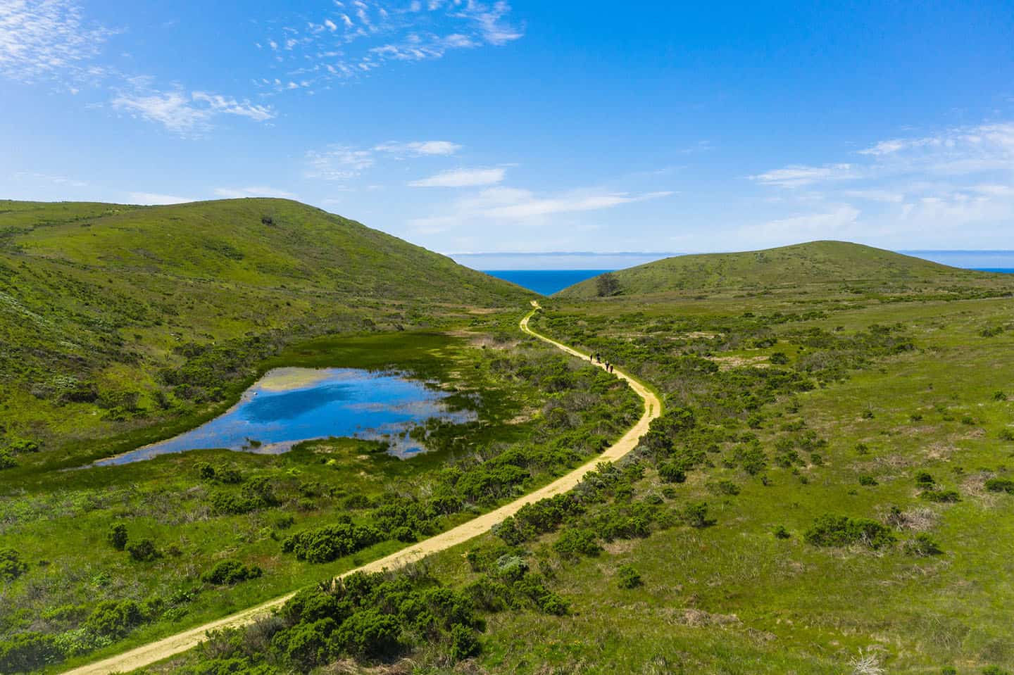
Harmony Headlands Trail
Harmony Headlands State Park, a pristine coastal sanctuary that debuted in 2008, invites explorers to discover one of Highway 1’s most unspoiled landscapes. This 784-acre expanse of untouched grasslands and rugged shoreline stands as a testament to conservation efforts, preserved in 2003 by the American Land Conservancy. Once part of the historic Rancho San Geronimo land grant and later a working ranch, today it offers a pristine escape for hikers, walkers, and trail runners.
Just 5 miles north of Cayucos, this natural wonderland beckons road trippers to veer off Highway 1. A modest $3.00 fee grants access to the gravel parking lot, though adventurers can opt for free roadside parking. At the trailhead, a large interpretive sign orients visitors to the park’s wonders.
The journey begins along an inland trail, where remnants of the park’s ranching heritage still stand. An old bunkhouse offers a glimpse into the past, while also housing the trail’s sole restroom facility. Further along, a man-made pond — another relic of bygone ranching days — serves as a haven for local birdlife, inviting nature enthusiasts to pause and observe.
At the 1.75-mile mark, the path dramatically meets the ocean bluffs. For the next 0.75 miles, hikers find themselves tracing the edge of the continent, with panoramic coastal vistas unfolding with each step. The trail concludes at the park’s northwest boundary, where trekkers turn to retrace their steps, carrying with them memories of this rare and beautiful seaside landscape.
This 5-mile round trip adventure through Harmony Headlands offers a perfect blend of California’s pastoral past and wild coastal beauty, promising an unforgettable experience for all who wander its paths.
Harmony Headlands Trail Summary
Distance: 4.5 miles, roundtrip
Elevation gain: 250 feet
Hiking difficulty: easy
Dogs allowed: no
Permits and fees: $3.00 parking fee at trailhead
Hours: 6 A.M. to sunset
Amenities: Parking, bike rack, three benches along the trail, pit toilet