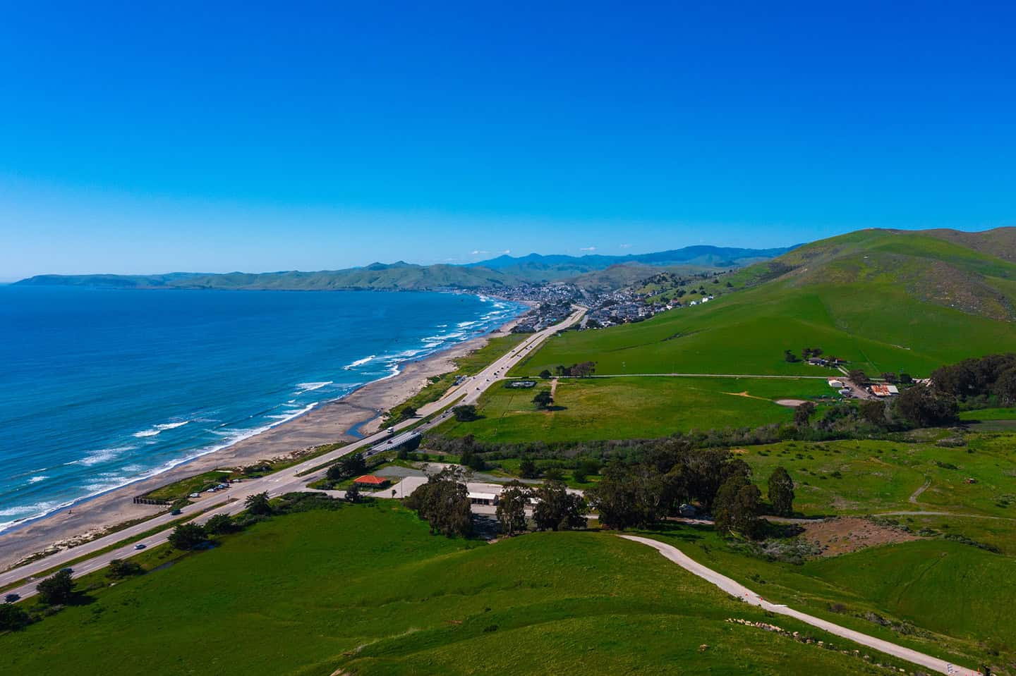
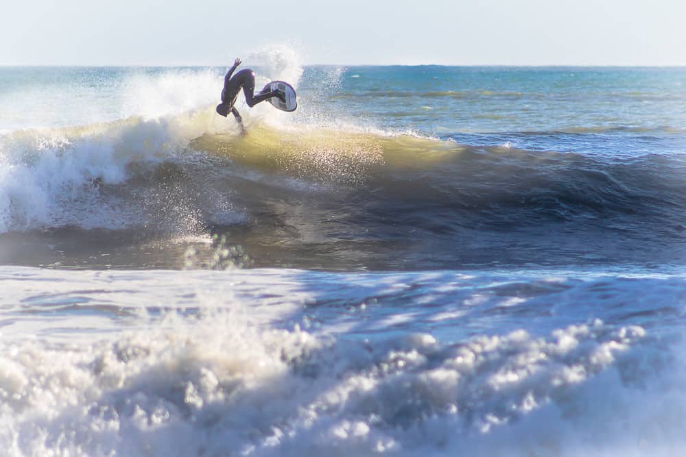
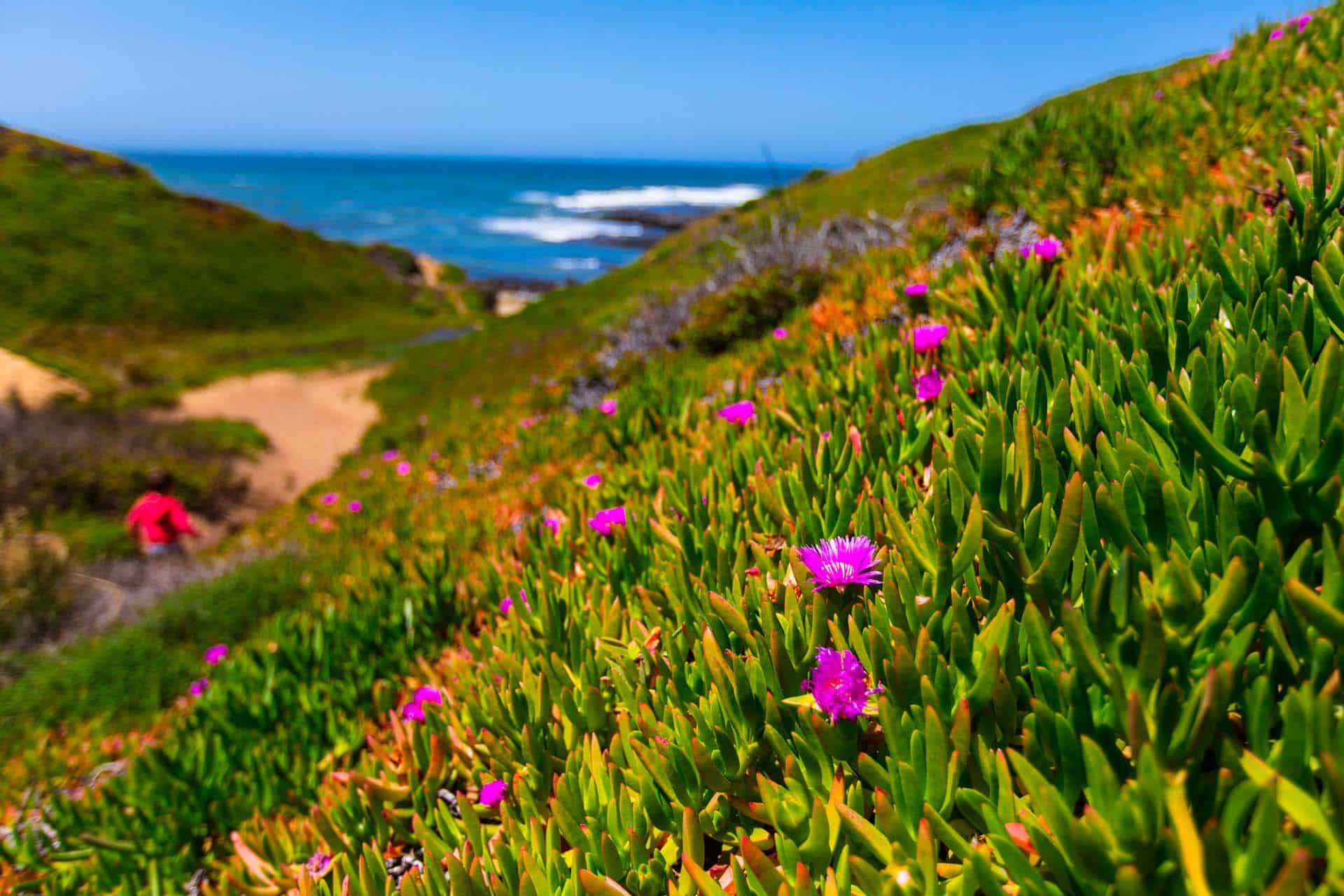
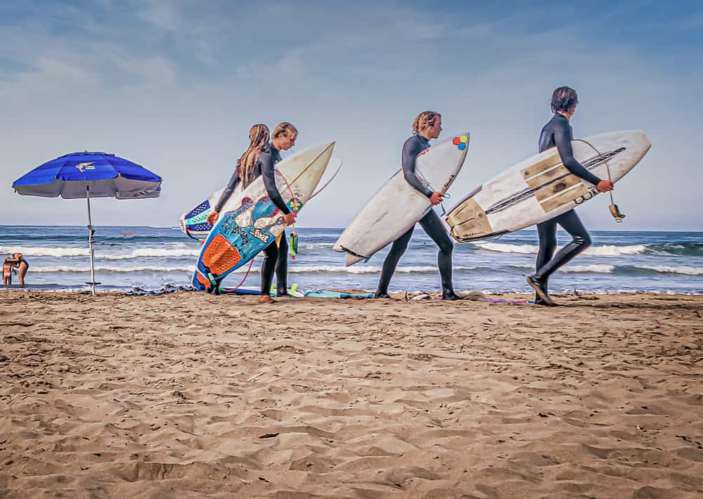
Surfing this unspoiled stretch of coastline off Highway 1 should be on every experienced surfer’s bucket list. Epic waves, beautiful barrels and a rare unexposed break make this the stuff of surfing dreams. All of the best spots in Los Osos are located within Montaña de Oro State Park, a large natural playground with more than just surfing to enjoy. Pick up a sandwich or burrito in town, then head out to the waves for a morning or evening. Afterward, sit on the beach or on a turnout along Pecho Valley Road to watch other surfers carve it up. Of course, the views alone are worth a visit: rugged shoreline, crashing waves, secluded beaches, and everything Highway 1 does best. Any one of these spots are accessible along Pecho Valley Road within the Montaña de Oro Park, and many are indicated by signs. Check the tides and surf reports, but please note that many of the waves in Los Osos are for experienced surfers only. Swells can be very large, while jagged rocks on shore and rip tides can be extremely unforgiving. Sharks and localism can be a factor as well, so gauge your abilities before paddling out. Most locals recommend bringing a longboard to avoid closeouts. And, as with most surf spots on the Central Coast, fall and winter tend to be the best time for swells.
Surfing Along Highway 1
Best Surf Spots in Los Osos
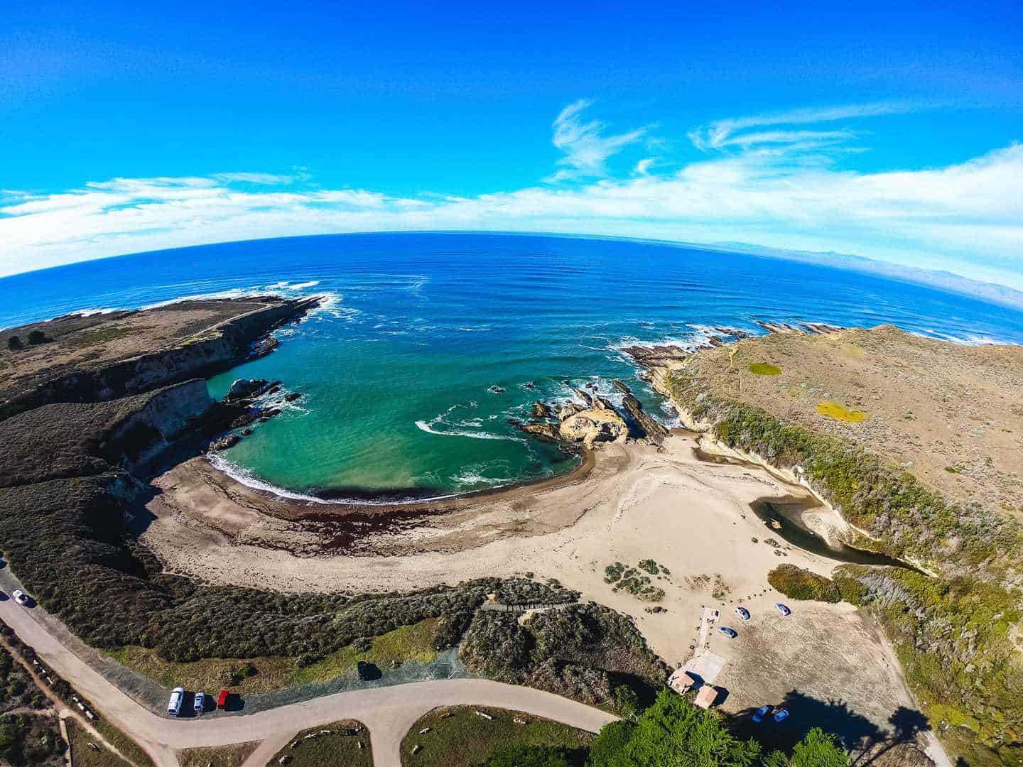
Spooners Cove Surf Spot
This is one of Montaña de Oro’s most popular beaches, but don’t let that deter you: the waves are wide open. Spooner’s Cove is a protected inlet with wide, high cliffs, surrounding a freshwater stream and a picturesque beach. But locals think of it as three distinct surf spots: Lonesomes, A-Frames and Spooner’s. Most visitors park in the parking lot, just off Pecho Valley Road, across from the Spooner Ranch House. But the locals will tell you to park on the grass above the cliff overlooking Spooner’s Cove.
Lonesomes breaks on the north point, in toward the cove. Catch it at its best, with swells from the northwest/west, and winds from the east/northeast. Swells can hold up to 16 feet or more, the best likelihood being during a falling tide. This right-breaking wave is named for the long, solitary paddle required to catch it. (Once again, experienced surfers only!) Watch for the reef rock standing in the middle of the cove.
A-Frames lies in the middle of Spooner’s Cove, a ways out from shore. True to its name, this wave breaks both right and left, giving plenty of options for where to ride it. That being said, it can also combine with the left-breaking wave from Spooner’s to become a painful closeout. Some surfers only use A-Frames to practice big drops and tow-ins, as it’s pretty far out. If you choose to do that, too, take care to ensure that surfers aren’t in your path.
Spooner’s is a left-breaking wave that rolls on the south point of Spooner’s Cove. In fact, many believe it’s the best big-wave break on the Central Coast, with 20-foot swells in good conditions. Spooner’s is world-class for its unexposed break — a rarity anywhere south of San Francisco. But with great power comes great responsibility: don’t attempt to surf Spooner’s on a whim. Catch it on a medium tide to avoid being forced into the rocks, but still able to get the swells. Come ready to paddle a lot and stay underwater a lot, as hold-downs can be long. On a good day, the barrel will be worth all the challenges.
Type: Reef break, beach break
Best Swell Direction: West
Wave Quality: Good for all levels when conditions are mild
Crowd Level: Light
Parking Information: Free parking at Spooner’s Cove
Hazards Surf Spot
For decades, this surf spot was considered the Central Coast’s best-kept secret — a notoriously huge wave, only accessible by hiking. The secret got out, however, when a surf photographer snapped shots of Hazards that made their way to print. But no matter: the spot is still mostly visited by locals, many of whom just want to watch you attempt that monster wave. Hazards breaks right over a jagged reef, with serious power, especially with southeast prevailing winds in winter. There is a lot to consider here, from the late drop and dangerous double-ups, ledges and bowls to the unforgiving rock shelf beneath. This is why only very experienced, near-pro surfers are successful here — and even they wipeout at Hazards, much of the time. Look for a medium tide, with swells about head-height. Unlike other Montana de Oro surf spots, this one does well with a shortboard or semi-longboard. Just be sure to bring your helmet: Hazards is not for the faint of heart. As you drive into Montana de Oro on Pecho Valley Road, look for the Hazard Reef trailhead sign. Parking access to the trailhead is along turnouts only.
Type: Powerful reef break
Best Swell Direction: West, northwest
Wave Quality: High-quality, challenging waves
Crowd Level: Light to moderate; mostly locals
Parking Information: Free parking at Montaña de Oro State Park
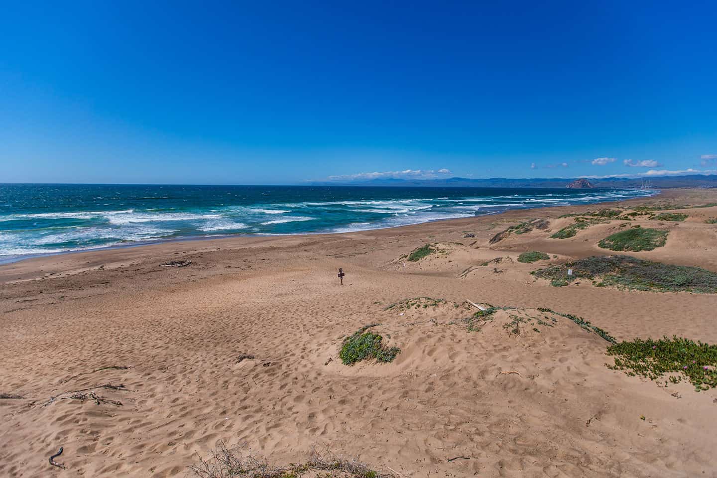
Sandspit Surf Spot
The long sandspit that connects Montaña de Oro State Park to Morro Bay is one of the most unique spots along Highway 1. This four-mile beach includes dunes stacked as high as 85 feet — as well as some of the best surf around. Literally anywhere you get in the water between Los Osos and Morro Bay along the sandspit will offer good waves, if timed right. Added benefits include a fantastic view of Morro Rock to the north, and a wide-open beach that’s practically empty. Swells come from the west and southwest, with winds to the north. The surf ranges from waist-high to several feet overhead; head out during low tide for the best conditions. (And, as a reminder, only experienced surfers should attempt Sandspit Beach.) To get to Sandspit, take one of two routes. Drive Pecho Valley Road and turn right to find the Sandpit day-use area. Park at the end of the road, where there’s a parking lot, restroom and picnic tables. The beach nearest the parking area can be accessed via a short trail, but Sandspit surf lies further out; be prepared to walk. Alternatively, access Sandspit Beach by parking at Morro Rock and paddling south across the channel.
Type: Beach break
Best Swell Direction: West, northwest
Wave Quality: Long, hollow waves; powerful barrels
Crowd Level: Moderate to heavy, depending on the swell
Parking Information: Free parking at end of Sand Spit Rd
Surfing Conditions by Season
Los Osos surf conditions vary dramatically throughout the year, offering distinct experiences each season. Note that morning sessions are recommended year-round to avoid afternoon winds, which can significantly impact wave quality at all breaks.
Fall
(September through November) typically delivers the most consistent conditions, with regular northwest swells creating powerful waves at all breaks. Morning offshore winds are common, creating clean faces at Spooner’s and Hazards before the afternoon onshores pick up.
Winter
(December through February) brings the biggest swells, frequently exceeding 15 feet at exposed breaks, making spots like Hazards exceptionally challenging but rewarding. Water temperatures drop to the low 50s, requiring a quality 4/3mm wetsuit with optional hood and booties.
Spring
(March through May) offers variable conditions, with occasional late-season northwest swells interrupted by shorter-period wind swell. This season often provides unexpected gems, especially during early mornings when offshore winds can persist longer.
Summer
(June through August) typically sees smaller waves and warmer water temperatures reaching the mid-6ps, though morning fog can be heavy. South swells can create excellent conditions at Sandspit, while Spooner’s generally offers more manageable waves for intermediate surfers.
Nearby Surf Shops
Wavelengths Surf Shop
A cornerstone of the Morro Bay surf community since 1984, Wavelengths Surf Shop offers an extensive selection of surfboards, from beginner-friendly foam tops to high-performance shortboards from leading brands like Channel Islands and Lost. Their wetsuit inventory includes premium options from O’Neill, Rip Curl, and XCEL, with expert staff providing personalized fitting services. Local surfers particularly value their repair services and insider knowledge of Central Coast breaks. The shop maintains a well-stocked rental fleet of boards and suits, perfect for visitors wanting to sample Los Osos waves. Located just 10 minutes from Montana de Oro State Park, they offer early morning opening hours during prime surf seasons and keep an active surf report on their website.
Joe’s Surfboard Shop
Joe’s Surfboard Shop stands out for its custom shaping services and deep connection to the local surf scene. Master shaper Joe has been crafting boards tailored to Central Coast conditions for over three decades, with intimate knowledge of how different designs perform at spots like Hazards and Spooner’s Cove. The shop specializes in performance shortboards and mid-lengths ideal for local wave conditions, while also offering a carefully curated selection of used boards. Their repair services are renowned throughout the region, handling everything from minor dings to major structural repairs. Visitors appreciate their rental program featuring locally shaped boards, and the welcoming atmosphere and willingness to share detailed spot knowledge with respectful visiting surfers.
Azhiaziam Surf Shop
Born from Central Coast surf culture, Azhiaziam has evolved from a local tee-shirt brand into a full-service surf shop while maintaining its authentic community roots. The shop offers a distinctive mix of surf hardware and their own locally-inspired apparel line, which has gained a following well beyond the Central Coast. Their surfboard selection focuses on versatile designs that work well in local conditions, including their own signature models shaped by regional craftspeople. The rental program features quality boards suitable for various skill levels and local breaks. Beyond equipment, Azhiaziam has become a hub for the local surf community, hosting regular events and staying active in local environmental initiatives. Their staff includes experienced surfers who regularly ride Los Osos breaks and provide valuable insights about conditions and spot selection.
Safety Tips for Surfing in Los Osos
Surfing Los Osos demands serious attention to safety due to its powerful waves and rocky reef formations. Before paddling out, always check local surf reports and tide tables, as conditions can change rapidly along this stretch of coast. A 4/3mm wetsuit is essential year-round, with booties recommended for rocky entries at spots like Hazards and Spooner’s. Pay particular attention to rip currents at Sandspit, which can be especially strong during larger swells and changing tides. The area’s reef breaks demand respect and often require protective gear. For example, a surf helmet is strongly recommended at Hazards and during bigger swells at Spooner’s. Familiarize yourself with each spot’s specific hazards and exit points before surfing, and stay aware of other surfers in the lineup. When in doubt, take time to observe the conditions and consider seeking local knowledge form nearby surf shops.
Always check local surf conditions before paddling out
Be aware of rocky reefs, rip currents, and shifting sandbars
Bring a thick wetsuit (4/3 or 5/4) due to cold water year-round
Respect the locals and surf etiquette rules
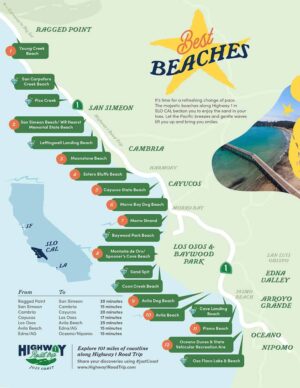
Discover Surfing Along Highway 1
Whether you’re an experienced surfer seeking pristine breaks or an adventurous soul drawn to the untamed beauty of the Central Coast, Los Osos stands as one of California’s best-kept surf secrets —but it’s not the only one. Discover the many other surf spots on Highway 1 that are begging to be explored, as well as a diverse array of unspoiled beaches.