Travel Where The Road Takes You
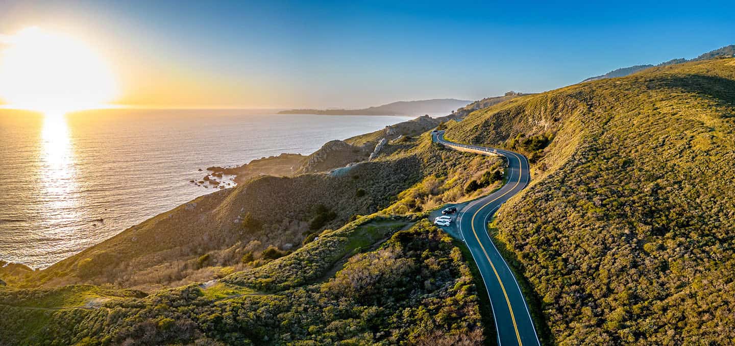
Drive our special stretch of Highway 1 between Ragged Point and Nipomo, and you can’t help but be awed by its natural beauty and scenic riches. These 81 miles are what make a Highway 1 scenic drive one of the top bucket-list excursions in the world. But finding all the secret treasures of this famous byway would take several days—and a local’s know-how. If you want the inside scoop on the best places to stop while driving Highway 1, you’ll need inspiration from a knowledgeable guide.
Here, we’ve shared a thorough list of must-see viewpoints along Highway 1 that will open your eyes to its many charms. Stand beneath a waterfall and listen to its roar. Taste wines influenced by the proximity of the Pacific Ocean. Travel through patchwork farmland and past towering sand dunes. Be dazzled by the kaleidoscope of thousands of Monarch butterflies. Explore the grounds of a historic lighthouse. Hunt for sea glass, pick apples, and summit coastal mountains. All of this and so much more can be found just off Highway 1, if you know where to look.
Take a peek at our list of the best places to stop along Highway 1, and use the links to Google maps to help you navigate each destination and attraction. If, however, you want to explore more in any given area, check out the destination-specific maps at the end of each section. And if you want a single map detailing all of the best scenic viewpoints on your drive, look no further than our Highway 1 Scenic Drive Map.
Now turn the ignition, roll down the windows, and put it in gear—it’s time to discover the scenic wonders of Highway 1.
Highway 1 Road Trip
Be In The Moment with Highway 1 Coastal Beauty
Experiencing awe is one of the simplest, fastest ways to become fully present. If you seek to live in the moment, Highway 1 offers free and accessible wonder-making opportunities around every bend. Stand on the cliffs at Ragged Point and watch the ocean churn below. Look out into a dreamily secluded bay at Hearst Memorial State Beach. Pull off Highway 1 onto Moonstone Drive for a magical view of the Cambria shoreline. Catch views of farms and backcountry on the Old Creek Loop. Marvel at the sand, surf and sunshine on Cayucos State Beach. Explore the rock formations and turquoise waters of Spooner’s Cove inside Montana de Oro State Park. Or drive out onto a historic pier to glimpse vistas of scenic Avila Beach. Each of these awe-inspiring moments is yours, just off Highway 1.

Ragged Point
Ocean-View Cliffs of Ragged Point
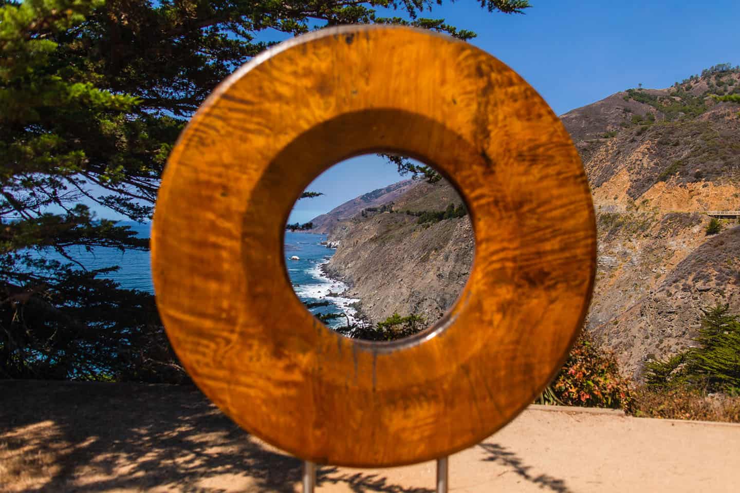
Home of the “Million-Dollar View,” Ragged Point offers some of the best scenery from the road. Park at the Ragged Point Inn, where you can grab a glass of wine or beer and enjoy panoramic views from the patio. This is an especially bewitching sight during sunset, perched high over the ocean. And don’t miss the Ragged Point Inn Restaurant for fresh-caught seafood, or the coffee bar and gift shop, too.
Thrill-seekers will want to take the steep walk along the Cliffside Trail down to a secluded purple-sand beach. Here, the Black Swift waterfall tumbles down to the beach and rolls to the ocean — a great view that’s hidden from the road. (Just be sure to wear grippy shoes and save some stamina for the steep walk back up!)
No matter where you turn in Ragged Point, ocean views are never far. And as the gateway to Big Sur, it offers some of the first cliffside driving heading north (or some of the last heading south).
For motorcyclists, this section of Highway 1 is one of the most popular rides on the globe. If you love tight turns, narrow roads and expansive ocean views, this is the area for you.
Where’s the best place to stop for this adventure? Pull over here for easy access to Ragged Point scenic views. Or use our Ragged Point Activity Map for more points of interest nearby, including the famous Bixby Bridge on Highway 1. Other experiences might include dipping your toes in San Carpoforo Creek or snapping photos of the vintage Piedras Blancas Motel.
Ragged Point Inn and Resort
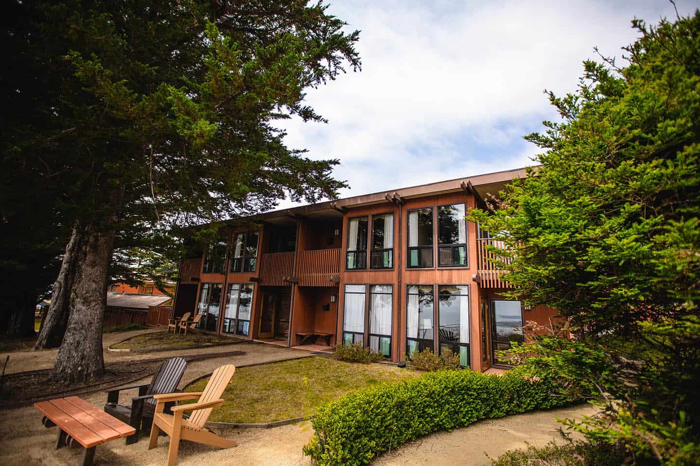
Beyond its breathtaking views, Ragged Point Inn and Resort serves as a perfect pit stop during your Highway 1 scenic drive. The beautifully landscaped gardens provide a peaceful setting to stretch your legs while taking in panoramic ocean vistas. Inside, find a charming gift shop with local crafts and coastal treasures. The onsite restaurant features floor-to-ceiling windows that frame the Pacific, allowing you to dine while watching for migrating whales and dolphins playing in the waves below. Whether you’re stopping for a coffee break or lingering over a leisurely lunch, this cliffside retreat gives you a chance to fully absorb the natural grandeur that makes this stretch of Highway 1 so memorable.
San Simeon
Vista Point at Hearst Memorial State Beach
Located just south of the entrance to San Simeon State Park, this vista point offers an ideal place for taking in effortless views. You can even park in the Hearst State Beach lot, off Highway 1, and see it all from the comfort of your vehicle. This is also a great place for whale watching, with its expansive ocean views. Bring binoculars to look for gray whales, minke whales, harbor seals, and sea otters, as well as dolphins and porpoises. These marine mammals are regular visitors to this stretch of shoreline. Do this from the bluffs above the beach, or with your toes wiggling in the warm sand below.
For the best place to stop on Highway 1, follow our map to the Vista Point at Hearst Memorial State Beach. Find plenty of other pullover activities on our San Simeon Road Trip Map. Sip award-winning wines at the Hearst Ranch tasting room then fish off the San Simeon Pier and take in the scenery. Or watch the kites of windsurfers and kiteboarders at Arroyo Laguna Beach, where winds can get up to 40 mph in the afternoons.
Elephant Seals & the Piedras Blancas Light Station
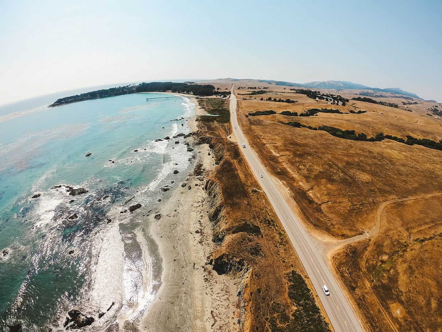
Driving the Pacific Coast Highway, it’s easy to see the Piedras Blancas Light Station from the road, but it’s not a close view. Some people park at the light station’s gated entrance to get a peek at it, but there’s actually a better way.
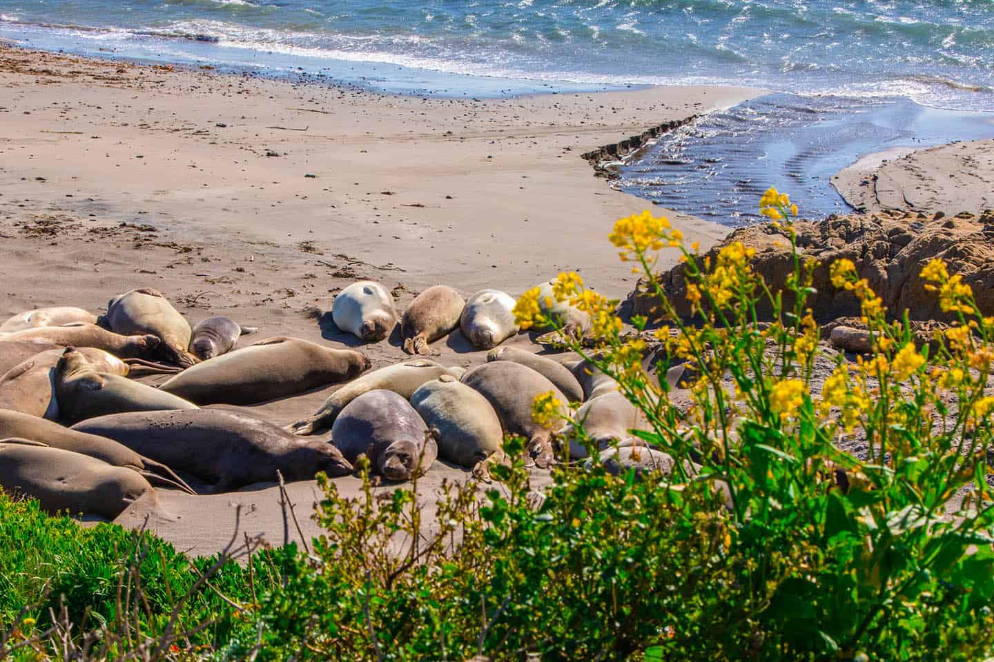
As an alternative, park at the Elephant Seal Rookery viewing area, where thousands of Elephant Seals can be seen mere steps away. Enjoy viewing the wildlife, then walk the adjacent Boucher Trail, which travels to the Piedras Blancas Light Station, built in 1875. This easy 1.9-mile walk parallels the coastline and provides more chances for wildlife viewing. You can even schedule a tour of the Light Station on your way, making this one of the Central Coast’s best two-for-one itineraries. Access to the light station grounds is by guided tour only.
For this adventure, the best place to stop along Highway 1 is at the Elephant Seal Vista Point. In addition to elephant seals and lighthouses, San Simeon offers many more things to see on Highway 1. Travel back in time with a tour of opulent Hearst Castle, the home of historic newspaper baron William Randolph Hearst. Or pull over to glimpse the famous zebras of Hearst Ranch, descendants of those in Hearst’s private zoo, still roaming beside Highway 1. These ideas and many more are available on our San Simeon Activity Map.
Zebras Along Highway 1
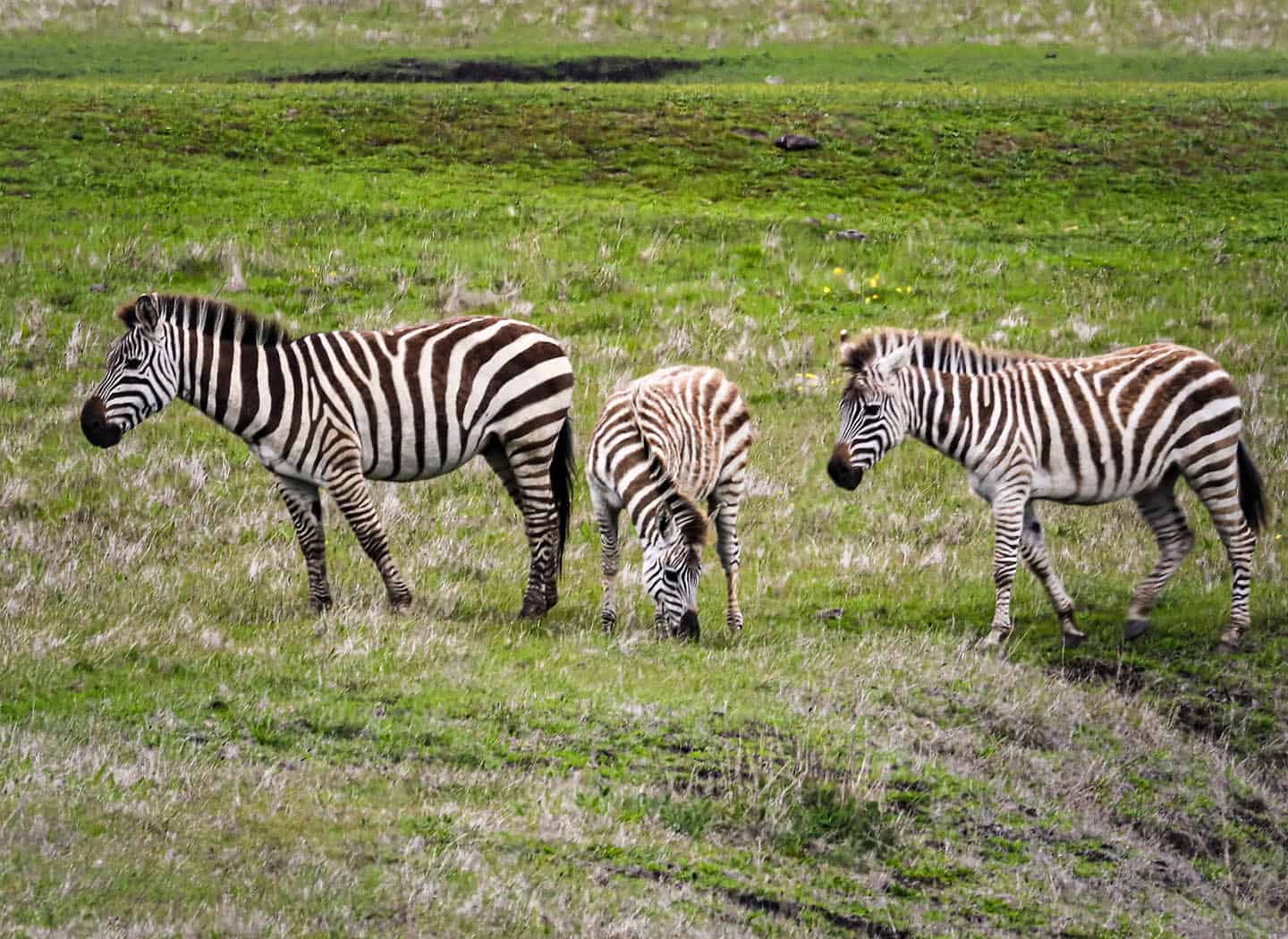
For decades, people have pulled over on Highway 1, shocked to see zebras grazing on the plains of San Simeon. Native to southern Africa, they are a sight to behold here, amongst the coastal cliffs, towering mountains and grandeur of Hearst Castle. It’s no accident that these zebras reside near Hearst’s magnificent estate: they were once members of his private zoo. He called his menagerie the “Hearst Garden of Comparative Zoology,” and it was the largest private zoo in the world in the 1930s. The zoo included lions, leopards, jaguars, tigers, grizzly bears, orangutans and an elephant, among other species. A lifelong animal-lover, Hearst hired a full-time veterinarian to his staff to care for the animals and ensure they were healthy and safe. When Hearst lost much of his fortune in 1937, he began dismantling the zoo — a process that lasted 15 years. Even then, the Hearst zoo never fully disappeared; zebras continue to cruise the property, as well as several other descendent species. Spying the zebras’ iconic black and white stripes along Highway 1 is one of the great pleasures of traveling this equally iconic roadway.
Hearst Castle
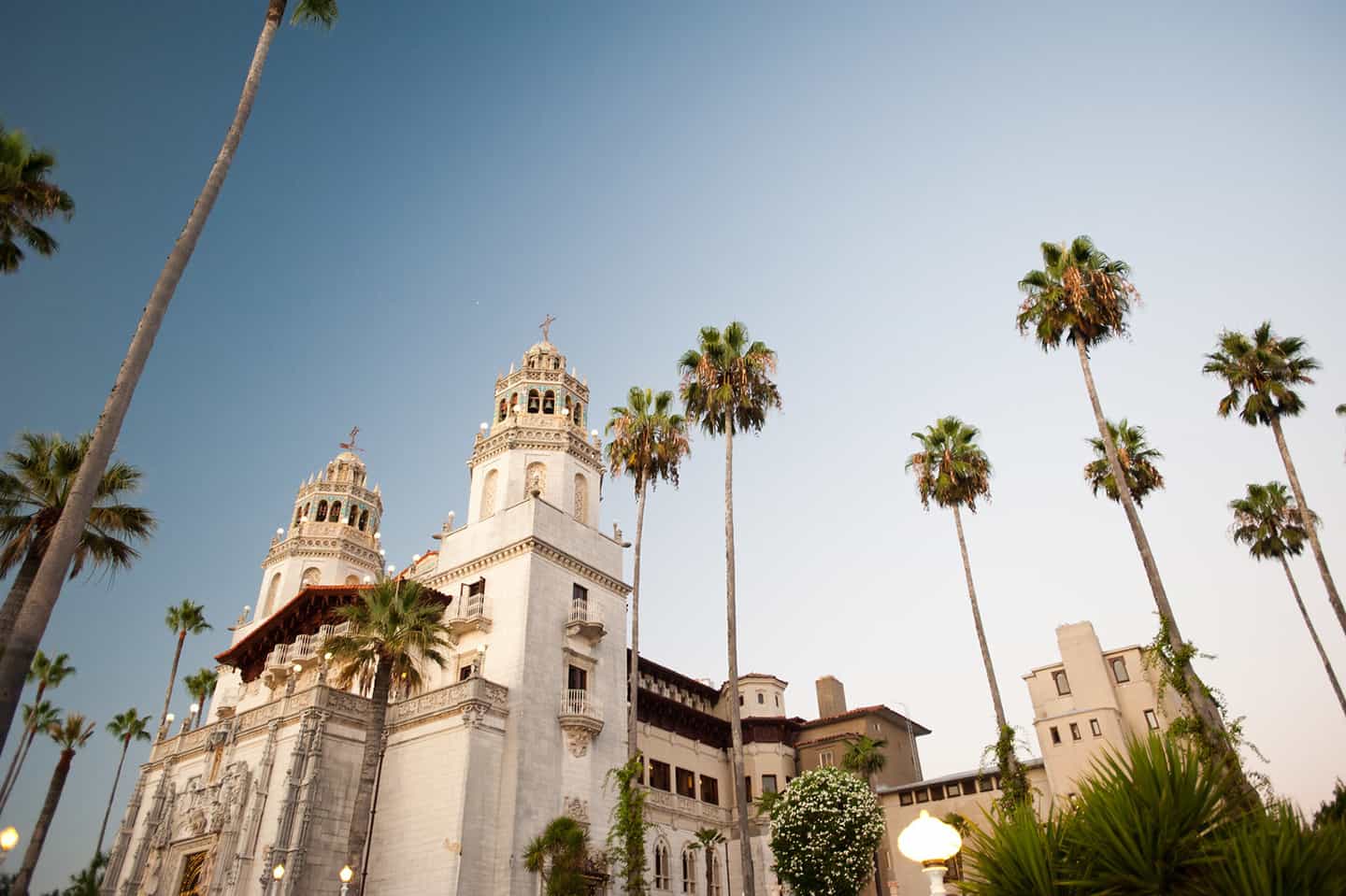
While driving Highway 1 through San Simeon, it would be criminal to breeze past Hearst Castle without stopping. This magnificent 165-room estate built by newspaper magnate William Randolph Hearst makes for an extraordinary detour from your scenic drive. The castle houses an impressive collection of European art and antiquities spanning centuries, while the Neptune Pool and indoor Roman Pool showcase spectacular tilework and classical design. The expansive gardens feature Mediterranean and native California plants alongside sculptures that date back to 1,000 BCE. Various tour options highlight different aspects of the estate, from the grand social rooms to the private suites and kitchens. Even if you don’t have time for a full tour, the Visitor Center offers fascinating exhibits about the estate’s history and construction.
Sebastian’s Café and General Store
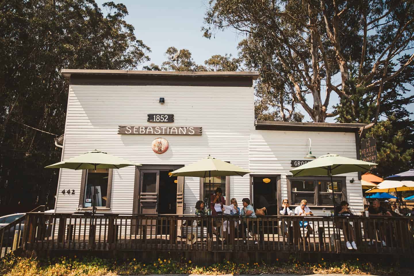
After experiencing the opulence of Hearst Castle or watching elephant seals along the shoreline, Sebastian’s Cafe and General Store presents a picturesque opportunity to refuel and relax. This historic establishment dates back to 1852 and sits at the heart of San Simeon’s old whaling village and serves now as a casual dining spot. The building itself tells stories of the area’s maritime past, when it functioned as the general meeting place for the community. Today, visitors can enjoy freshly-prepared sandwiches, salads, and local seafood specialties while surrounded by historic photographs, or while taking in the iconic views of San Simeon Bay from the patio. The adjoining general store features locally-made goods, wines from Hearst Ranch Winery, and practical provisions for travelers continuing their Highway 1 scenic journey. This authentic slice of California’s coastal history makes for a delightfully unhurried stop.
Cambria
Moonstone Beach Drive
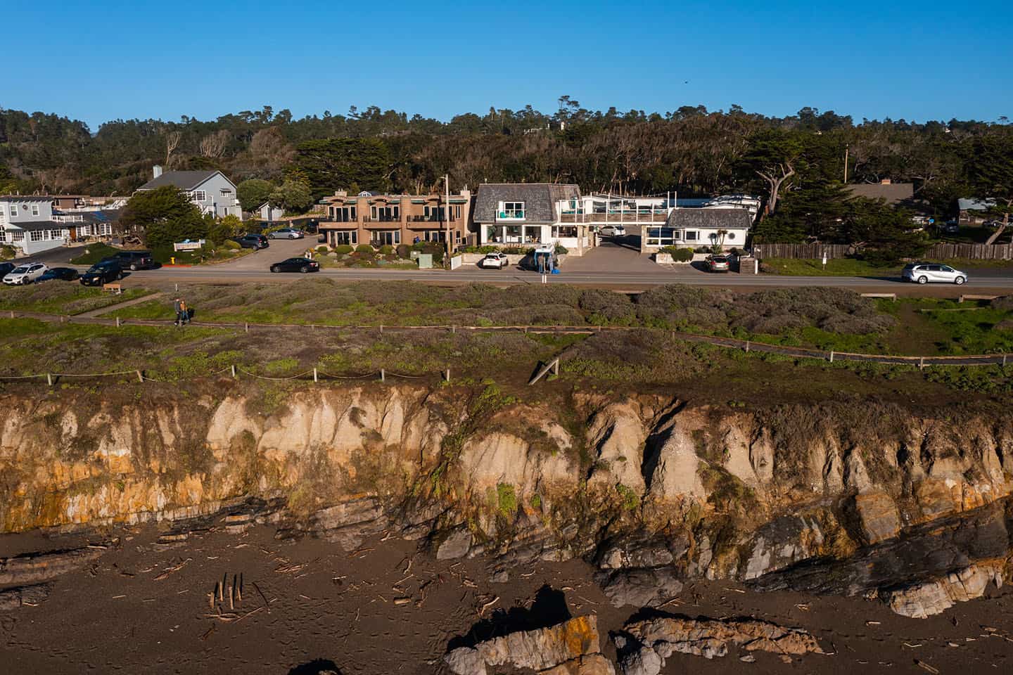
From Highway 1, it takes just a moment to pull onto this 2-mile oceanfront roadway that parallels the shoreline. Moonstone Beach lies below, a favorite hidden beach where locals come for excellent beachcombing that includes sea glass, colorful worn stones, and driftwood. Taking advantage of the classic coastal California views across Moonstone Beach Drive, several restaurants offer indoor and outdoor seating here, overlooking the ocean.
Start at the north end of Moonstone Beach Drive; the best place to stop is at the Leffingwell Landing State Park parking lot. A trail leading toward Hearst State Beach stands here, for those wanting to take a stroll north. Otherwise, to walk toward Moonstone Beach Park, pick up the Moonstone Beach Boardwalk about 0.5 miles south of Leffingwell Landing. Walk the boardwalk, which spans the majority of the shoreline, for a romantic stroll or to watch seals from the viewing deck. If you’re driving rather than walking, the best place to stop for this spot is at the Santa Rosa Creek Parking Lot. The Moonstone Beach Park offers an ideal setting for a picnic or a sunset view.
Many more attractions lie nearby in Cambria’s East and West Villages, including the Covell Clydesdale Ranch where horses roam over 2,000 acres. Or peak into the tiny Old Santa Rosa Chapel, Gardens & Cemetery, where Bing Crosby attended services when he stayed at Hearst Castle. For these and other Highway 1 road trip ideas in Cambria, see our Cambria Road Trip Map.
Fiscalini Ranch Preserve
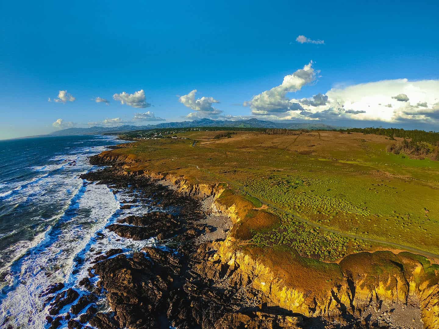
A true hidden gem along Highway 1, the Fiscalini Ranch Preserve spans 437 acres of protected coastal habitat with hiking trails that showcase some of the most spectacular ocean views in Cambria. The Ranch’s Bluff Trail, an easy mile-long path suitable for all ages and abilities, runs along dramatic coastal cliffs where you can spot migrating whales, playful otters, and soaring seabirds. Inland trails wind through a stand of Monterey Pines—one of only five native stands remaining in the world—as well as grasslands and wildflowers, plus wetland habitats teeming with birds. The preserve remained undeveloped thanks to community conservation efforts, preserving this stretch of unspoiled coastline for public enjoyment. Great for a quick scenic stop or a longer exploration, the Fiscalini Ranch Preserve offers benches at strategic viewpoints where you can pause to absorb the beauty of Highway 1’s coastal landscape.
East Village Shopping District
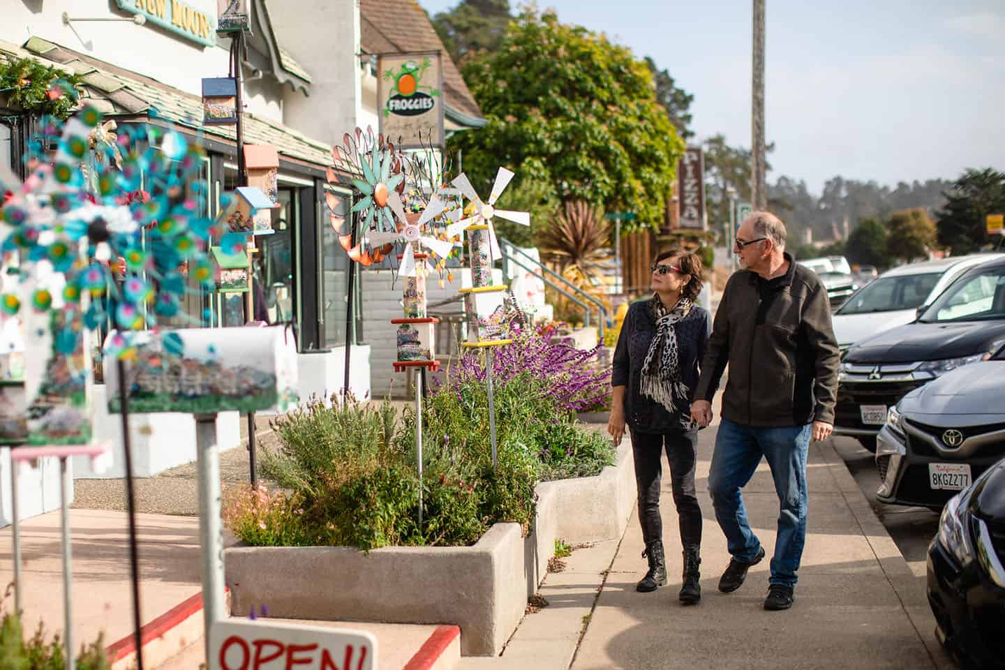
Pause your Highway 1 scenic drive to explore Cambria’s quaint East Village, where historic buildings from the 1870s now house unique boutiques, galleries, and specialty shops. This walkable district invites leisurely strolling along tree-lined streets as you discover locally-crafted jewelry, fine art by regional artists, antiques, and specialty foods like olallieberry jam. Browse through independent bookstores with carefully-curated collections, or find coastal-inspired home decor that captures the essence of Highway 1 living. The Easy Village exudes small-town charm, with each shop reflecting the creative spirit and warm hospitality that defines Cambria. After shopping, relax in a courtyard cafe or wine bar to sample local vintages from nearby Paso Robles and the coastal wine regions. This delightful detour offers a glimpse into the artistic community that thrives along scenic Highway 1.
Local Dining Options
Cambria’s culinary scene showcases the bounty of the Central Coast in settings that complement any Highway 1 scenic drive experience. Robin’s Restaurant serves globally-inspired cuisine in a garden setting or inside a restored adobe home, with standout vegetarian options and seasonal ingredients from local farms. Their famous salmon bisque and Moroccan chicken have earned devoted followers among locals and visitors alike. Just down the street, Linn’s Restaurant celebrates farm-to-table dining centered around the olallieberry, a blackberry-raspberry hybrid that stars in signature pies, preserves, and savory dishes. For ocean views with your meal, the Sea Chest Oyster Bar serves pristine seafood in a cozy setting overlooking Moonstone Beach. Indigo Moon offers artisanal cheese plates, local wines, and sophisticated dinner options in their intimate dining room or patio. No matter which eatery you choose, it’s sure to complement a day of coastal exploration with flavors as memorable as Highway 1 itself.
Cayucos
Old Creek Road Loop from Cambria to Cayucos
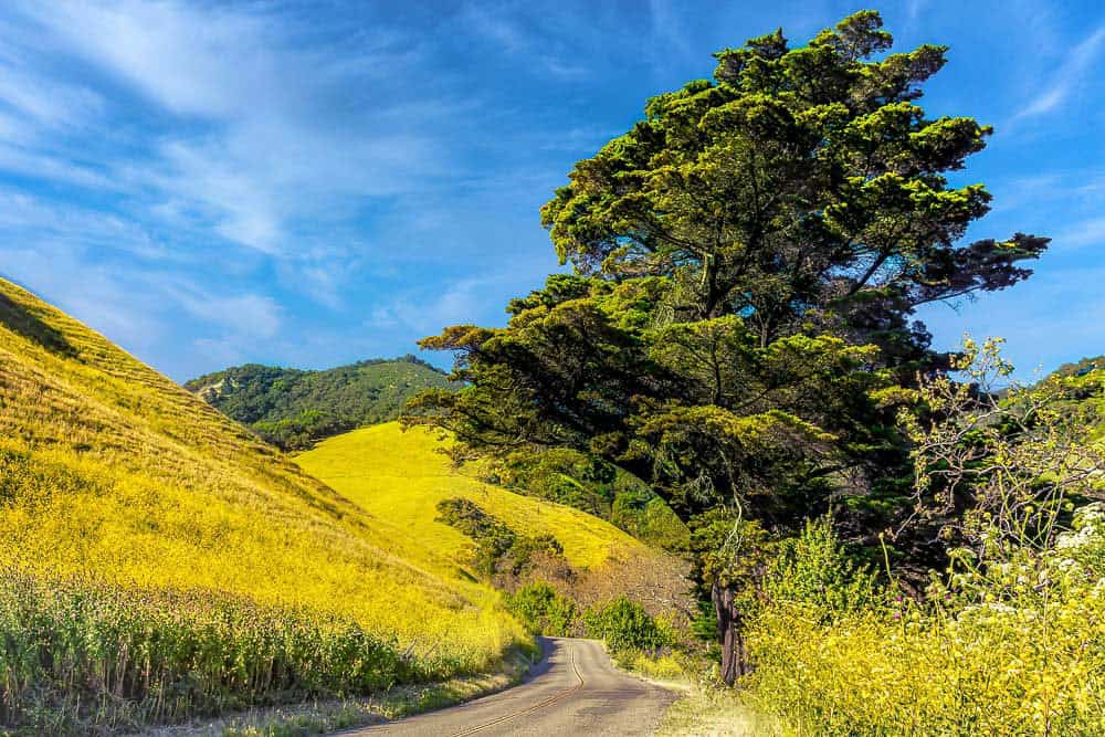
Looking for a scenic backcountry adventure while driving the Pacific coast? Follow this itinerary through the roads behind Cambria and Cayucos, forming a loop with Highway 1. You can begin in Cambria at Santa Rosa Creek Road, or in Cayucos with Old Creek Road. Along the way, check out the views of Whale Rock Reservoir, a deep blue basin above Cayucos and the coastline. You can also buy slices of pie at the quaint Linn’s Fruit Bin Farmstand (temporarily closed), tucked into the hillsides surrounding Santa Rosa Creek Road. And don’t miss wine tasting at Stolo Family Vineyard & Winery; you can even sit on their lush lawn to indulge in a picnic. For details on the itinerary, check out the Old Creek Loop route map.
Riders on a Pacific Coast Highway motorcycle trip will love this back-road loop, too. Here, motorcyclists can twist and wind through scenic farmland and over rolling hills. The intersection of Highway 46 offers opportunities to travel even deeper into the mountains west of Highway 1. Get lost on wine country backroads like Vineyard Drive, Peach Canyon and Chimney Rock Road. These can take you to Paso Robles winery tasting rooms, or out toward Lake Nacimiento, if you feel like making a day of it.
And if you’d like more things to do and see near Cambria, have a look at the Cambria Road Trip Map. You may consider tacking on a hike along the Fern Canyon Henry Kluck Memorial Trail or Strawberry Canyon.
Ocean View from Cayucos State Beach
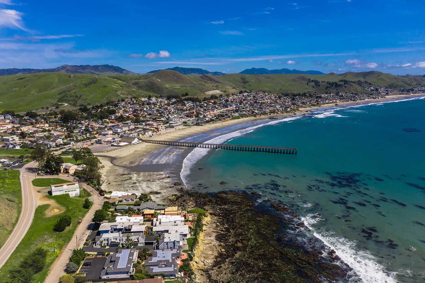
On your road trip, pull over for a cruise down North Ocean Avenue in Cayucos, just a stone’s throw away from Highway 1. This is Cayucos’s main thoroughfare, running directly parallel to downtown, Cayucos State Beach, and the historic Cayucos Pier. North Ocean Avenue offers plenty of dining options, from clam chowder and fish and chips, tacos to farm-to-table fare. Pull over to grab a bite, then head to the Cayucos Pier, which is within walking distance of all downtown restaurants. Here you can walk the planks of Captain Cass’s pier, originally built in 1872, and watch surfers hang ten below. Kids will love the play structure, directly on the beach, and they may just spy dolphins or a whale spouting offshore.
Of course, the view from just about anywhere in Cayucos is picture-perfect, but some of the best spots are really tucked away. Make like a local and travel to the southern end of Cayucos State Beach. Here, you’ll nearly be “on” the beach, with a wide open view of the waves. Enjoy the ocean view from your car, or step out and take a stroll north to Cayucos Pier or south to Morro Rock. The best places to stop are in the parking lots for Morro Strand State Beach Day Use Area or Sand Dollars Beach.
Want to hang a bit longer in the Cayucos area? Try ideas from our Cayucos Road Trip Map, including wine tasting the Pacific Coast Wine Trail and hiking Harmony Headlands.
Park and Stroll the Estero Bluffs State Park
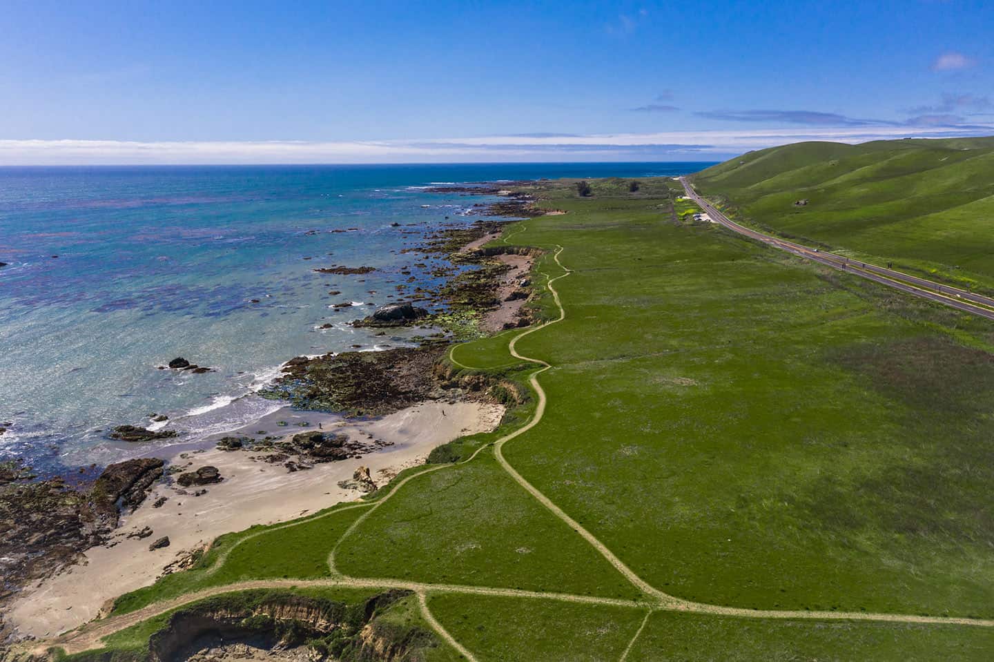
One of the best bang-for-your-buck walks off Highway 1, the Estero Bluffs trails can be explored a little or a lot. In other words, you don’t need hours to enjoy this dramatic state park. The trick is knowing where to find the 7 pull-outs that lead to the trails, midway between the towns of Harmony and Cayucos. These are nondescript dirt turnouts just off Highway 1 that can easily be missed without local know-how. If you find them, they’ll grant access to a magical coastal walk to view the state park and its namesake, the Estero Bluffs. Alternatively, you can just park and enjoy the ocean views from the comfort of your car.
For more activities to tackle en route to Cayucos, check out our Cayucos Discovery Loop Map. Here you’ll find ideas for your trip, like tasting cookies at Brown Butter Cookie Company and surfing and swimming at Cayucos State Beach.
Antique Street Faire
Downtown Cayucos reveals its rich coastal heritage through the eclectic collection of antique shops that line Ocean Avenue, boasting treasures as interesting as the town itself. Cayucos Antique Mall houses numerous vendors under one roof, with everything from vintage surfboards to maritime collectibles that celebrate the town’s beach culture. Remember When specializes in mid-century furniture and retro beach decor that captures the quintessential California coastal aesthetic. Rich Man Poor Man Antiques features a fascinating collection of nautical instruments, maps and salvaged pieces from historic coastal properties. Treasure-hunters often discover one-of-a-kind souvenirs like hand-blown glass fishing floats, vintage postcards depicting early Highway 1, and artwork by local artists. The relaxed, unpretentious atmosphere encourages conversation with shopkeepers who readily share tales about Cayucos’s colorful past, making this stop along Highway 1 as educational as it is enjoyable.
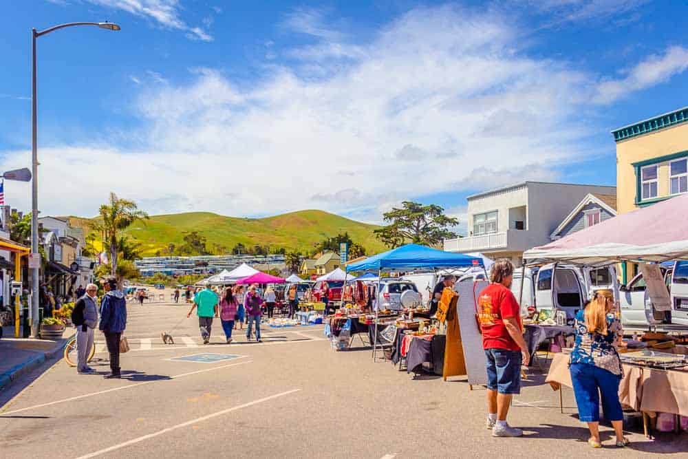
Local Dining Options
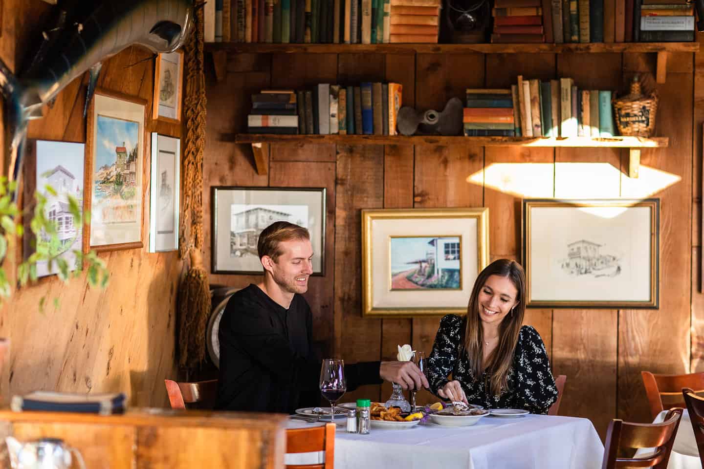
Cayucos tempts Highway 1 travelers with seafood-centric dining spots where casual coastal vibes meet surprisingly sophisticated flavors. Duckie’s Chowder House serves what many consider the Central Coast’s best clam chowder in a family-friendly setting just steps from the beach. Their signature dish comes in a sourdough bread bowl, perfect for enjoying at their outdoor tables with pier views. The Sea Shanty, a beloved local institution since 1983, delivers generous portions of fresh seafood, burgers, and comfort food classics in a nautical-themed setting that celebrates Cayucos’s fishing heritage. For something more upscale, Lunada Garden Bistro serves lunch, dinner and Sunday brunch from the historic Way Station and its secluded gardens.

Los Osos
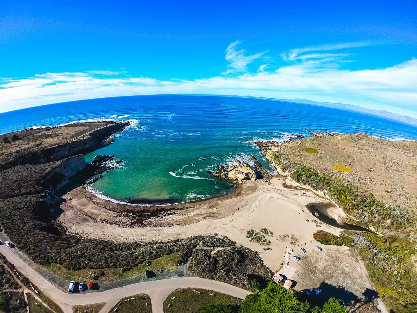
View of Spooner’s Cove and Montaña de Oro
At 8,000 acres, with 7 miles of shoreline, Montana de Oro State Park makes for a lovely scenic drive. This special state park offers panoramas of Estero Bay as well as paths that wind beneath towering eucalyptus forests. The road that travels through it all is Pecho Valley Road, which extends directly from Los Osos to Montana de Oro State Park.
One of the best places to stop is Spooner’s Cove, a secluded, magical beach cove with swimming, beachcombing and picnic facilities. Park in the parking lot, step out of your car, and you’re immediately right at the center of a locals’ favorite beach. Another best place to stop is further into the park, featuring grand ocean views you can take in from your car. To find this cliffside pull-over spot, drive slightly further past Spooner’s Cove to park between the Bluff Trail and the Spooner Ranch House.
Of course there’s a lot more to do nearby, like hiking the Black Hills Trail and bird-watching at the Elfin Forest. For more activities near Montana de Oro, check the Los Osos / Baywood Road Trip Map.
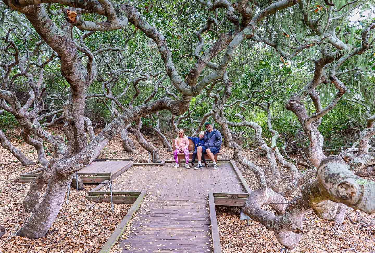
Elfin Forest Preserve
The Elfin Forest Natural Area presents a fascinating ecological wonder just off Highway 1 in Los Osos. This 90-acre preserve gets its name from the miniature oak trees that grow only four to 20 feet tall due to unique soil conditions and salty marine air—the same species that would normally reach 50 feet elsewhere. A mile-long elevated boardwalk loop train makes the forest accessible to visitors of all abilities while protecting the delicate ecosystem. As you stroll this easy path, you’ll encounter distinct plant communities including coastal dune scrub, maritime chaparral, and pygmy oak woodland. The boardwalk leads to several viewing platforms overlooking the Morro Bay Estuary and iconic Morro Rock. Interpretive signs explain the rich biodiversity found here, including over 200 plant species and numerous birds and butterflies. This quick nature stop offers photographers especially good morning light for capturing the mist rising over the estuary. With free parking and a flat, accessible trail, the Elfin Forest provides a serene interlude during your Highway 1 scenic drive.
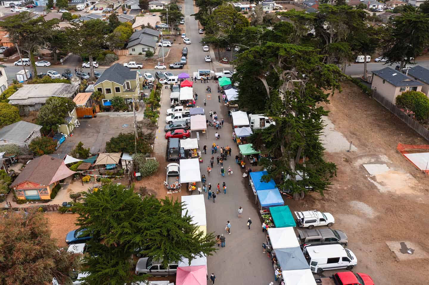
Baywood Farmers Market
Every Monday afternoon, the sleepy waterfront district of Baywood Park transforms into a vibrant community gathering when the farmers market sets up along Second Street. This locally-cherished event showcases the agricultural bounty of the Highway 1 corridor in a homegrown setting overlooking the calm waters of Back Bay. Unlike larger markets that cater to tourists, the Baywood Farmers Market maintains a genuinely local feel where farmers and producers personally share their seasonal harvest. Visitors can sample just-picked strawberries, artisanal goat cheeses, freshly-harvested shellfish, and specialty items like lavender honey and coastal-grown olive oils. Live music from local musicians creates a festive atmosphere as shoppers browse handcrafted goods ranging from driftwood art to hand-knitted caps. Time your Highway 1 drive to catch this Monday market between 2pm and 4:30pm, year-round.
Local Dining Options
Los Osos rewards Highway 1 travelers who venture off the main route with distinctive dining experiences that showcase local ingredients and laid-back coastal ambiance. Mirazur occupies a charming bayside location that serves up small plates and entrees, as well as local beer and wine. Their garden patio, draped with twinkling lights, creates a magical setting for dinner. For more casual fare, Noi & Doi’s Second Street Cafe prepares authentic Thai cuisine and comfort food, perfect for picking up picnic provisions to enjoy at nearby Montana de Oro State Park. Beerwood combines craft beer with elevated pub fare in a friendly atmosphere where you can watch kayakers float across the bay during high tide. For breakfast or lunch with a view, Back Bay Cafe serves hearty portions with spectacular estuary vistas from their waterfront patio. And fans of French pastries can’t miss Wayward Baking Company, where locals line up for croissants, tarts, morning buns and espresso drinks.

Edna Valley & Arroyo Grande Valley
Wine Tasting in Edna Valley
Just a short, scenic detour from Highway 1, Edna Valley welcomes visitors with its gently rolling vineyards set against dramatic volcanic morros to create one of California’s most distinctive wine regions. A unique east-west orientation funnels the influence of the Pacific Ocean through the valley to create a cool climate that’s ideal for growing lively, food-friendly Chardonnay and Pinot Noir wines. Unlike the more crowded wine regions of California, Edna Valley retains a refreshingly relaxed atmosphere where winemakers might pour your tasting flight themselves. Tolosa Winery showcases estate-grown wines in a modern, sustainable facility with panoramic vineyard views from their patio. Family-owned Baileyana operates their tasting room in a charming yellow schoolhouse built in 1909, where visitors can sample wines while playing bocce ball on the grounds. And Chamisal Vineyards offers intimate seated tastings highlighting their pioneering legacy in the Edna Valley. With most tasting rooms just minutes apart from each other, visitors can easily experience several during a leisurely afternoon drive.

Historic Arroyo Grande Village
The historic Village of Arroyo Grande preserves the charm of early California in a walkable district that makes for a delightful pause in your Highway 1 scenic journey. The Village’s iconic swinging bridge, suspended 40 feet above Arroyo Grande Creek, has connected the community since 1875 and remains one of the few such bridges in California. Strolling across its wooden planks offers both a touch of adventure and lovely creek views. Along Branch Street and Bridge Street, well-preserved buildings from the late 1800s now house independent shops selling everything from antiques to handcrafted sweets. The Village’s unique character comes alive through unexpected details like the rooster population that freely roams the streets, descendants of the town’s agricultural heritage. Rori’s Artisanal Creamery produces small-batch ice creams while the Arroyo Grande Meat Company continues traditional butchery practices established generations ago. Weekend visitors might encounter the Village’s vibrant farmers market or seasonal festivals that celebrate the area’s roots. This authentic remnant of California’s history provides a refreshing contrast to any coastal road trip

Lopez Lake Recreation Area
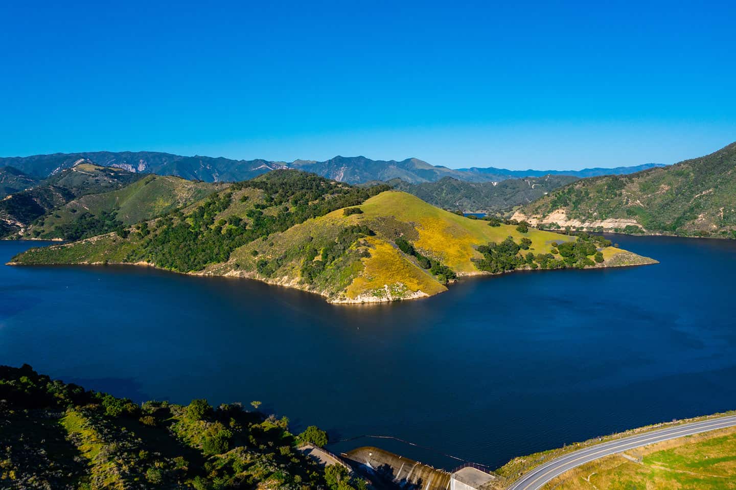
When fog shrouds Highway 1, savvy travelers know to head inland to Lopez Lake Recreation Area where sunshine and dramatic scenery await just 15 minutes inland from Arroyo Grande. This 4,200-acre lake, cradled by oak studded hills, offers a complete change of landscape from the coastal drive. The winding access road delivers breathtaking vistas at every turn, with numerous pullouts where you can safely stop to photograph the expansive water views. Wildlife spotting opportunities abound, with bald eagles, deer, and wild turkeys frequently sighted along the shoreline. The recreation area features scenic picnic spots with panoramic views that make for a great lunch stop. Adventure seekers can experience the thrilling Mustang Waterslides or Vista Lago Adventure Park with its ziplines and bird’s-eye views of the lake. Fishing enthusiasts appreciate the lake’s reputation for bass, crappie, and trout. Even if you have just 30 minutes to spare, the drive to the main vista point is worth the drive.
Avila Beach
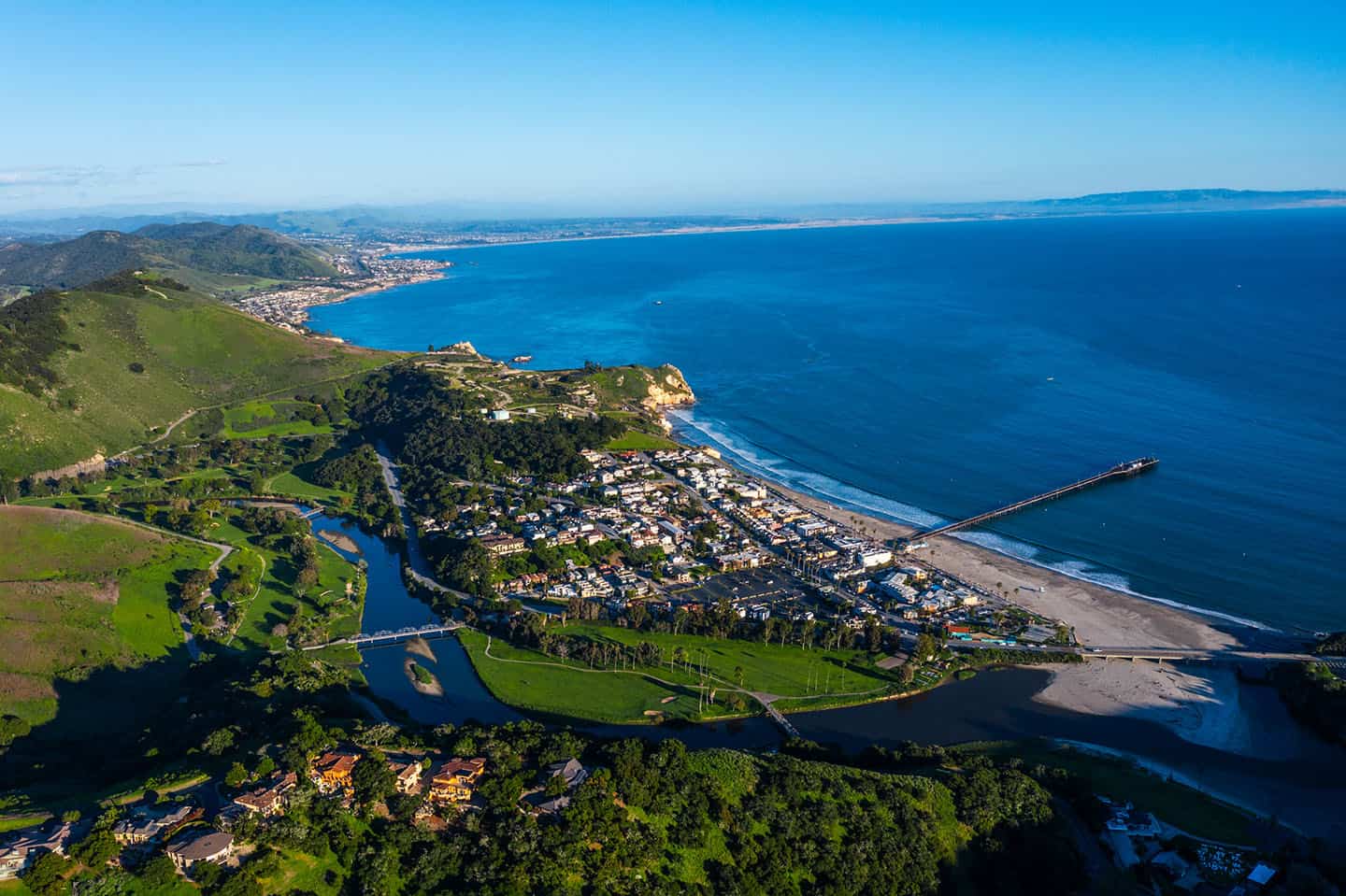
Scenic Views of Avila Bay
Anyone who cruises Avila Beach Drive through Avila Beach can tell you what a stunning ocean-side drive it offers. But the hidden vistas and lesser-known views from historic Point San Luis Lighthouse are absolutely worth the hunt.
Pick up Lighthouse Drive near the end of Avila Beach Drive, before it terminates on the Harford / Port San Luis Pier. This will eventually lead you out to Point San Luis Lighthouse. The best place to stop is at the Point San Luis Lighthouse parking lot. Along the way, enjoy the remote coastal scenery, from both sides of the vehicle. At the parking lot, you’ll have access by stairs to a secluded beach cove, as well as the trailhead for the Pecho Coast Trail.
Pro tip: This Lighthouse Drive excursion is a much less-trafficked scenic drive than the more well-known cruise out to Pirate’s Cove off Cave Landing Road. Pirate’s Cove definitely delivers on amazing views, along with a bluff trail and a clothing-optional beach — but it can be very crowded. The best place to stop for this alternative adventure is in the parking lot at the end of Cave Landing Road.
For other activities nearby, like hayrides at the Avila Valley Barn or kayaking, paddleboarding and sport fishing, check our Avila Beach Road Trip Map.
Bob Jones City to Sea Trail
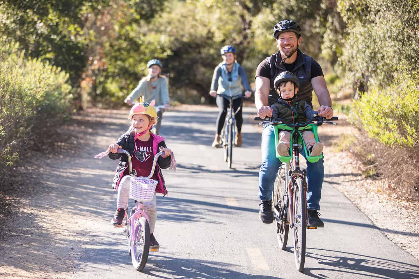
This bike and pedestrian path offers Highway 1 travelers a way to experience the coastal landscape beyond the windshield. This paved 3-mile path follows San Luis Obispo Creek through a lush riparian corridor from Ontario Road (Just off Highway 1) to Avila Beach. Perfect for all ages and abilities, the flat trail accommodates walkers, joggers, cyclists, strollers, and wheelchairs. Shaded by sycamore and oak trees, the path provides a cool respite even on warm days. Wildlife sightings commonly include herons, egrets, and hawks hunting along the creek, while seasonal wildflowers bring bursts of color to the creekside. Halfway along the trail, the Woodstone Marketplace offers refreshments and restrooms. Bicycle rentals are available in Avila Beach make it easy for Highway 1 travelers to park and get on the trail in no time. For those with shorter timelines, even walking the first half-mile rewards visitors with peaceful creek views and a sense of the valley’s raw natural beauty.
Avila Beach Pier & Promenade
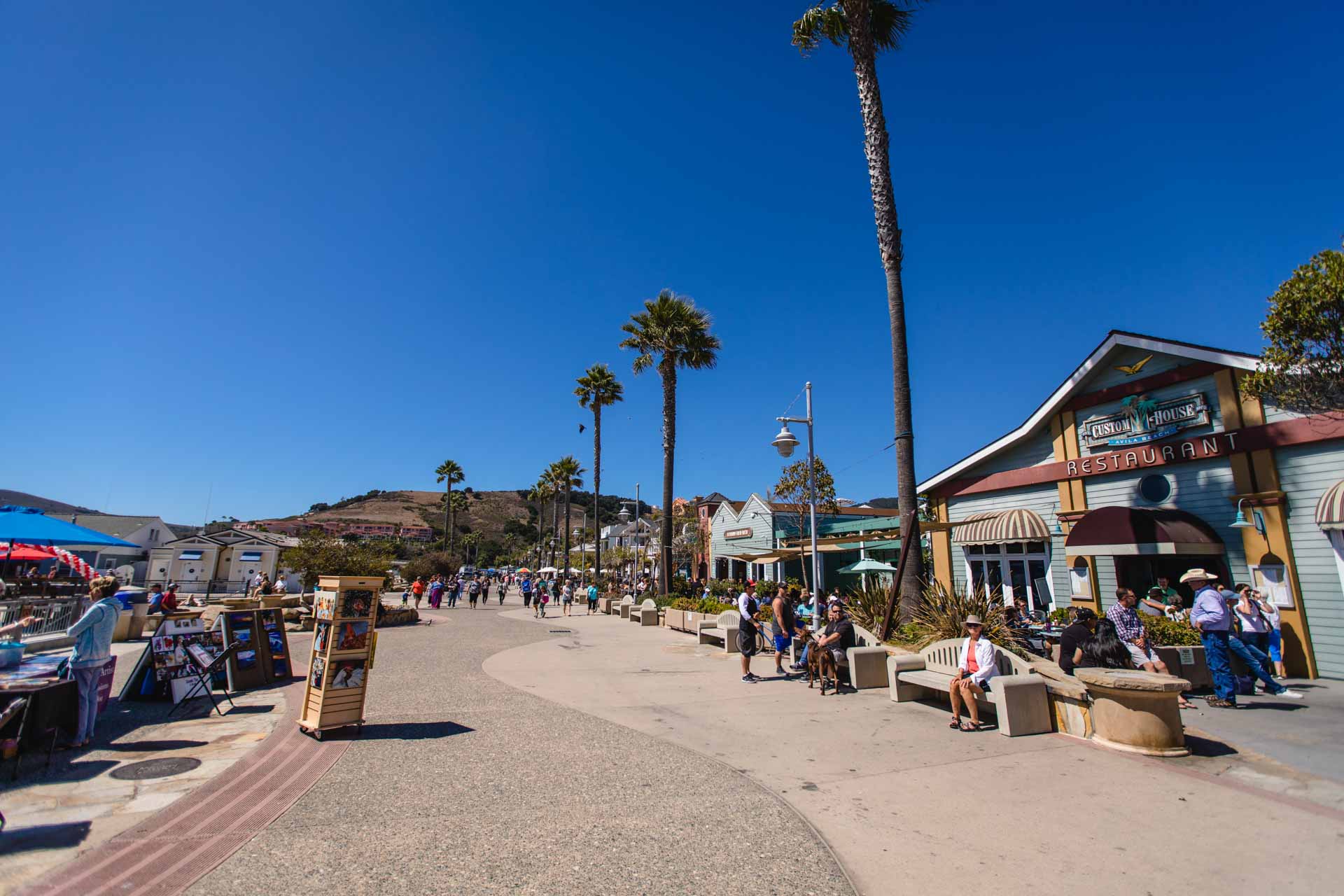
The vibrant beachfront promenade in Avila Beach delivers classic California coastal vibes in a surprisingly compact setting. Unlike larger beach towns, Avila’s Front Street concentrates oceanfront dining, shopping, and beach access into three walkable blocks directly facing the sheltered bay. The historic wooden pier extends 1,685 feet into the Pacific, offering unobstructed views of the surrounding coastline and frequent wildlife sightings without the crowds of better-known piers. Stroll to the pier’s end for 360-degree vistas of San Luis Bay and the rugged Point San Luis headland. Look down to spot bat rays and sea lions in the clear waters below, too! The adjacent promenade features built-in chess tables, artistic benches, and landscaped areas perfect for enjoying an ice cream cone while watching the sunset. Small specialty shops line the street, selling everything from locally-designed coastal apparel to handcrafted kites for flying on the beach. This postcard-perfect stop along Highway 1 delivers maximum coastal charm with minimal time investment, making it an essential milestone during your drive.
Local Dining and Shopping
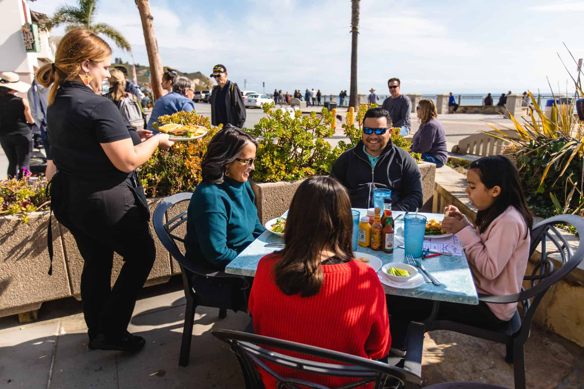
Avila Beach punches above its weight in culinary experiences, offering travelers sophisticated dining options in a relaxed beachfront setting. The Custom House prepares fresh seafood to serve on their oceanfront patio, where diners can watch surfers catching waves and enjoying specialties like cioppino or a cocktail. For a distinctly local experience, Mersea’s on the Harford Pier serves sustainably-caught seafood mere feet from where fishing boats deliver their catch. The bustling dining room, housed in a historic maritime building, boasts large windows framing sweeping bay views and passing marine life. Between meals, explore the boutiques on Front Street, where shops like Avila Beach Paddlesports and Lifestyle carry beach essentials, coastal home decor, and locally-crafted gifts that capture the spirit of Highway 1. The Hula Hut sells tropical-inspired fashion and accessories ideal for beach days, while Avila Wine & Roasting Company combines locally-roasted coffee with regional wines in a setting that’s lovely for morning pick-me-ups or evening wind-downs.
Oceano & Nipomo
Butterfly Groves and the Oceano Dunes
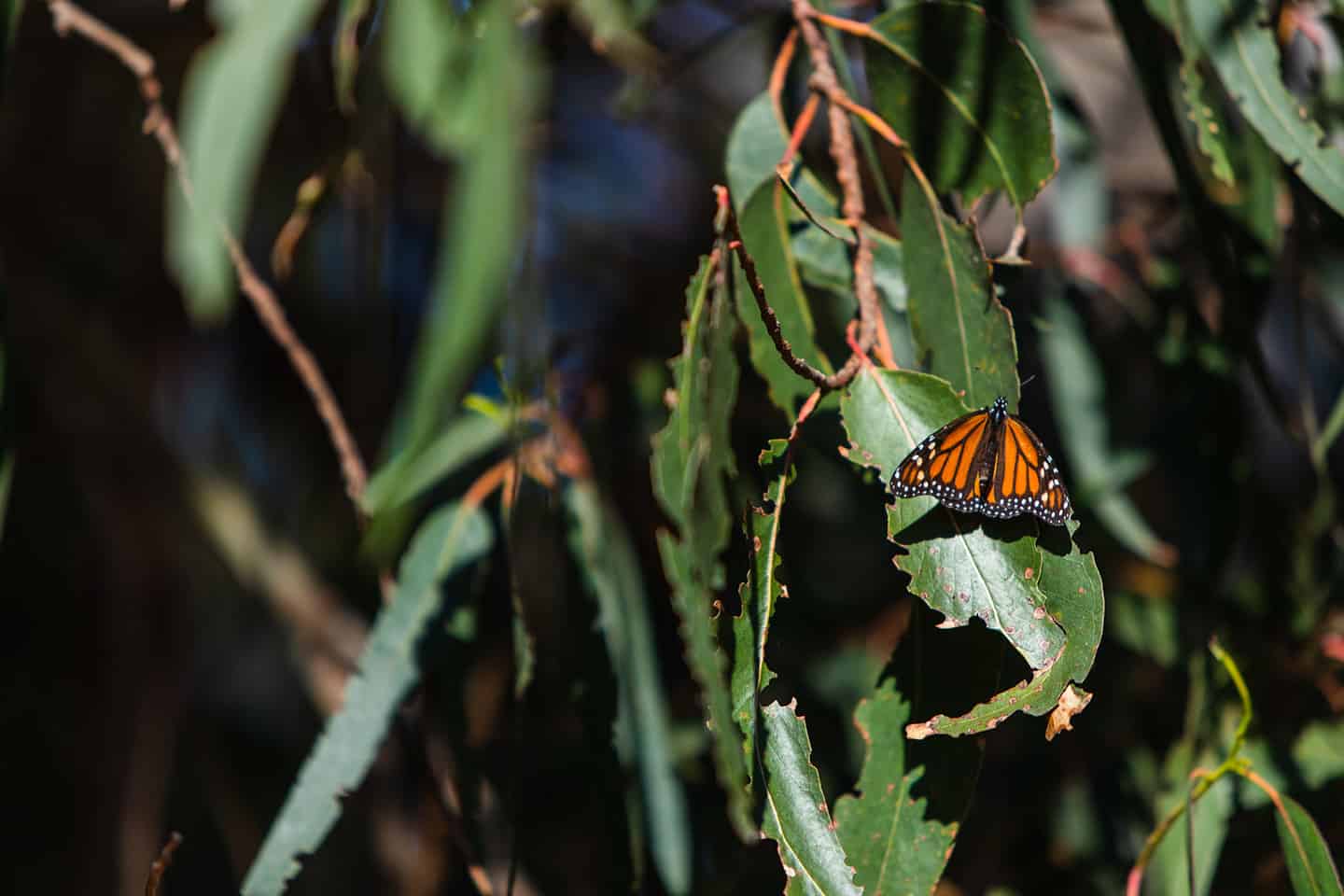
Thousands of Monarch Butterflies migrate to the eucalyptus trees within the Pismo State Beach Monarch Butterfly Grove each year. Directly on Highway 1, this incredible sight is one of the easiest wildlife viewing opportunities available on the Central Coast. The best place to stop on your Highway 1 road trip is the Monarch Butterfly Grove parking lot, just south of Pismo Beach.
After marveling at the Monarchs, drive 2 miles south to discover California’s only drive-able beach! The best place to stop for this is at the entrance to the Oceano Dunes Natural Preserve. The ideal time for most vehicles to drive the beach is during low tide. Stick to driving over the hard-packed sand closer to the water to avoid getting stuck in the soft sand further from the shoreline. (Find a tide table for this area at Central Coast Weather.) Parking is also available at the park’s entrance for those who can’t or don’t want to drive onto the beach.
Pro tip: South of the Oceano Dunes Natural Preserve lies Oso Flaco Lake, which drains into the ocean via Oso Flaco Creek. While this area is well worth a visit, crossing the creek without a four-wheel drive vehicle is not recommended.
Can you ride motorcycles on the beach? Yes, you can; in fact, it’s welcomed. Keep in mind that it’s recommended to stay on the hard pack sand unless you’re riding a full enduro or dirt bike. That said, if you have the right kind of bike, you can easily venture deep into the dunes — a bucket-list adventure, if ever there was one. Dirt bikes are available for rent, along with ATVs, dune buggies and just about any other kind of vehicle you can think of.
For more activities nearby, including stellar golfing and side-splitting comedy at the Great American Melodrama, download the Oceano / Nipomo Road Trip Map.
Guadalupe-Nipomo Dunes National Wildlife Refuge
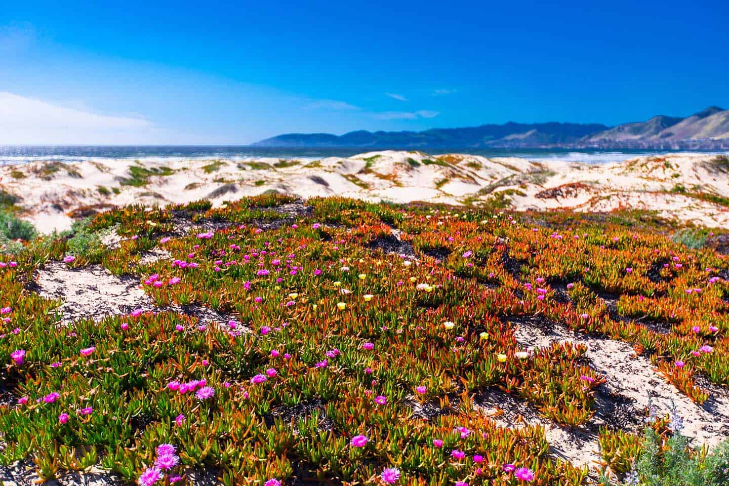
Beyond the more developed Oceano Dunes area lies the Guadalupe-Nipomo Dunes Complex, one of the largest intact coastal dune ecosystems on the planet, and a must-see natural wonder on your Highway 1 scenic journey. This 18-mile stretch of windswept sand dunes rises dramatically from the coastline, creating a mesmerizing landscape that has served as the filming location for movies like Cecil B. DeMille’s The Ten Commandments, and Pirates of the Caribbean. The Dunes Center in Guadalupe offers exhibits about this unique ecosystem and the partially-excavated movie set buried beneath the sand. For those looking to explore on foot, several trails of varying difficulty wind through the preserve. The Dunes Center Trail provides an accessible one-mile loop with interpretive signs explaining the remarkable biodiversity found here, including more than 200 species of birds and rare plant communities that exist nowhere else. The breathtaking views of pristine dunes meeting the Pacific make this one of the most photographed natural landmarks along Highway 1, particularly during the golden hours of early morning and late afternoon when shadows create dramatic textures across the sand formations.
Historic Dana Adobe & Cultural Center
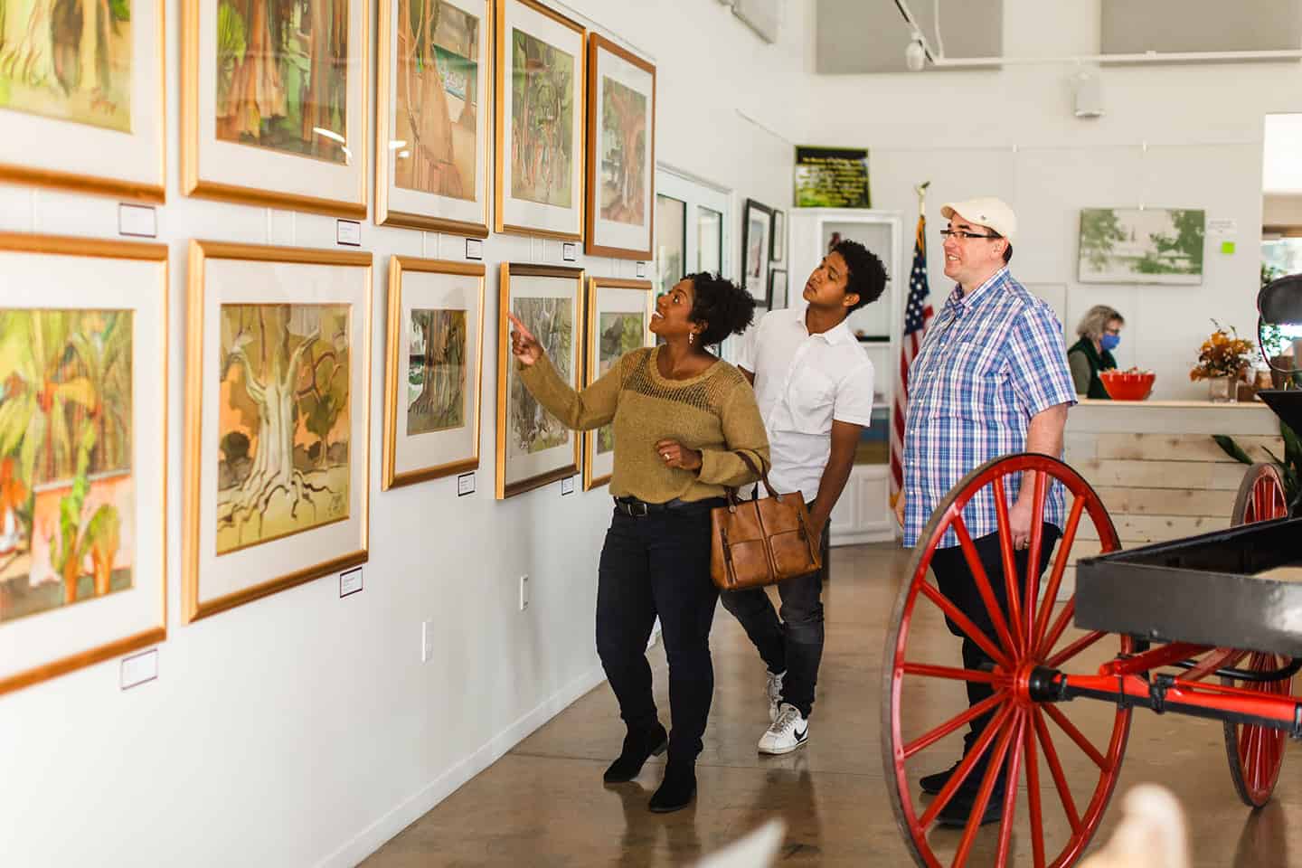
A tucked-away historical gem off Highway 1, the Dana Adobe & Cultural Center in Nipomo preserves one of California’s most important rancho-era adobe homes. Built in 1839 by Captain William Goodwin Dana, a Boston seafarer who became a Mexican citizen to acquire land, this 13-room adobe stands as testament to Californai’s rich multicultural heritage at the crossroads of Native American, Spanish, Mexican, and early American settlement. The adobe has been carefully restored with period furnishings and offers guided tours that bring to life the story of the Dana family, which operated a 37,000-acre ranch during a pivotal period in California history. The surrounding 130-acre property features interpretive trails with sweeping views of the Nipomo foothills, gardens showcasing native plants and traditional crops, and educational exhibits about rancho life. Special events throughout the year include living history demonstrations where visitors can participate in traditional crafts, cooking, and ranching activities.
Local Dining Options
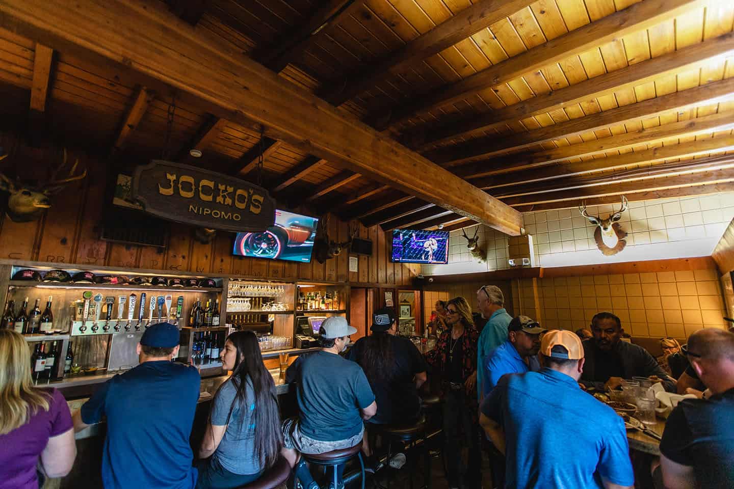
Oceano and Nipomo’s culinary landscape reflects the area’s diverse cultural heritage. Jocko’s Steakhouse in Nipomo has achieved legendary status along the Central Coast for its Santa Maria-style barbecue, prepared over red oak coals in traditional rancho fashion. This no-frills institution has been serving exquisitely-grilled steaks for generations, drawing devoted fans who gladly accept the often lengthy wait times. For Mexican cuisine, head to Old Juan’s Cantina in Oceano, where the food is fresh and the margaritas are cold. Elevated American comfort food is on offer at The Spoon Trade, where favorites like fried chicken and waffles and bologna sandwiches are made from scratch and get the gourmet treatment alongside a nice list of beers, cider, and wine. And the Rock & Roll Diner occupies two converted vintage railroad cars, serving diner food and Greek specialties in a music-themed atmosphere.
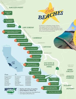
Refresh the Soul with Uncrowded Beaches and Coastal Hiking
Think “California beaches” and you might picture busy spots where folks compete for space on the sand and in the surf. Not so here. The beaches on this stretch of Highway 1 are remarkably uncrowded and open, with sunshine and space aplenty in which to revel. Even better, these beaches are accessible right off the road, making it easy to turn any day into a spontaneous beach day. You’ll also find coastal hiking trails of various lengths and difficulty off Highway 1. Pull off and take a quick jaunt down to the beach or spend the day exploring the coastal plains, forests, and shoreline via winding paths. Breathe in the salty-fresh air and feel your workaday cares melt away. Reconnect with yourself, your friends, your family, and your planet. With something for everyone, Highway 1 beaches and trails offer a special way to restore your spirit and experience roadside coastline wonder.
