Where History Meets the Sea
Discover the historic piers and California coastal lighthouses that define Highway 1’s rich maritime heritage. Long before roadworkers paved a scenic route along this iconic stretch of California coastline, these waters were alive with the rhythms of maritime life. Chumash paddlers once navigated these shores in sleek tomol canoes, trading goods along a coastline that would later welcome Spanish explorers, whalers and bootleggers.
Imagine San Simeon’s rocky coves echoing with the calls of whale hunters, or Spooner’s Cove hiding the glint of moonshine bottles during Prohibition. Each pier and lighthouse stands as a monument to the region’s fascinating maritime heritage—silent storytellers of trade, community and coastal resilience, creating some of the most iconic things to see on Highway 1.
Today, these historic structures invite you to step into Highway 1 history: Walk the same planks where fishermen continue to haul in their catch, climb lighthouse stairs that guided ships through treacherous waters and enjoy the same views that have mesmerized travelers for generations.
Whether you’re a history buff, an avid photographer or simply a wanderer drawn to coastal treasures, Highway 1 piers and lighthouses offer living chapters of seaside heritage—they’re a shining beacon of Highway 1’s enduring maritime spirit.
Explore the Piers and Lighthouses of Highway 1
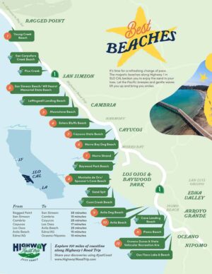
San Simeon
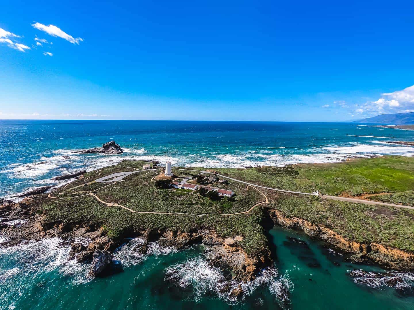
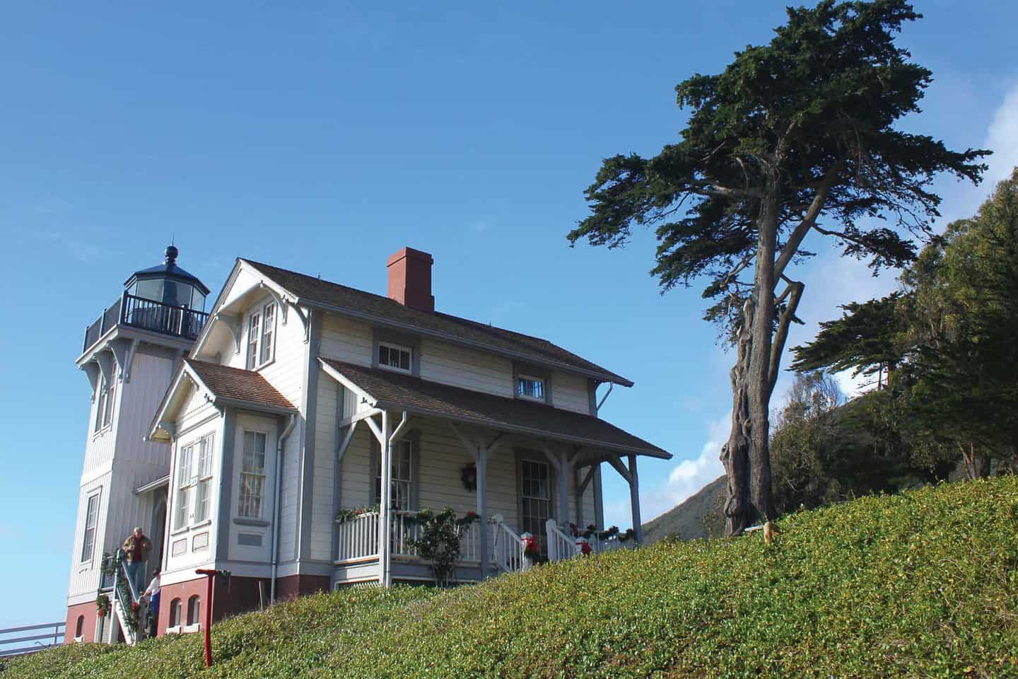
Piedras Blancas Light Station
Perched along the rugged coast near San Simeon, the Piedras Blancas Light Station has been keeping watch along Highway 1 since 1875, guiding ships safely past the rocky shoreline. Once crowned by a striking glass cupola housing its original first-order Fresnel lens, the lighthouse stood 100 feet tall.
Though the lens now glows proudly beside the Veterans Memorial Building in Cambria (a free stop worth a detour), the lighthouse still rises 70 feet above the Pacific—a weathered reminder of Highway 1’s maritime history.
Take your time here: Guided tours invite you to explore the historic buildings, windswept coastal trails and panoramic ocean views that stretch as far as the eye can see. You’ll hear the waves crashing below and maybe even catch a glimpse of the Elephant Seals basking on the nearby beach.
This historic California coastal lighthouse offers more than just spectacular views—it provides a living connection to Highway 1’s maritime past, joining other remarkable Central Coast lighthouses that have guided mariners for generations.
Whether you’re a lighthouse lover or just looking to stretch your legs in a place that feels far from city life, the Piedras Blancas Light Station delivers. It’s a peaceful stop that connects you to the coastal heart of Highway 1—and it’s just one more reason to slow down and enjoy the journey.
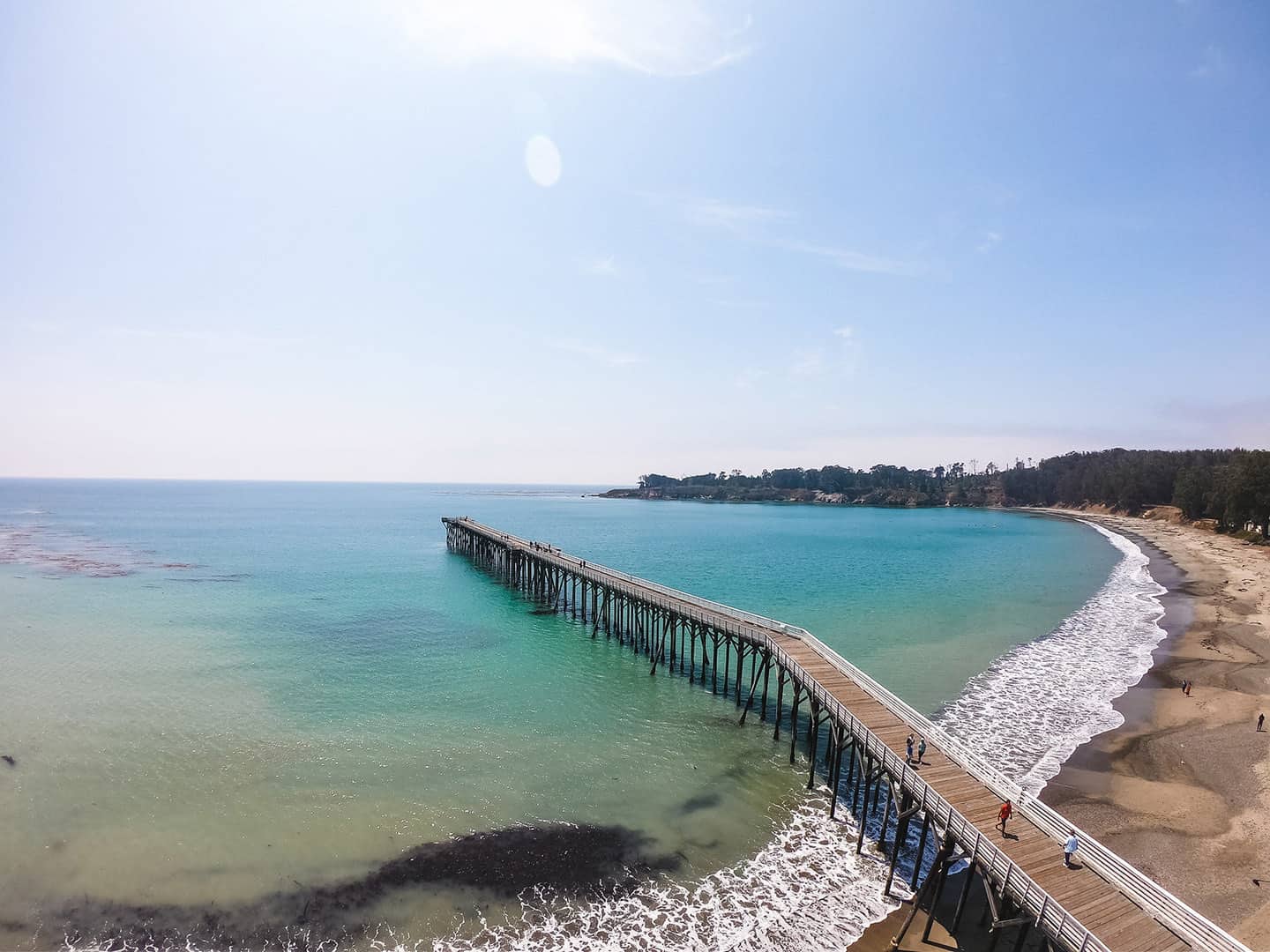
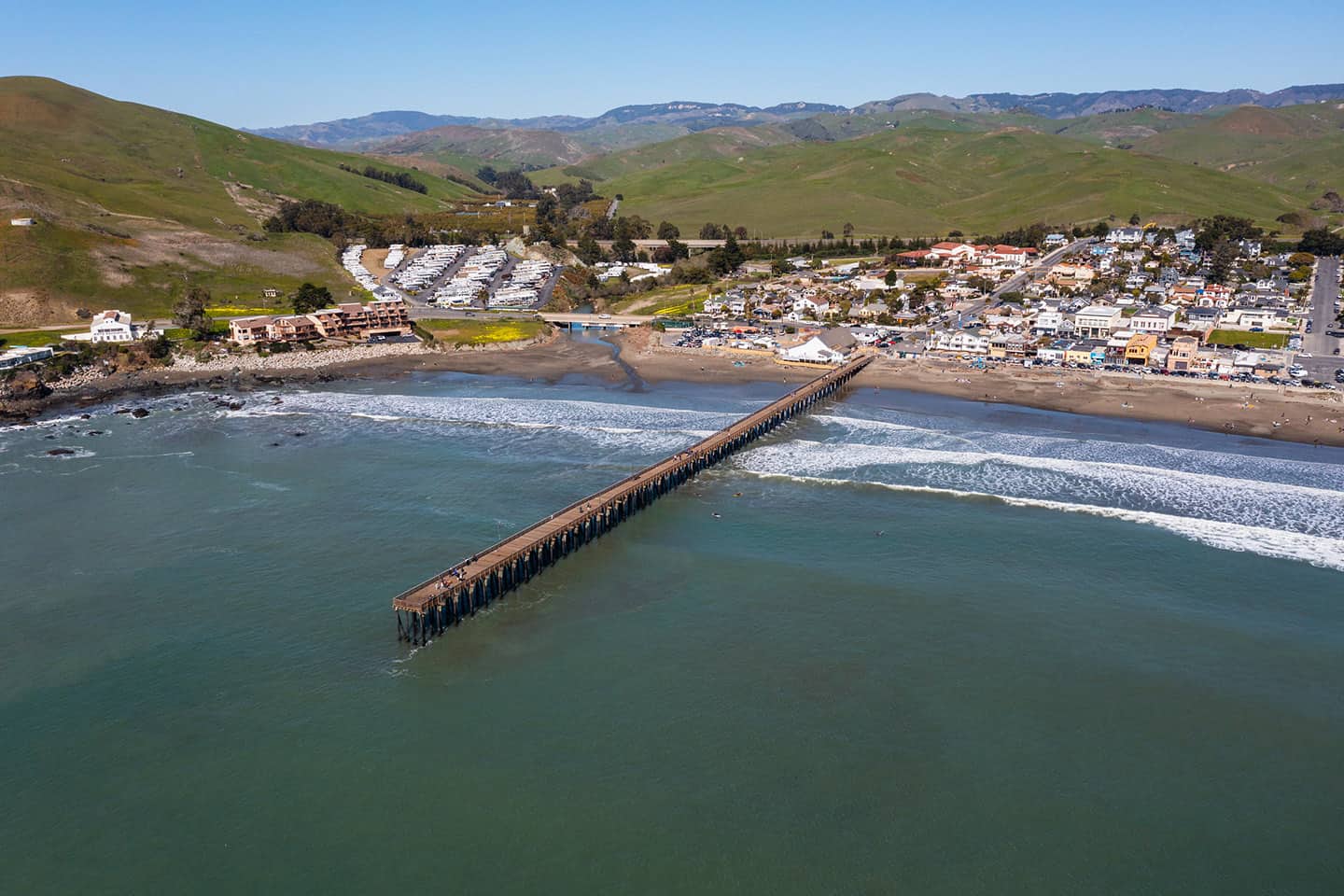
San Simeon Bay Pier
Tucked into the sheltered curve of San Simeon Bay, this quiet pier boasts roots that stretch back to 1878, when California State Senator George Hearst built the original wharf to serve his sprawling 40,000-acre ranch. Decades later, that same wharf would welcome treasures from across the globe—bound for the now-famous estate of his son, media mogul William Randolph Hearst. While the original structure is long gone, a new pier was built in 1957 at Hearst Memorial State Beach, this time for the simple joys of recreation.
Today, San Simeon Bay Pier is a dreamy stop where time slows down. Cast a line for some laid-back fishing, scan the horizon for passing whales or watch the sun dip behind the hills in a blaze of orange and gold. You might even spot otters floating in the kelp or seabirds wheeling overhead. It’s the kind of place that makes you want to linger just a little longer.
Cambria
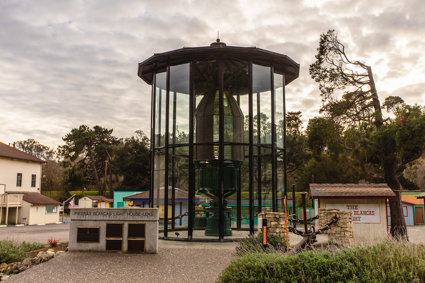
Fresnel Lens at Veterans Memorial Hall
In the heart of Cambria, just off Highway 1, a shimmering piece of maritime history awaits. The first-order Fresnel lens, originally crafted in France in 1872 and once housed at Piedras Blancas Light Station, is a true coastal treasure. First lit in 1875, this intricate lens—complete with curved glass panels and a clockwork mechanism—cast a signature flash every 15 seconds, warning mariners of the rugged shoreline.
After an earthquake damaged the lighthouse in 1948, the lens found a second life thanks to the Cambria Lions Club, who installed it at the Pinedorado Grounds in 1951. Today, you’ll find it glowing beside the Veterans Memorial Building, free to view—a unique photo and history stop in Cambria. However, it’s currently under construction as part of an ongoing community effort to preserve it.
While exploring piers near San Simeon and Cambria, this brilliant piece of lighthouse technology offers a unique glimpse into maritime engineering that once illuminated the Central Coast’s treacherous waters. Restoration efforts led by the Pinedorado Lions Foundation and the Piedras Blancas Light Station Association are underway, with hopes to keep this rare beacon shining for generations to come.
Cayucos
Cayucos Pier
If you’re rolling through Cayucos, make time to stroll the town’s most iconic landmark: the Cayucos Pier. Built in 1872 by Captain Cass and his partner Captain Ingals, this wooden beauty once welcomed schooners loaded up with goods from the sea. These days, it’s all about easy going coastal charm. Walk along these iconic planks to experience a quintessential Highway 1 vibe.
Thanks to a $3.5-million restoration in 2015, the pier now stretches proudly over Cayucos State Beach, offering plenty of space for fishing, watching the surf scene unfold below or simply soaking in those endless Pacific views. Gulls wheel overhead, the scent of salt and seaweed lingers on the breeze and the rhythm of the waves is pure coastal magic.
Whether you’re here to cast a line, spot dolphins cresting in the distance, or cheer on a local surfer from the rail, the Cayucos Pier’s got a little something for everyone.
Captain Cass House
Long before Captain James Cass arrived in Cayucos in 1867, the Chumash people were already paddling these waters in “cayucos”—the small canoes that gave this breezy beach town its name. But when Cass sailed in from the East Coast, he brought with him big dreams and a vision that would transform the shoreline into a hub for international trade.
Today, the beautifully preserved Cass House—the historic home of Cayucos’s founder—still stands just steps from the ocean. This stately structure now hosts a charming boutique inn and restaurant, offering coastal cuisine served with a side of rich local history.
With its lush gardens, ocean breeze and a front-row view of the nearby Cayucos Pier, a stop here helps connect the dots between past and present. Whether you’re stopping in for a romantic dinner, or just want to snap a photo of one of Cayucos’s most iconic landmarks, the Cass House invites you to slow down and savor the whole story.
Morro Bay
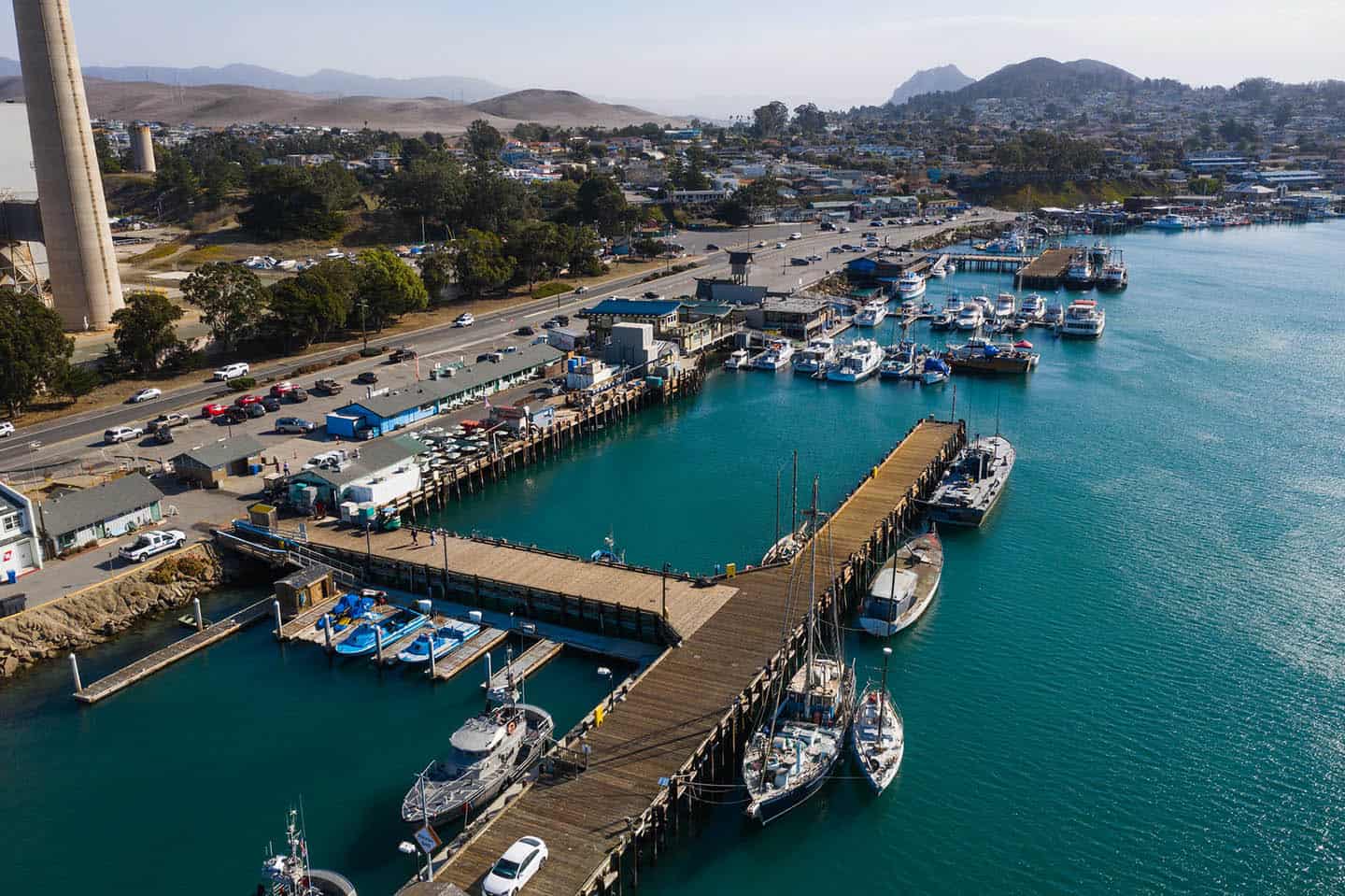
T-Pier and South T-Pier
Shaped like the letter they’re named for, the T-Pier and South T-Pier sit quietly at the northern edge of the Morro Bay Embarcadero, just a stone’s throw apart. Still in daily use by working boats and local fishers, these modest piers might be unassuming—but they’re a goldmine for harbor life and seaside charm.
Come for the seasonal pier fishing (locals claim some of the best catch-per-hour stats in all of California), and stay for the playful sea otters, harbor seals and views of docked vessels gently swaying in the tide. This is the salty soul of Morro Bay, where the water hums with life.
While you’re nearby, pop over to the Morro Bay Maritime Museum for a glimpse into the town’s nautical past, or explore more things to do in Morro Bay just steps from the water. Whether you’re casting a line or just savoring the salt-tinged breeze, these twin harbors of maritime charm serve up authentic coastal life—no fancy gear required.
Los Osos
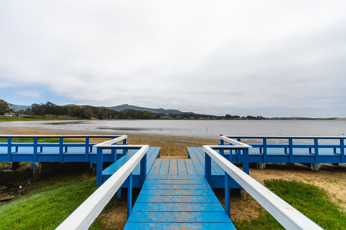
Baywood Park Pier
Nestled into the gentle curve of Los Osos back bay, the Baywood Park Pier is a wooden walkway with a heartwarming story. This fourth-generation pier emerged from community spirit, first taking shape after the Chamber of Commerce launched fundraising efforts in 1955. A massive storm in 1983 might have knocked it down, but local determination brought it back to life.
The Baywood Navy, a local sailing club, now keeps watch over this iconic pier. Each year, they carefully repaint the weathered planks just before their annual Boatzart in the Bay concert, a tradition that turns this simple pier into a colorful community gathering spot. Its position overlooking the Morro Bay Estuary offers a front-row seat to the quiet drama of coastal wildlife—blue herons stalking the shallows, egrets drifting above the water and the occasional playful seal gliding by.
This quiet wooden pathway serves as a window into the rhythm of back bay life. Enjoy the gentle lapping sea against the wooden pilings, inviting road trippers to stop and soak in a moment of true Central Coast tranquility.
Avila Beach
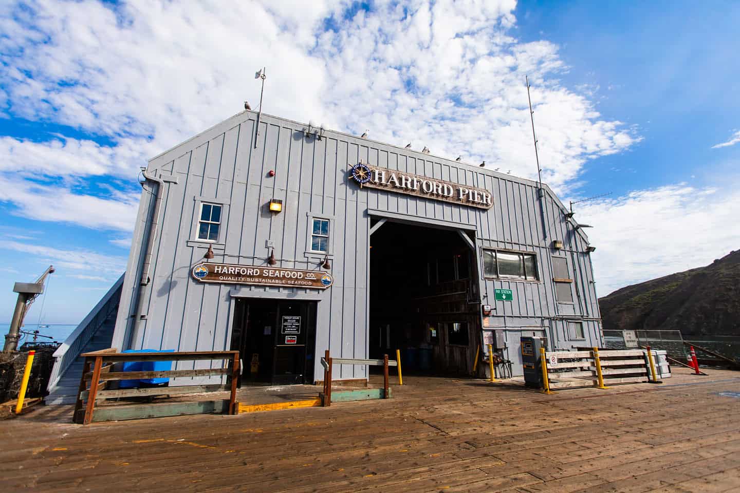
Harford Pier (Port San Luis Pier)
Standing proud since 1873, the Harford Pier is one of the most historically significant Avila Beach piers and as old as Highway 1’s coastal communities. This working pier hasn’t just survived—it’s thrived, continuing to serve local fishing boats and welcoming hungry patrons at Mersea’s, a seafood spot that captures the essence of fresh Highway 1 dining. One of only a handful of driveable piers in the United States, the Harford Pier offers an unparalleled Avila Beach fishing experience with ample parking and direct access to some of the Central Coast’s most productive fishing waters.
Take the time to drive or stroll the pier and you’ll find yourself in the heart of local maritime activity, with pelicans swooping overhead and fishermen casting lines into waters that have sustained communities for generations. Whether you’re an avid angler looking to reel in the day’s catch or a coastal wanderer hoping to soak in authentic maritime views, this working pier delivers a genuine slice of Central Coast heritage.
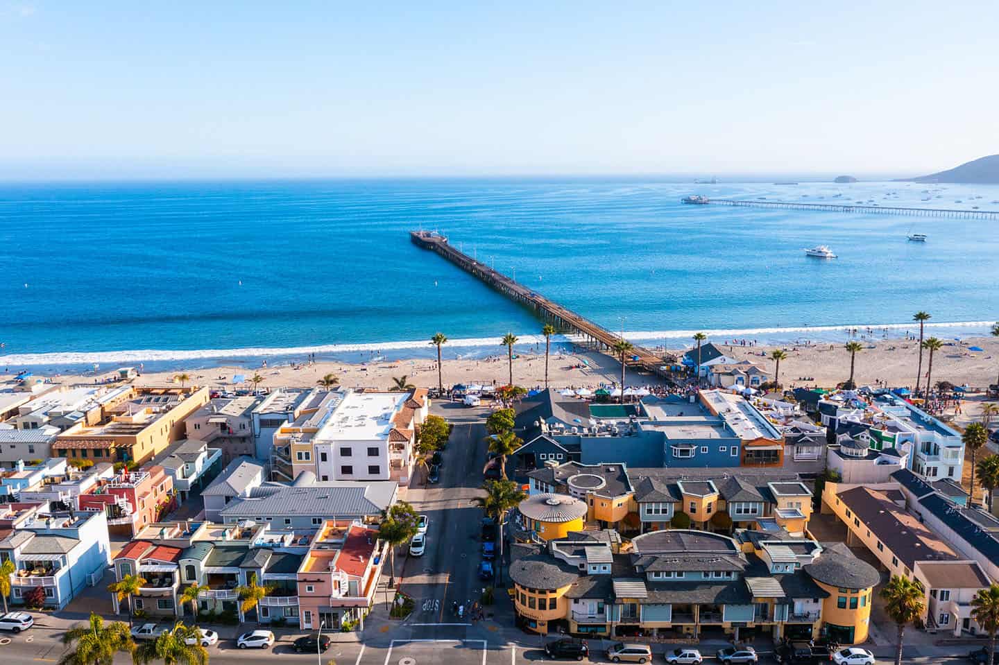
Avila Beach Pier
Built in 1908, this historic pier stretches out over the sparkling waters of Avila Beach, serving as the crown jewel of the town’s breathtaking waterfront. This beloved coastal landmark doubles as a vibrant community space where locals and adventurers alike come to gather, watch the surf and soak in the spirit of coastal life. Each step on its planks connects you to over a century of beach town history, with rolling waves providing a constant soundtrack.
A spacious and serene white sand beach stretches out below, inviting sunbathers of all ages to explore its calm waves and shallow wading areas. Just steps away from charming wine tasting rooms, waterfront restaurants and a vibrant farmers market, the pier serves as the perfect springboard for your Avila Beach adventure, whether you’re interested in fishing, dining or hitting the surf. Do yourself a favor and spend sunset combing for shells, then wander from the beach to the pier, letting the Avila’s breezy charm wash over you.
Cal Poly Pier
Just out of reach but never out of sight, the Cal Poly Pier stands as a testament to marine research and scientific discovery. While not open to the public, this historic research pier can be admired from nearby Avila Beach piers—a silent monument dedicated to understanding the marine ecosystems of the Central Coast.
Point San Luis Lighthouse
Perched on a rugged stretch of the Central Coast, the Point San Luis Lighthouse offers up a refreshing blend of scenic views and storied Highway 1 lore. This isn’t just any lighthouse—it’s the only Prairie Victorian model lighthouse remaining on the West Coast, a rare gem on the National Register of Historic Places. Located near Avila Beach and Port San Luis, you’ll find this coastal destination offers one of the most compelling lighthouse tours on Highway 1.
For lighthouse enthusiasts, the Point San Luis Lighthouse tour offers an unparalleled journey through time, connecting road trippers to the rich maritime heritage of California coastal lighthouses.
The story of the Point San Luis Lighthouse begins with a maritime drama that reads like a swashbuckling adventure novel: Back in the 1860s and 1870s, Port Harford was a bustling hub, with nearly 400 ships navigating these treacherous waters each year. The lighthouse’s creation was delayed for years, with early attempts falling short. But everything changed on a dark night in April 1888, when the ship Queen of the Pacific began taking on water about 15 miles from Port Harford, narrowly avoiding disaster.
Completed in June 1890, the lighthouse became a beacon of hope and safety for seafaring travelers. Its 4th Order Fresnel lens would send alternating red and white flashes every 30 seconds, visible for 17 nautical miles. The steam-powered fog whistle added an extra layer of protection, guiding ships through the Central Coast’s unpredictable waters. Today, maintained by the dedicated Point San Luis Lighthouse Keepers, this volunteer group ensures that the story of this coastal guardian lives on.
Take a trolley tour, hike the surrounding trails and immerse yourself in a slice of maritime history that’s uniquely Highway 1. Though the original Fresnel lens was retired in 1969 and the Coast Guard decommissioned the station in 1974, the lighthouse’s historic significance remains.
Pismo Beach
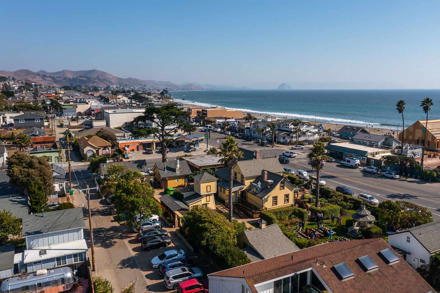
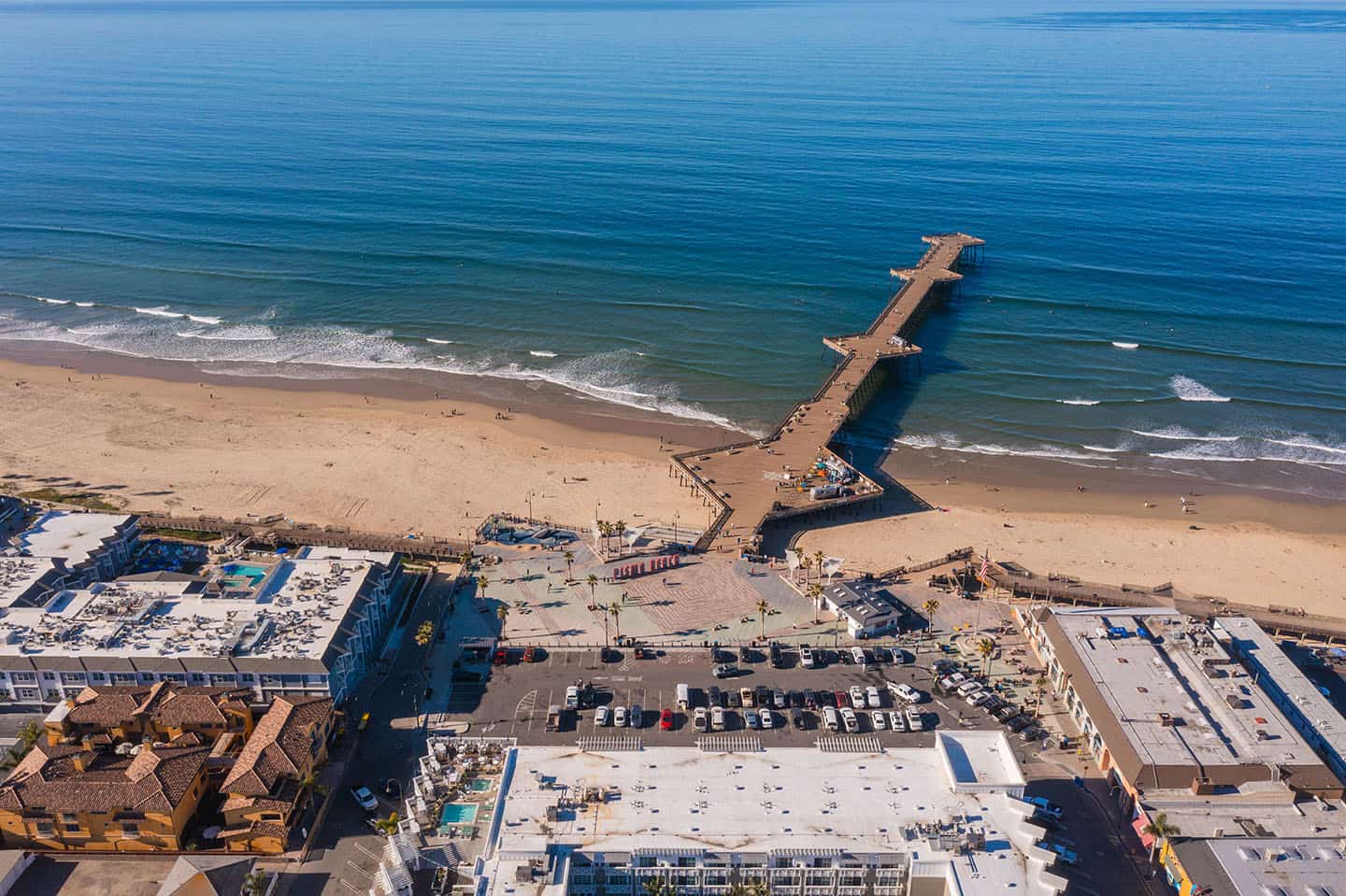
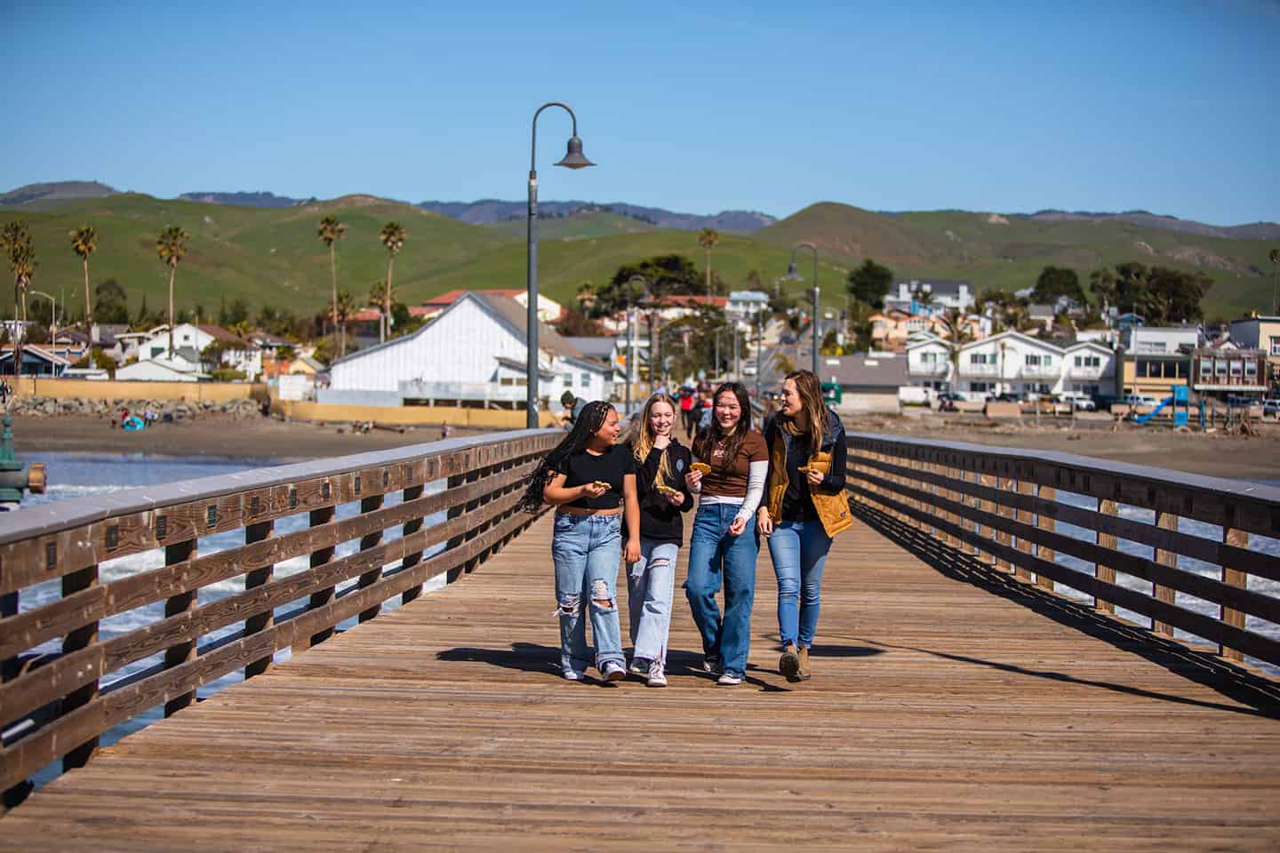
Pismo Beach Pier
Stretching out over the golden sands of Pismo Beach, this historic pier has been a coastal beacon of seaside fun since 1924. The Pismo Beach pier history reflects over a century of community gatherings, epic fishing tales and sun-drenched memories. Stroll its length to feel both salty spray on your face as well as the invigorating buzz of downtown, where surf shops and famous clam chowder await. A prime example of the best classic fishing piers on the Central Coast, you never know what you’ll catch sight of here: Surfers carve waves below, beach-goers stroll in the sun and diverse local events bring the community together against a backdrop of rolling blue horizon.
Surf, sun and family fun come together at the newly remodeled Pismo Pier & Promenade, creating a hub of coastal attractions. Just a quick stroll from boutique shopping, restaurants and endless coastal adventures, you’re never far from your next memory-making moment. From sunbathing to surfing, beach cruising to wine tasting, the Pismo Beach Pier serves as a sunny launching point for exploring the Central Coast and scenic Highway 1.
Oceano/Nipomo
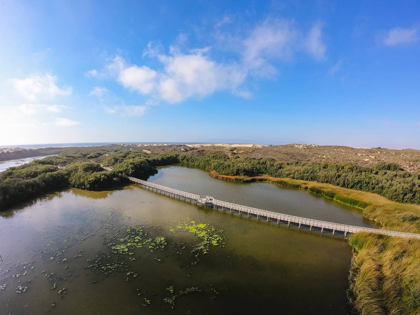
While Oceano and Nipomo may lack a historic pier, the Oso Flaco Lake Boardwalk reveals a hidden coastal treasure. Constructed in the early 1990s, this weathered wooden pathway winds through a secret ecosystem, connecting road trippers to the raw beauty of the Oceano Dunes. As you walk, the lovely landscape unfolds—a delicate intersection where freshwater lake meets golden sand, and a vibrant world of wildlife thrives just beyond the boardwalk’s edge.
Pause to watch herons glide over the water, listen to the rustle of native plants and breathe in the unique atmosphere of this Highway 1 oasis. The boardwalk beckons adventurous souls to explore one of the Central Coast’s most distinctive landscapes, where every step reveals another layer of coastal ecological wonder.
Plan Your Pier & Lighthouse Adventure
Walk the plank to Highway 1’s maritime beacons—Central Coast lighthouses that have long illuminated the way for travelers and dreamers alike. From historic piers on Highway 1 to towering California coastal lighthouses, this scenic stretch offers a journey through maritime history that continues to guide adventurers.
Feel the salt-laden breeze, listen to waves splash against time-honored wooden pilings and explore things to see on Highway 1, from the morning mist of Cayucos to the golden-hour glow of San Simeon Bay.
Some of the best fishing piers on the Central Coast await your discovery, offering both seasoned anglers and first-time road trippers a chance to cast a line into the famous waters of Highway 1.
Time your journey with the rhythm of coastal life. Winter brings the thunderous ballet of migrating whales breaching just offshore, while spring transforms the coastal landscape into a canvas of wildflowers. Each pier offers a different perspective: fishermen casting lines at the piers in Avila Beach, otters floating just beyond Cayucos’ planks, the quiet wisdom of Point San Luis Lighthouse watching over it all.
Pack light but come prepared for wonder: Bring a camera to capture unexpected moments, a jacket to ward off the ocean’s cool embrace and an appetite for discovery. Some of Highway 1’s most magical scenes unfold when you least expect them—a sudden ray of light breaking through coastal fog, a pelican splashing into the water or the silhouette of California coastal lighthouses against a blazing sunset.
Stewardship travel for good
The magic of Highway 1’s piers and lighthouses isn’t just in their history—it’s in their ongoing legacy. These landmarks survive through the passion of local communities, volunteer groups, and travelers who understand that preservation is a living, breathing commitment.
Remember: You can help make the difference for historic piers and California coastal lighthouses on Highway 1. Join a coastal cleanup, support marine sanctuaries or take a docent-led tour at Piedras Blancas or Point San Luis Lighthouse.
These Stewardship Travel for Good efforts soar far beyond typical tourist activities—providing an invitation for road trippers to become part of Highway 1’s continuing narrative. Whether you’re exploring Central Coast lighthouses and piers, learning about local ecosystems, supporting restoration efforts or simply treading lightly along the coast, your impact can help protect these treasures for generations to come.