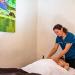
[…]aging using Truth Treatment Systems skincare. Facials can include additional enzyme treatments, dermaplane, peels, and regenerex electrolight therapy, as well. Or splurge on a specialty massage from Avila Bay Club Spa’s expert massage therapists. Modalities include Swedish, hot stone, reflexology, and deep tissue massage, as well as cupping. Any massage […]
[…]more. Each of these can include a Truth Treatment Systems add-on like enzyme treatments, peels, dermaplane, regenerex electrolight therapy, and waxing, if desired. The spa also provides manicures, pedicures, and gels from the comfort of massaging pedicure chairs. You can even get a haircut with additional salon services. Avila Bay […]
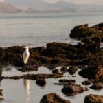
[…]of pristine coastal habitat (you just need to know where to look).Get your free hidden secrets map hereArmed with our expert recommendations and a pair of binoculars, you too can embark on your own Season of Coastal Discovery rife with amazing animal surprises. Feeling the call of the wild? Let’s […]
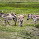
[…]monarch butterflies arrive every winter by the hundreds of thousands. Download the free Wildlife Map to start ticking off the sights.Read the full list from Fodor’s Travel. The Highway 1 Discovery Route is home to an abundance of wildlife throughout the year. The area is especially teaming with diverse creatures and critters […]
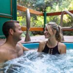
[…]Beach Spa & Massage Center provides facials and skin care, including enzyme treatments, peels, dermaplane and Regenerex LED electrolight therapy. The Spa The Spa is a full-service wellness retreat located at Sycamore Mineral Springs in Avila Beach. Indulge in a complimentary dip in Sycamore’s private, outdoor mineral hot springs tub […]
[…]Route reveals the secret spots to stop, wander and observe wildlife. It’s such a magnificent map, the Monterey National Marine Sanctuary Foundation awarded H1DR its Sanctuary Sea Star for the Stewardship Travel for Good Program, a way visitors can help preserve the area while they enjoy it. Read the full […]
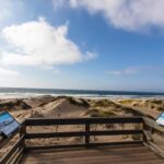
[…]quite a lot, coming from someone like you). Get your free hidden secrets map here 1. Get Snapping! Invigorate your Instagram: Want in on a stellar social media selfie secret? Snap an impromptu photo shoot at the Ragged Point Inn scenic viewing point, where you can look out onto the […]
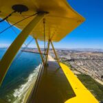
[…]themselves! Which adventurer are you? Get your free hidden secrets map here 1. The High Flyer You’ve never met a height you didn’t like!Kiss the sky: While most folks traverse the beach by foot, you’ll be hanging with the birds enjoying one of Highway 1’s most coveted sky-high secrets. Banner […]
[…]restaurant. The food is good, but their olallieberry pie is what put Linn’s on the map. A cross between youngberry and loganberry, similar to a blackberry, it’s the perfect mix of sweet and tart. I leave with two jars of the jam.The wines of San Luis Obispo County easily rival […]
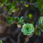
[…]drizzled, sizzled and seasoned to perfection! Get your free hidden secrets map here 1. Splash into a Secret Seaweed Adventure A briney delight just below the surface: Sea food totally differently! You might already know that Highway 1 is awash in accessible oceanic delights all year round (simply look to […]
[…]years later, Los Osos had been well established as a farming and ranching area. Developers filed a map with the County Recorder’s office that shows a subdivision where Sweet Springs Preserve stands now. The subdivision was never built, but another developer, Walter Refield, tried to do so in 1919. He […]
[…]your wayNot quite sure where to start? No worries! Download our easy-to-use map and hit the highway! As you snap photos along your journey, don’t forget to hashtag Highway 1 Discovery Route with #Hwy1HiddenSecrets. Who knows, you might just inspire a fellow photographer to get out there and explore the […]
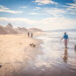
[…]beckons savvy surfers, beachcombers and sunbathers alike. Need directions? Check out our Google Maps list of these five beaches. 1. Pico Creek Beach Surf’s up in San Simeon: Follow local surfers’ sandy footsteps as you paddle out to Pico Creek Beach, a stellar surf spot conveniently nested at the north […]
[…]like Crab Cake Benedict, Steak and Eggs Quesadilla or Pancake Fritters with sausage and honey-maple syrup. Visitors can quench their thirst with a barrel-aged Mason original like the Strawberry Basil Lemon Drop or go for a mimosa made with local sparkling wine. Fans of spice: Don’t miss Mason Bar’s brunch-friendly […]
[…]exploring the diverse trails along the coast even more accessible by releasing a digital map of the existing sections of the California Coastal Trail—a network of paths that could eventually allow the public to traverse the entire length of California’s 1,230-mile-long coast. This collection of trails was first named in 1975 and […]
[…]country.Our guide on this stretch of the coast is the Highway 1 Discovery Route, which offers maps, tips and suggestions for exploring the rich heritage of this lesser-known stretch of the coast. Our first stop after hitting the water is the rustic harbor of Morro Bay, where Tognazzini’s Dockside Cafe serves […]
[…]the photos to iNaturalist, enter the approximate geographical location (very easy, with the App mapping feature), and try your best to identify the animal or plant (again very easy, with the App offering suggestions). Once you have completed your entry the science community at iNaturalist confirms, or suggests, other identifications […]
[…]and tasting rooms, you’ll visit 28 historic sites throughout Cambria (with the help of a free map). Be sure to keep your camera handy: You’ll want to snap pics of the tiny chapel perched atop of a hill, the prohibition-era hotel and card hall and one of the oldest remaining […]
[…]whiskey and corn whiskey to spiced rum and gin. Some of these are flavored with cherry, cinnamon, maple and apples, as well as botanicals like juniper and coriander. Located just off Los Osos Valley Road, the distillery was built and is operated by Todd Adams, whose specialty is corn whiskey. […]
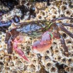
[…]House. As the headquarters for Montana de Oro State Park, here you’ll find tide charts and trail maps for your tidepool excursion. A family adventure touring the tide pools Corallina CoveJust south of Spooners Cove, Corallina Cove presents a less-trafficked area for tide-pooling. Much of what makes Montana de Oro’s […]


